The last leg of this journey included parts of Arizona, New Mexico and Utah. The name Organ Pipe Cactus National Monument sounded pretty interesting and I’d always wanted to photograph the giant saguaro cactus and whatever wildlife I could find nearby. I drove south from Phoenix and arrived at about 3:30 PM, in time to find a campsite and walk around before sunset.
The first thing I noticed was the heavy Border Patrol presence. Aside from the two checkpoints in the park, where they stop every vehicle, it seemed that every other vehicle on the road inside the park was an official one. In the campground, I’d never seen such frequent circulation of Park Ranger vehicles checking on the campers, maybe every hour. A helicopter flew overhead several times. I wasn’t surprised, since I’d known of this area’s reputation, but to see the extent of the official activity first hand was still eye-opening.
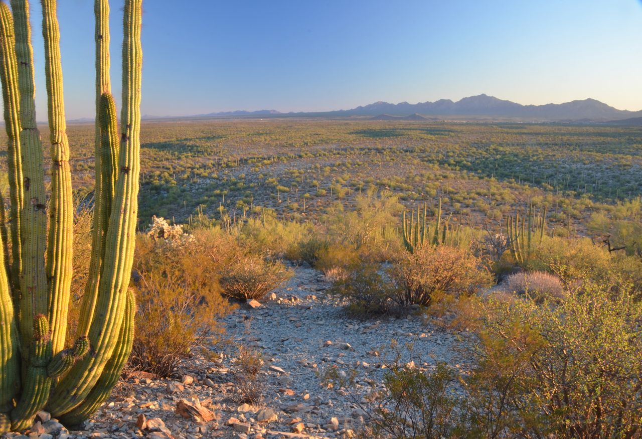
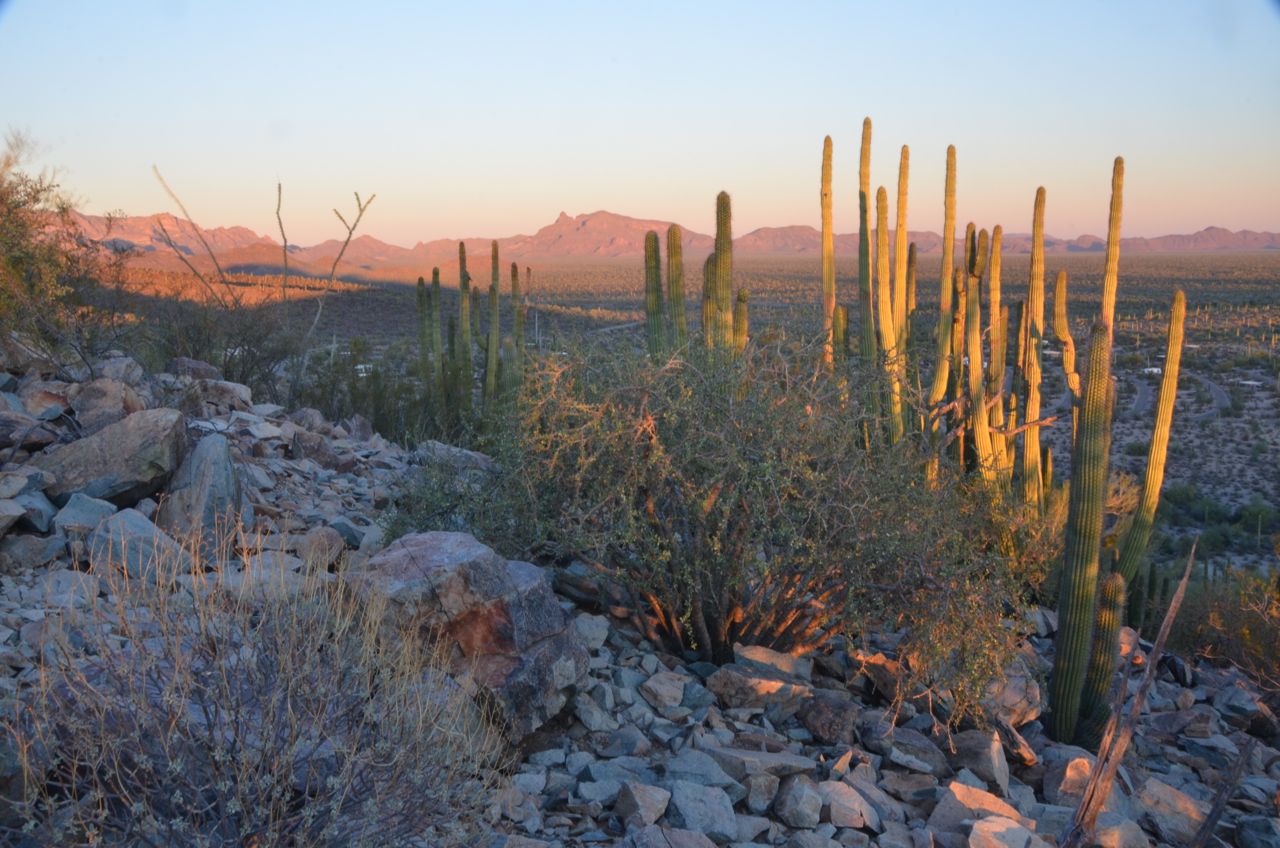
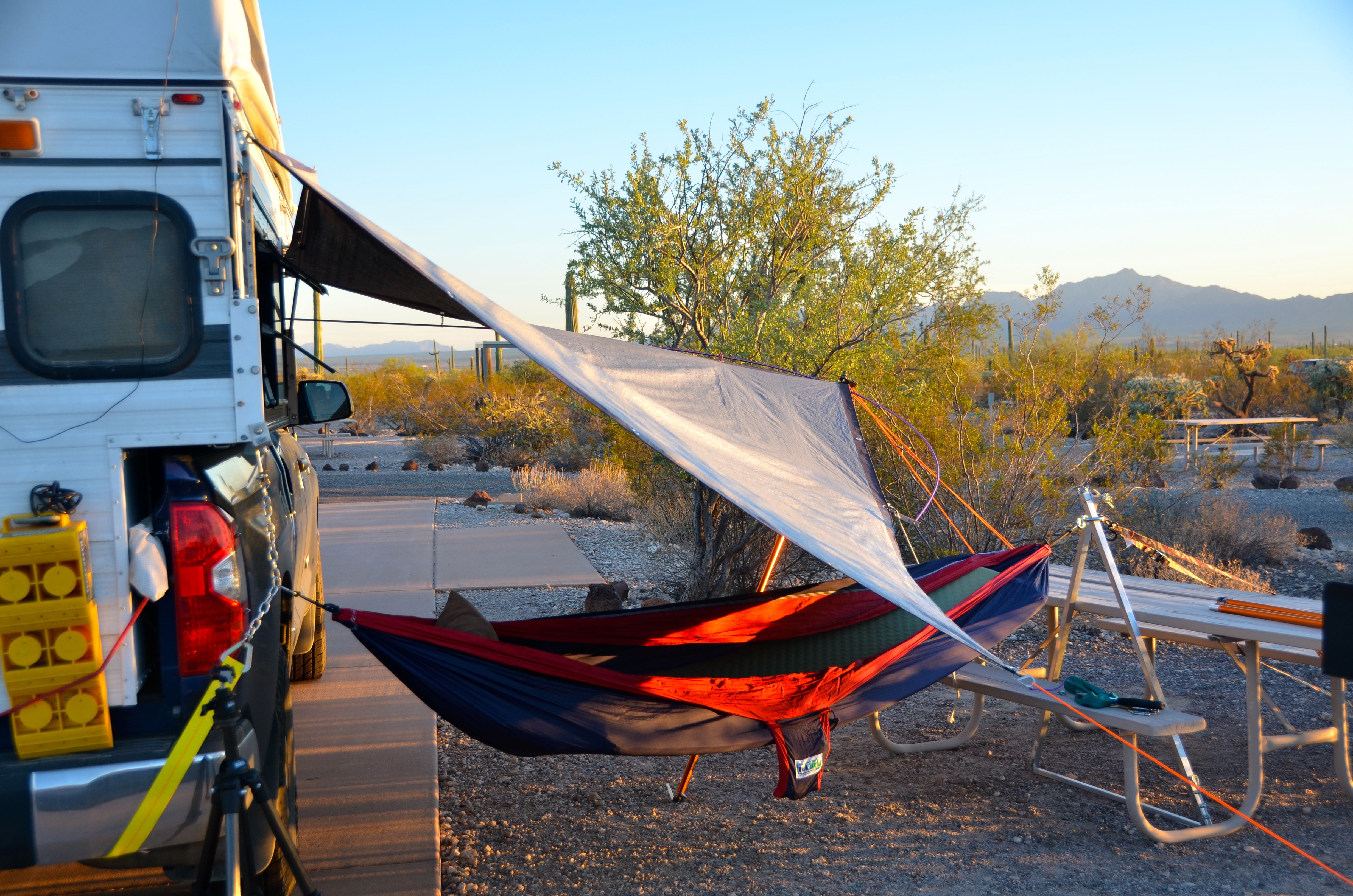
But the scenery was great, with 26 different species of cactus, the most imposing being the giant saguaro, which grows only in the Sonoran Desert. The weather was perfect, so I hung my hammock and awning and decided to stay for two days, shooting Garden-of-Eden landscapes (ninety-five percent of Organ Pipe Cactus National Monument is designated wilderness)…


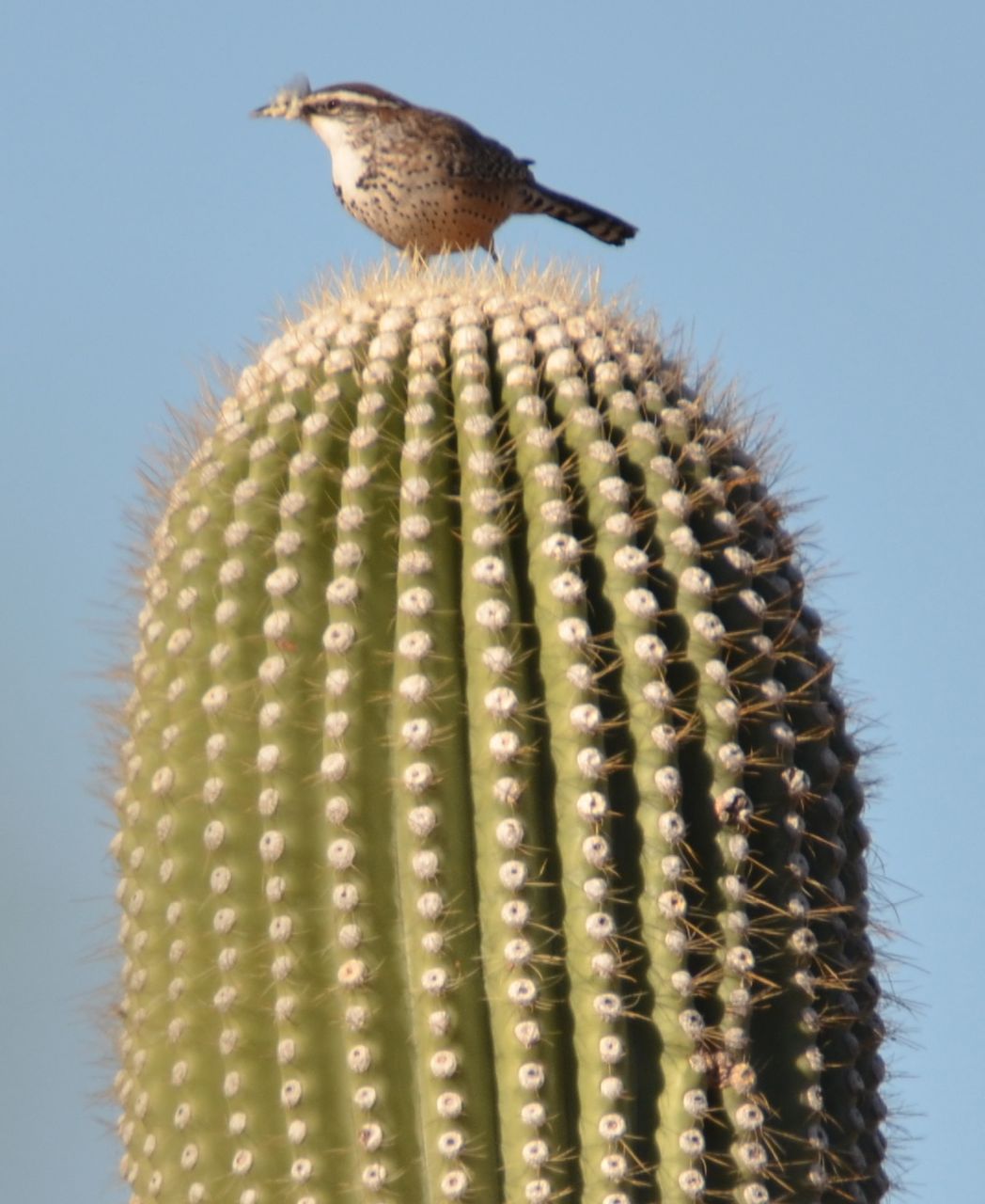
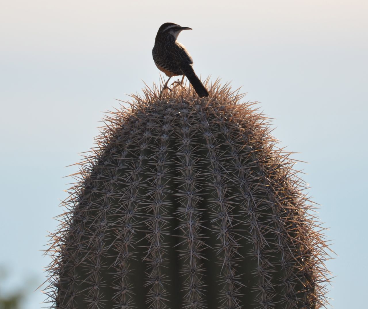
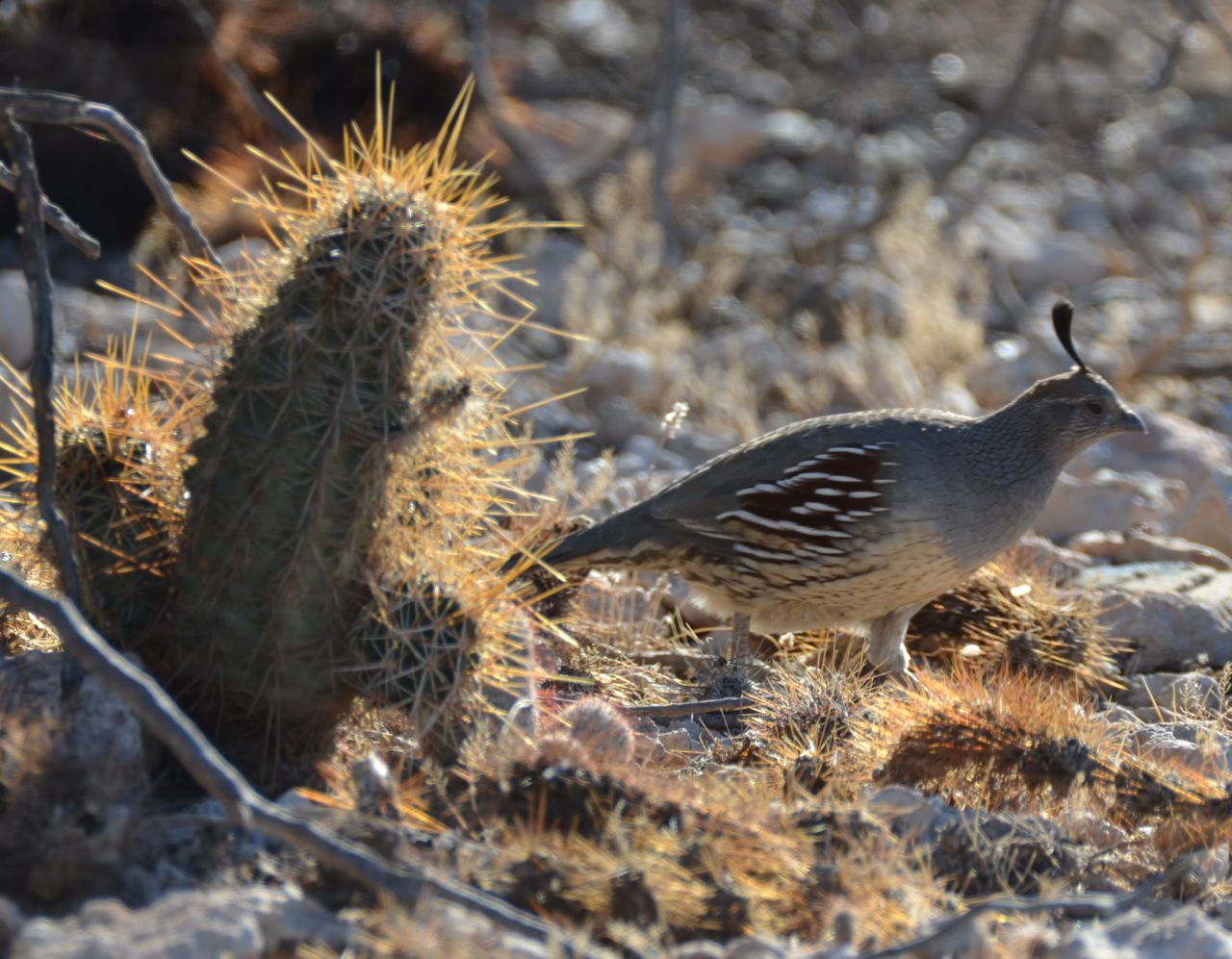
… and birds (Cactus Wren, Gambel’s quail, Gila woodpecker):


The second morning I wanted to drive one of the loops, but Ajo Mountain Drive was closed. So, I started to drive the much longer Puerto Blanco Drive, with a Roadrunner and Kangaroo Rat sighting enticing me, but after seeing the warning sign… 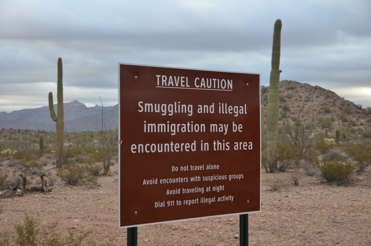
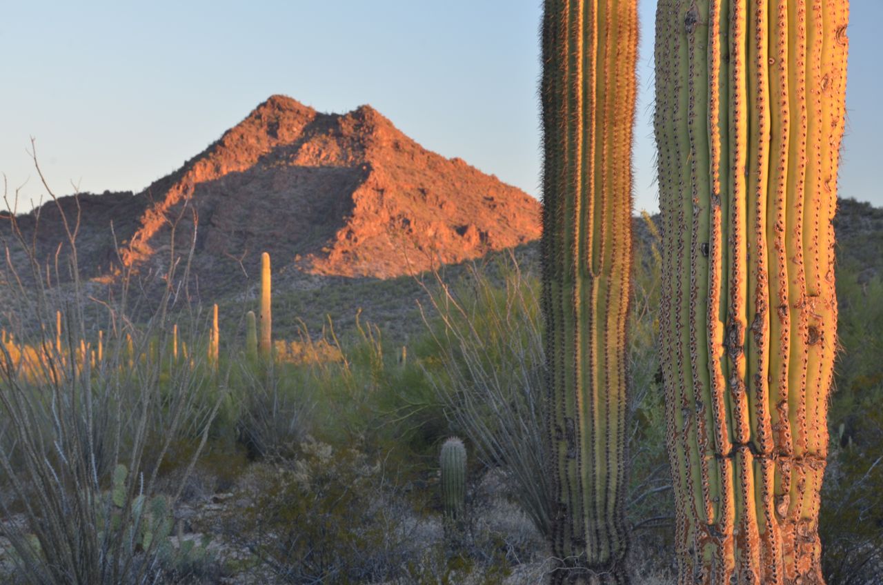
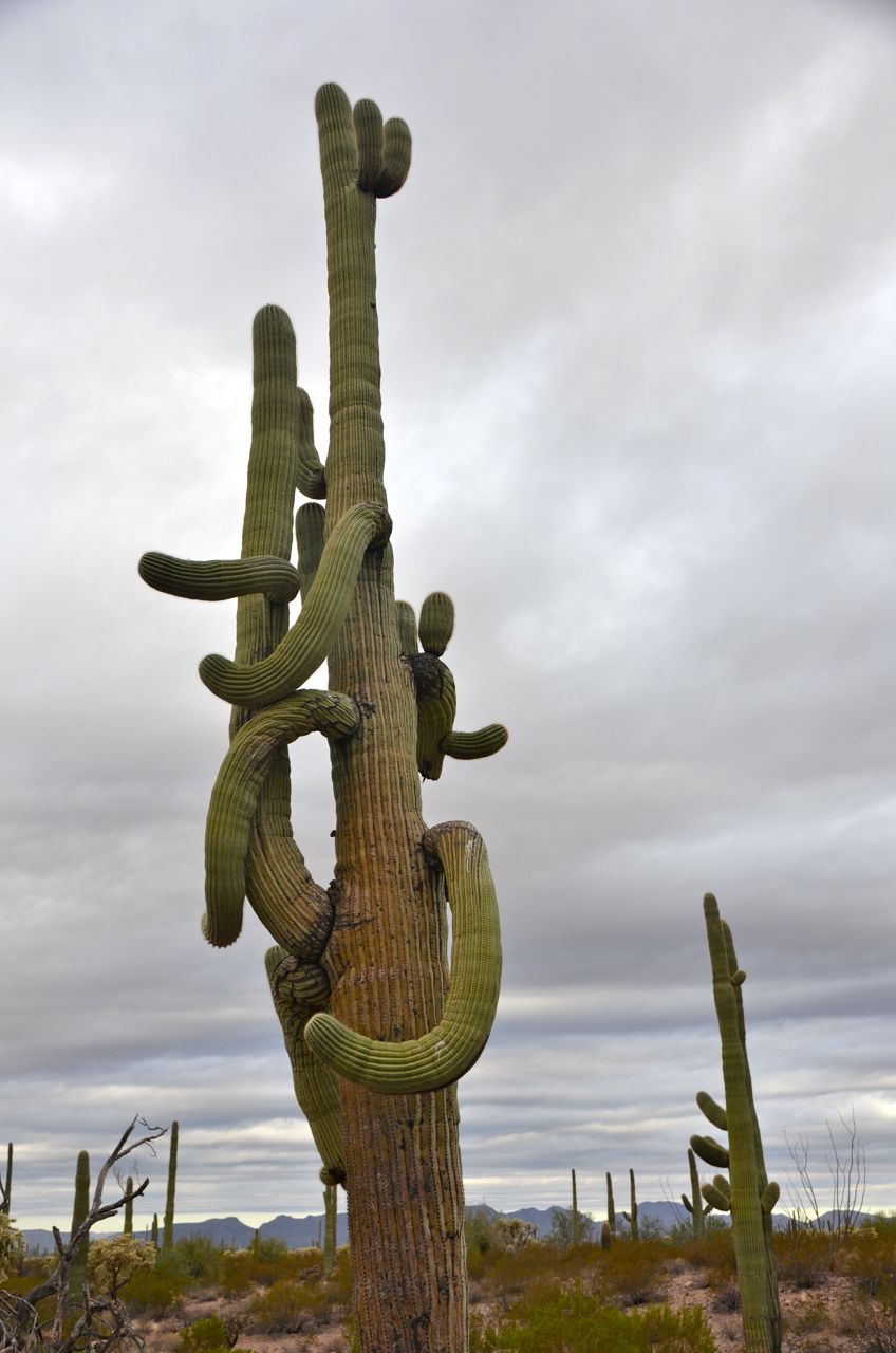
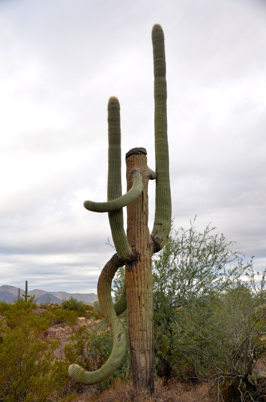
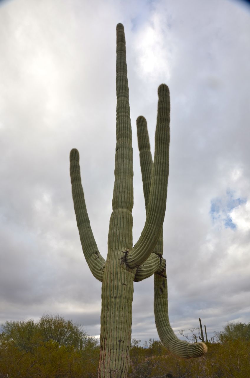
… and feeling how rough the 30-mile dirt road would be, I changed my mind and decided to head out of the park to Tucson, taking pictures of the most unusual saguaro giants along the way:
In Tucson, as part of their fabulous hospitality, my old friends Bill and Georgette drove me up to the peak of Mt. Lemmon for sunset:

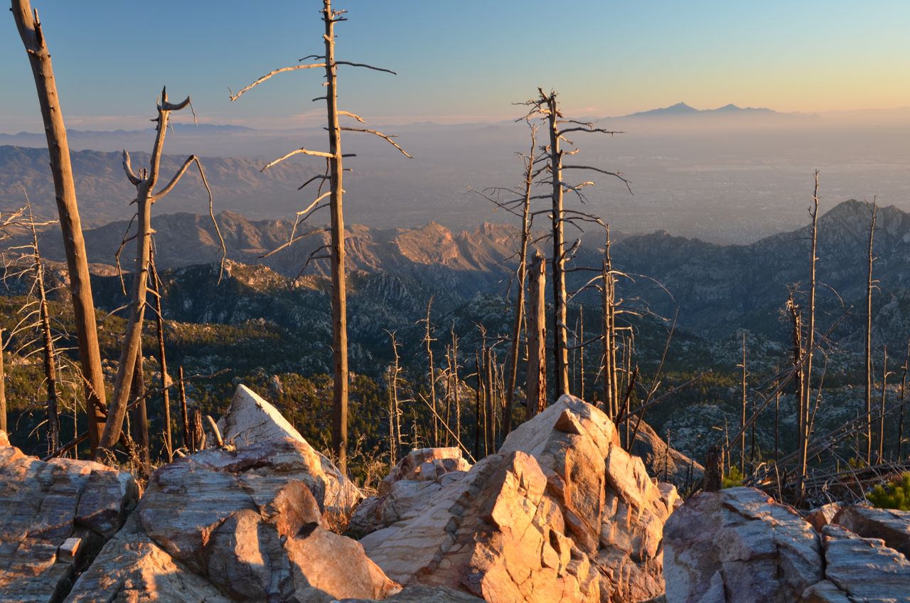
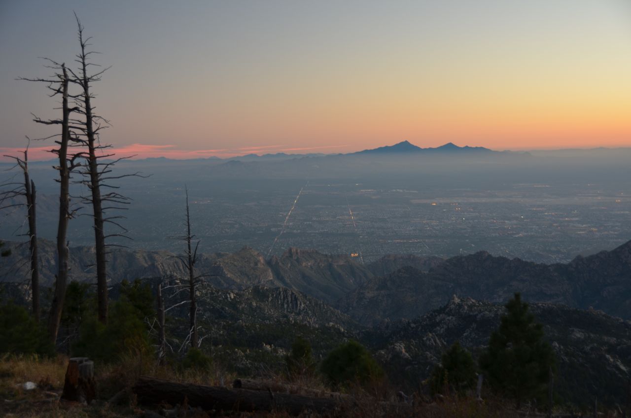
We could even see Kitt Peak Observatory about 90 miles away. “In the heart of downtown Tucson, a city of nearly 500,000, one can view the Milky Way with the naked eye. Tucson and Pima County first adopted outdoor lighting ordinances in 1972 in an effort to provide standards so that night lighting did not interfere with nearby astronomical observatories.” (Institute for Local Self-Reliance) After dinner, we watched meteors from their back “yard,” which is landscaped beautifully with desert plants. They regularly see a fox and a bobcat in this yard, so they keep their cats indoors.
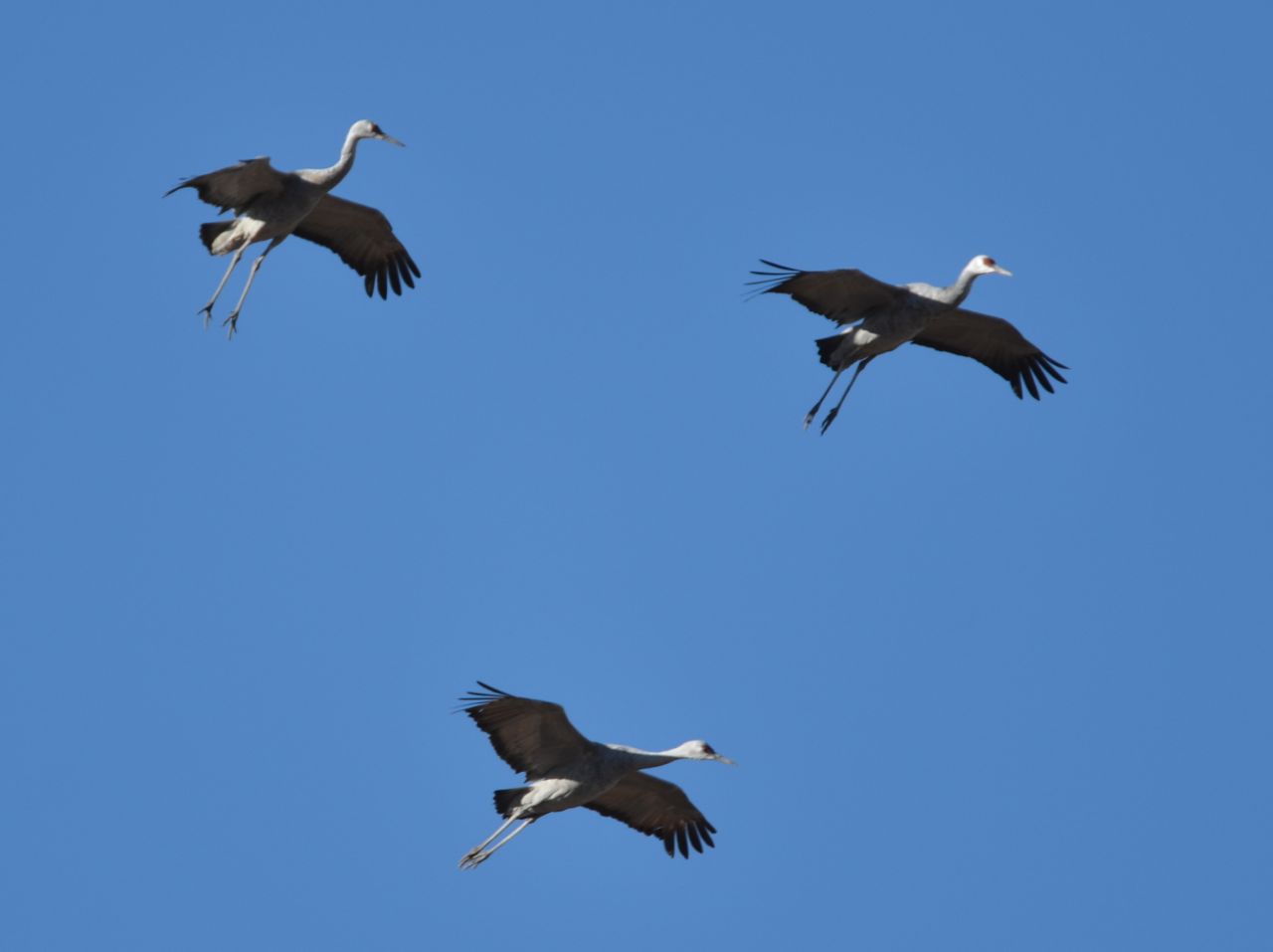
Bill told me about a birder site southeast of Tucson where Sandhill cranes could be seen, so I researched the cranes and their Arizona gathering sites online, checked for free campsites online and found one at the best place to view the cranes (Whitewater Draw near McNeal, AZ), according to a Wild Bird Center in Tucson.
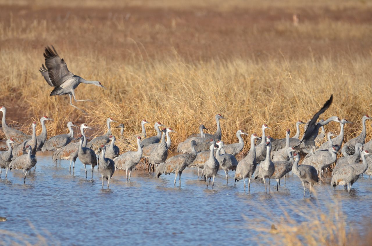
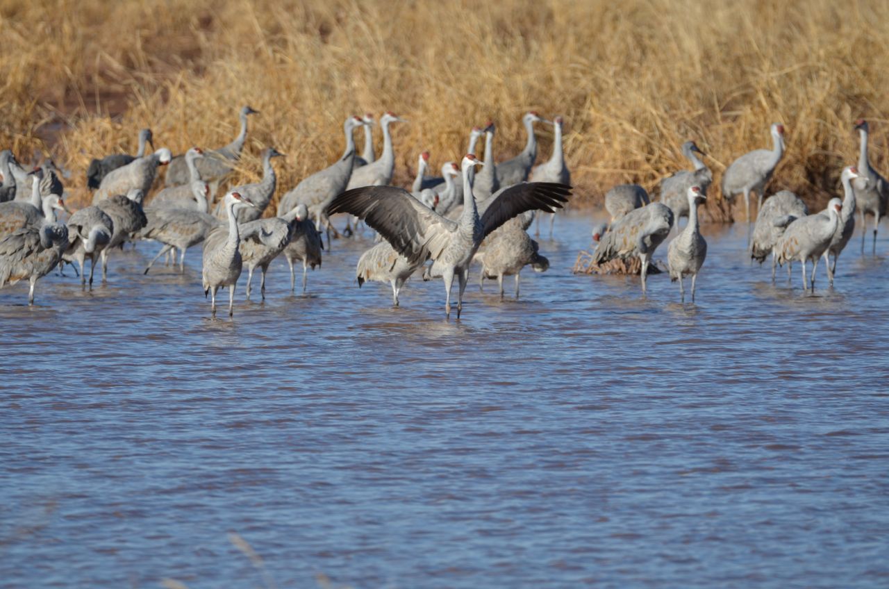
I drove there the next day, stopping to see Bisbee, a picturesque old mining town along the way. I arrived at the bird site about an hour before sunset, and the light was perfectly showcasing the cranes. They migrate from Siberia to Arizona in the winter, and it was thrilling to watch these huge, dinosaur descendants arrive slowly in threes, like WWII bombers from afar, land and congregate in the pond, squawking the whole way:
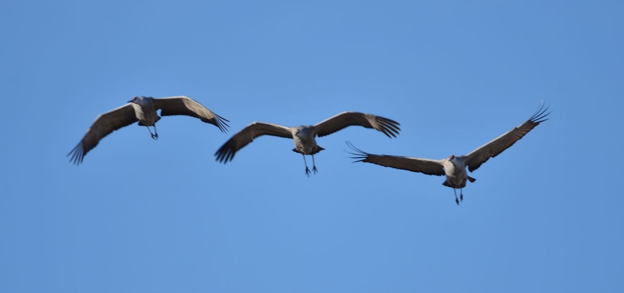
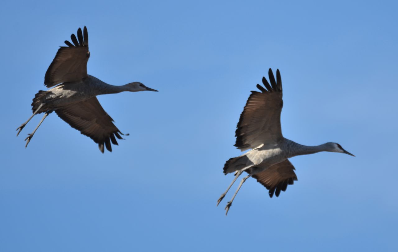
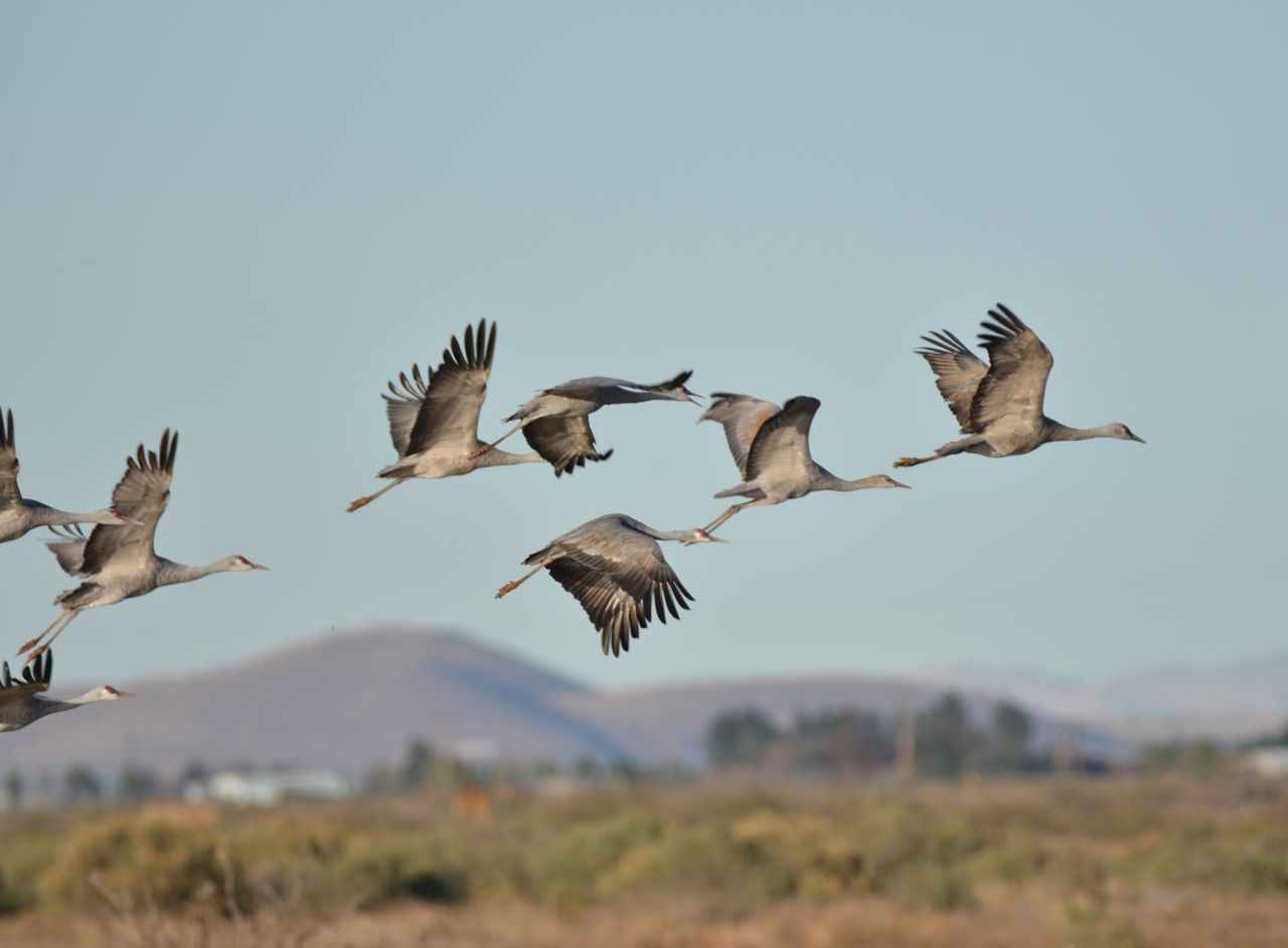
It was spectacular seeing them take off and fly away, too:
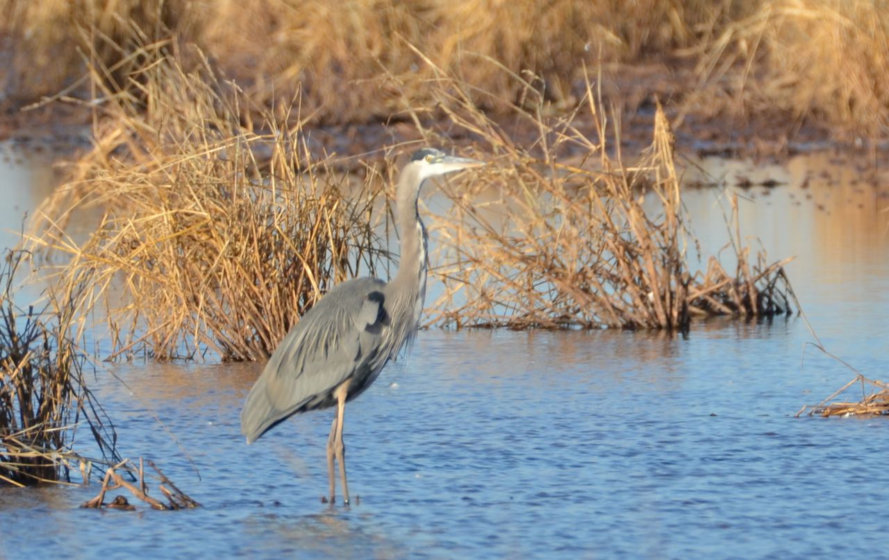
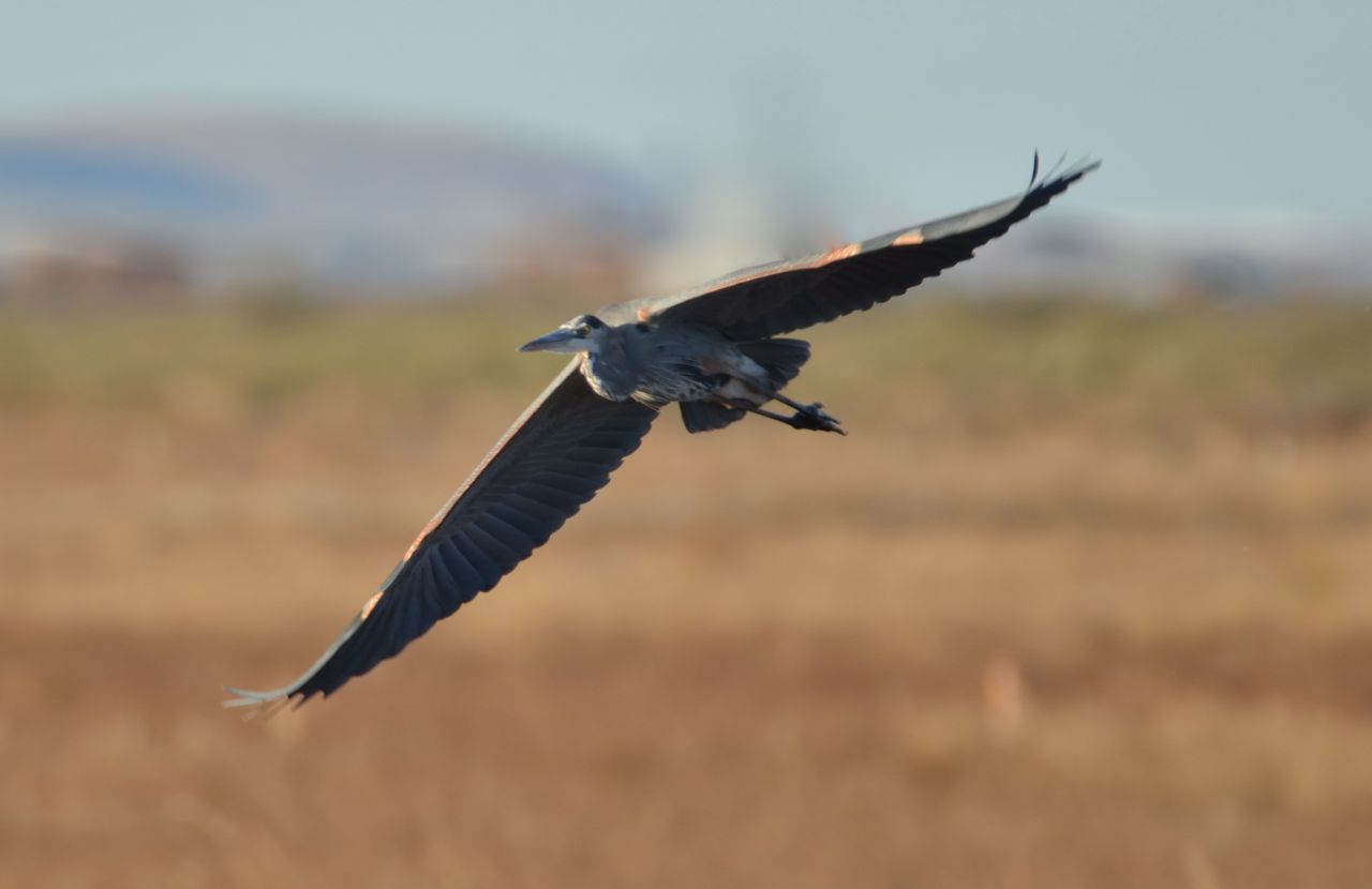 Other birds at the site included a Blue Heron sharing the pond and a Northern Harrier (I guess):

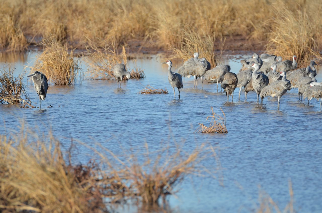
 The cranes gradually flew away, leaving only two behind, which looked around for a minute, realized they were alone, and finally flew off, leaving only the heron behind:

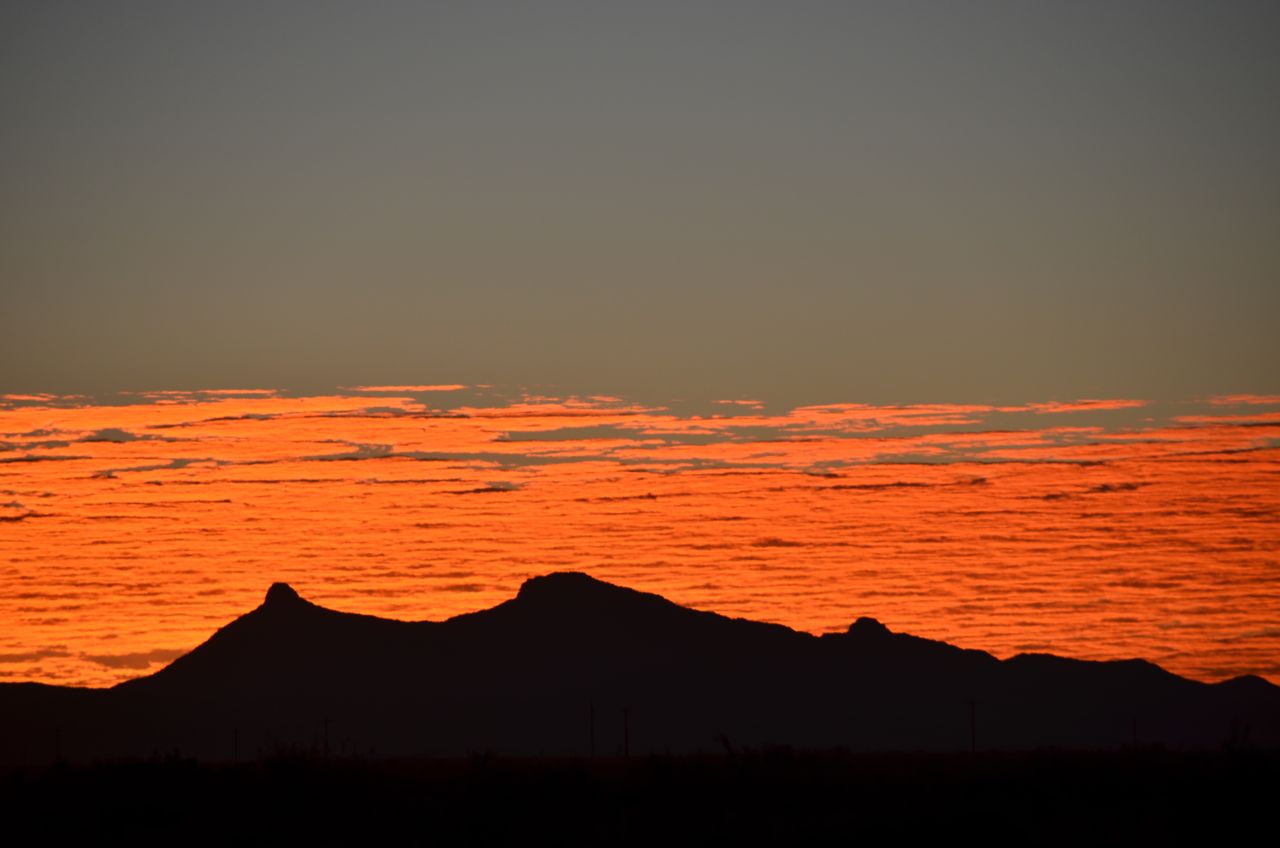
I spent the night at this site and got up before sunrise to shoot the cranes again and opened my camper door to see this colorful horizon:
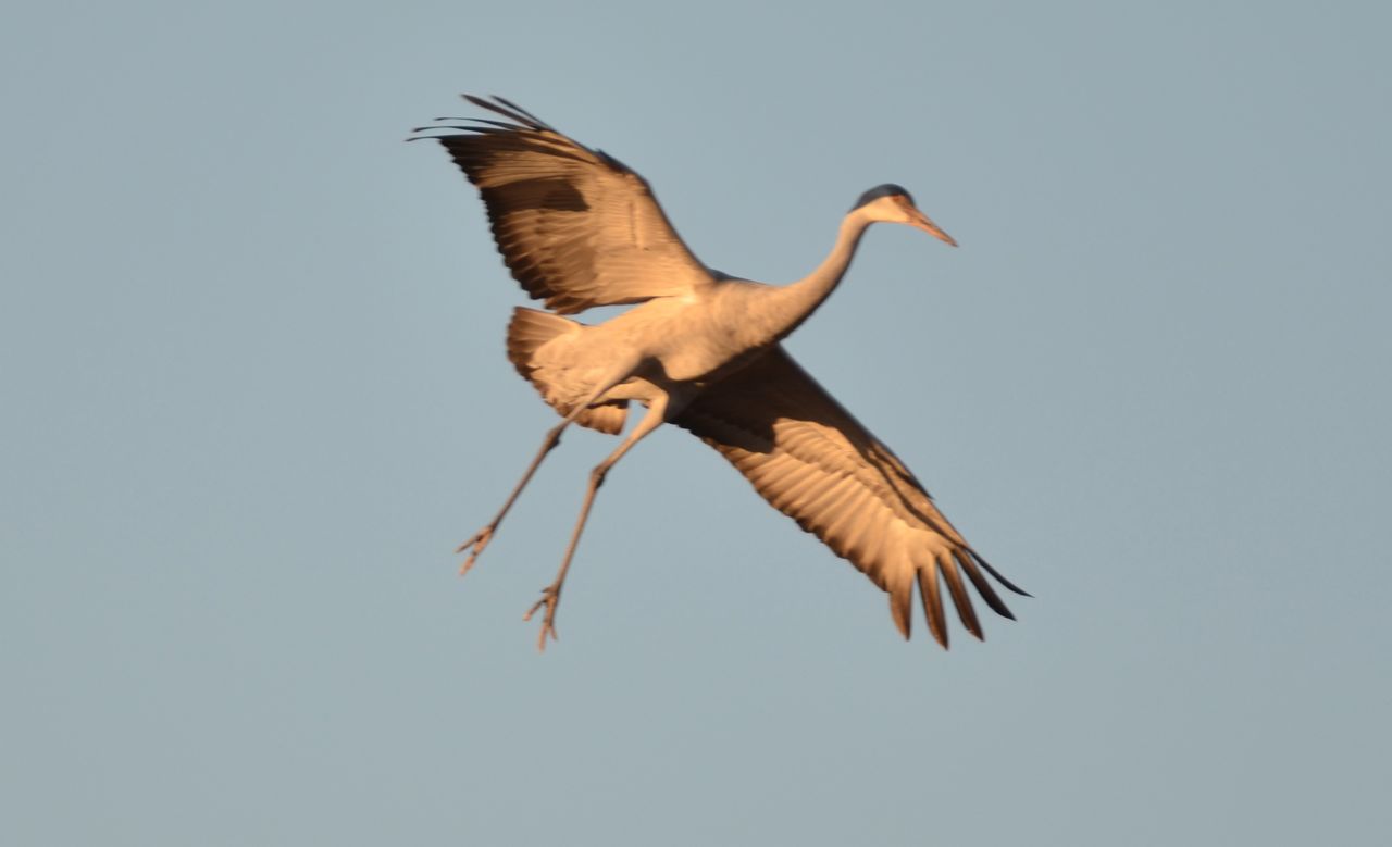
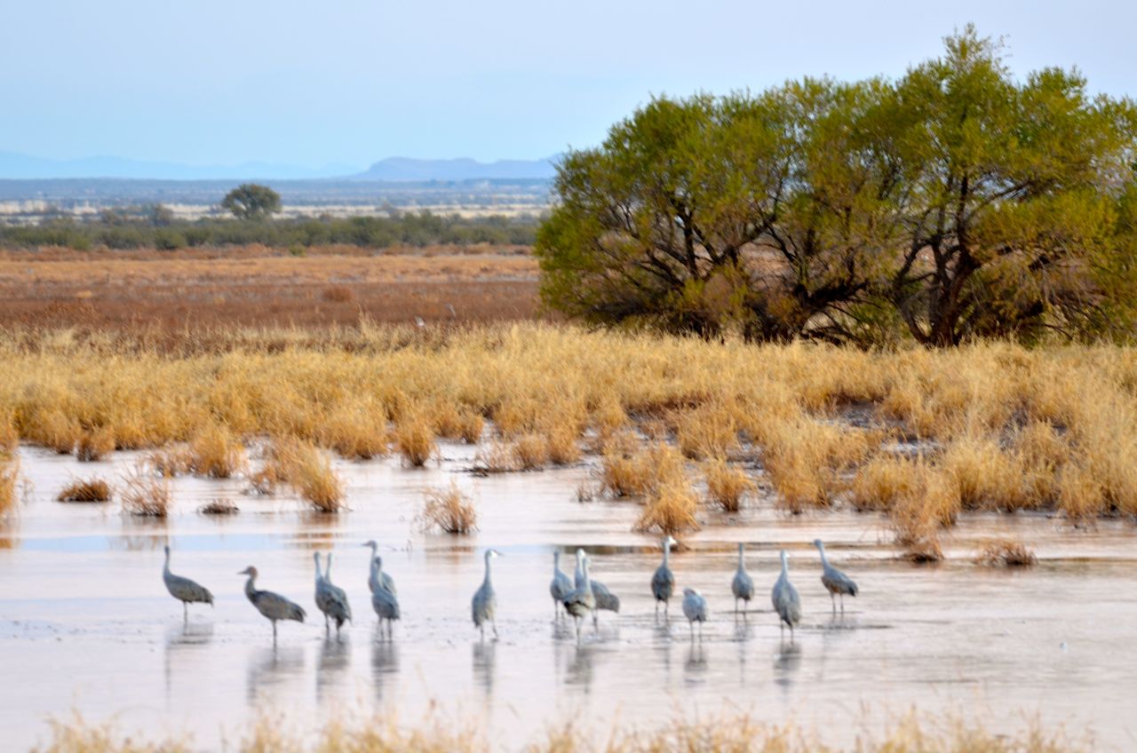
I found a few cranes that had gathered at the pond, but they didn’t look as relaxed as before. For one thing, they were now standing in a frozen pond, as the overnight temperature had dropped below freezing:
 (I know how they felt: I had to change the propane tank at 4 AM because I had left the roof vent wide open, the most effective way to lose heat in the camper.) Maybe it’s because I was the first human invasion of the day for them, but about 10 seconds after I took this shot they were flying away, and I didn’t see any more even after sunrise.
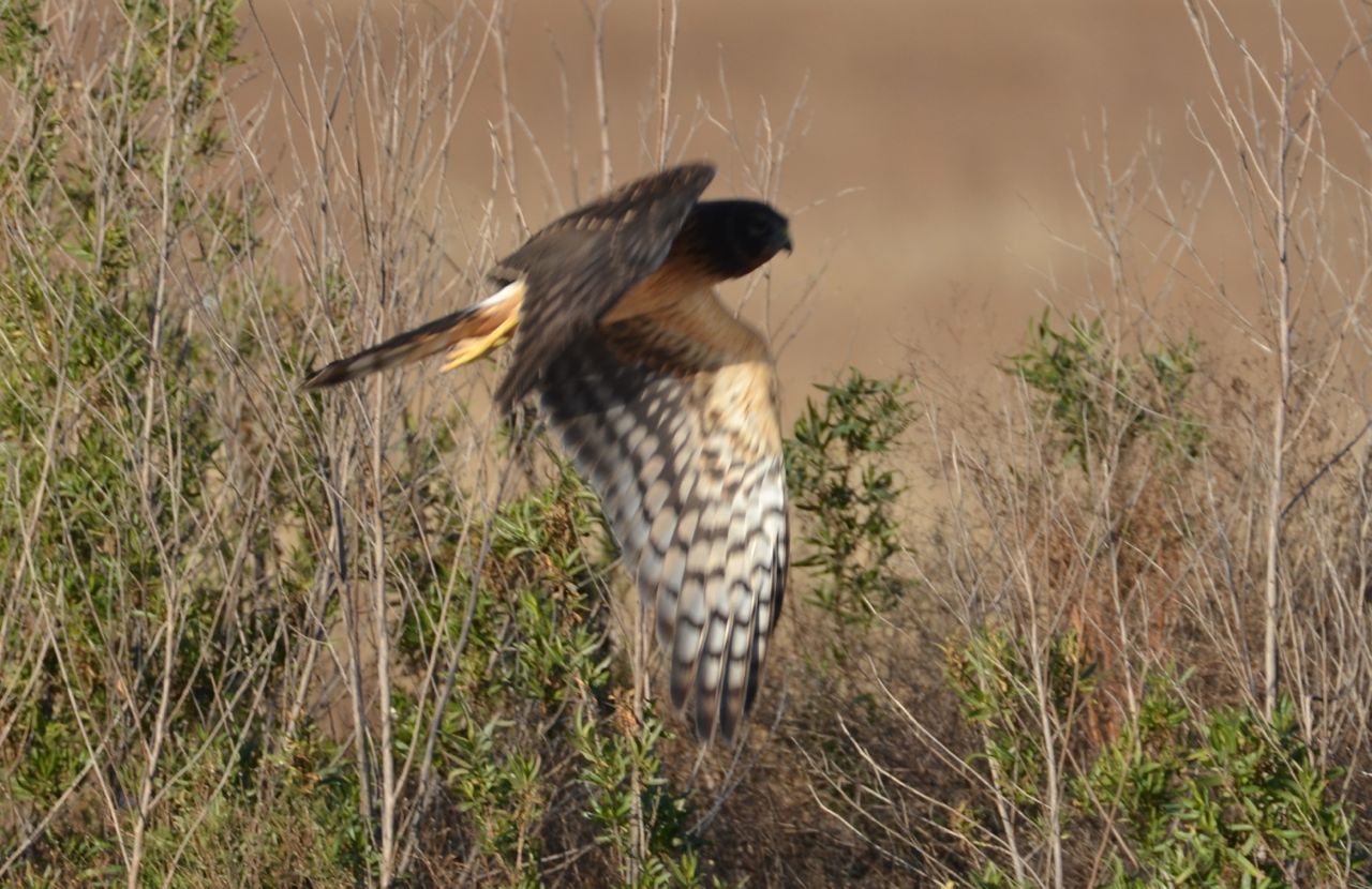
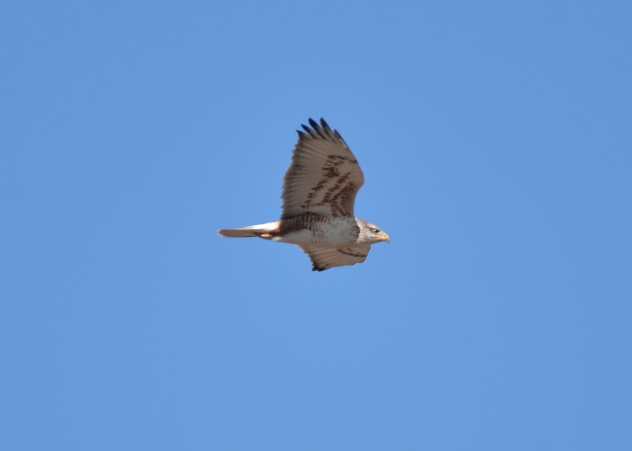
So, I shot a Meadowlark and an unidentified hawk at the same site… 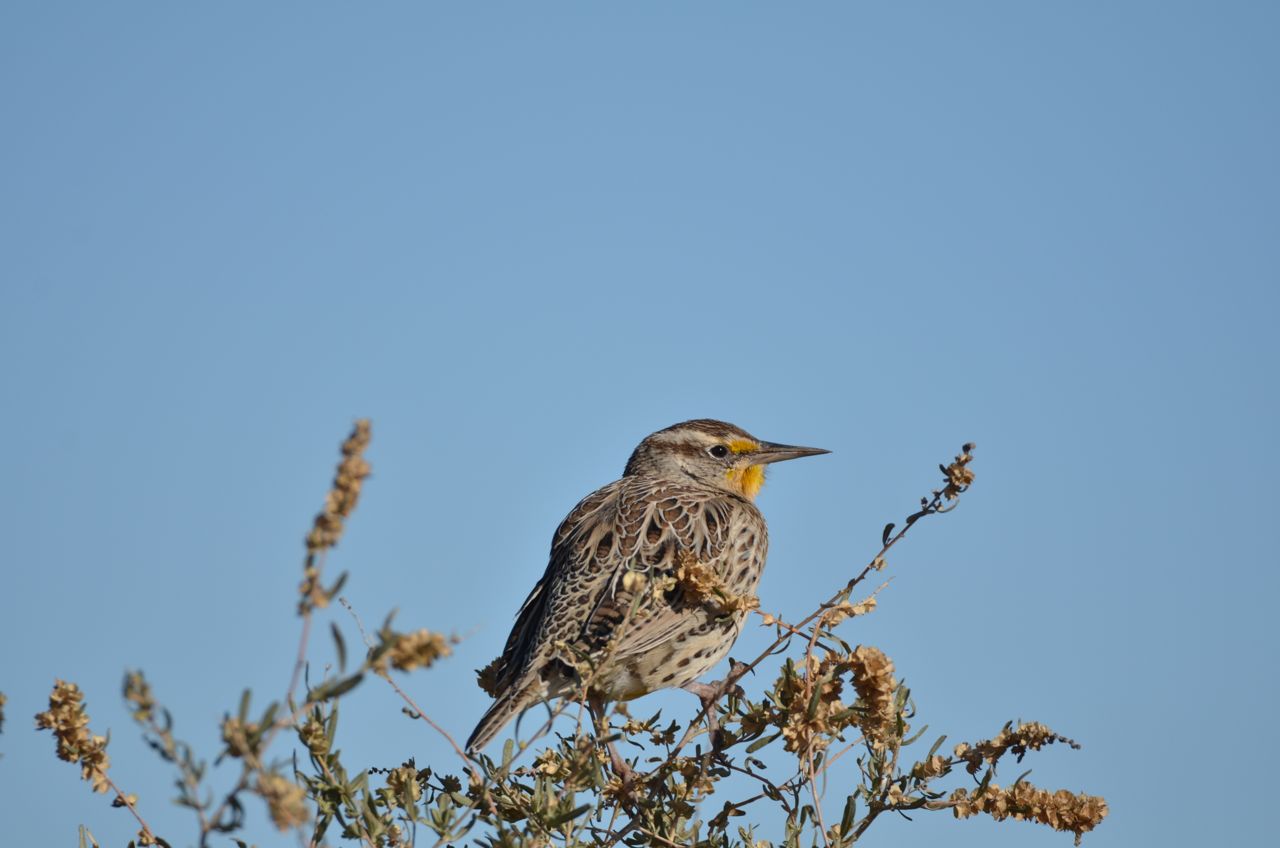
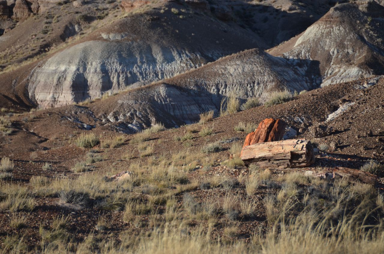
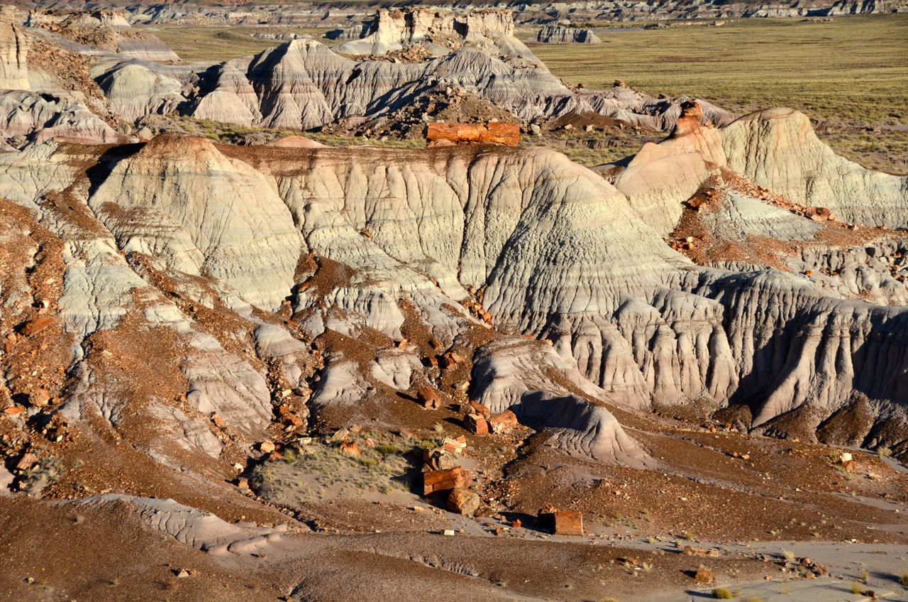
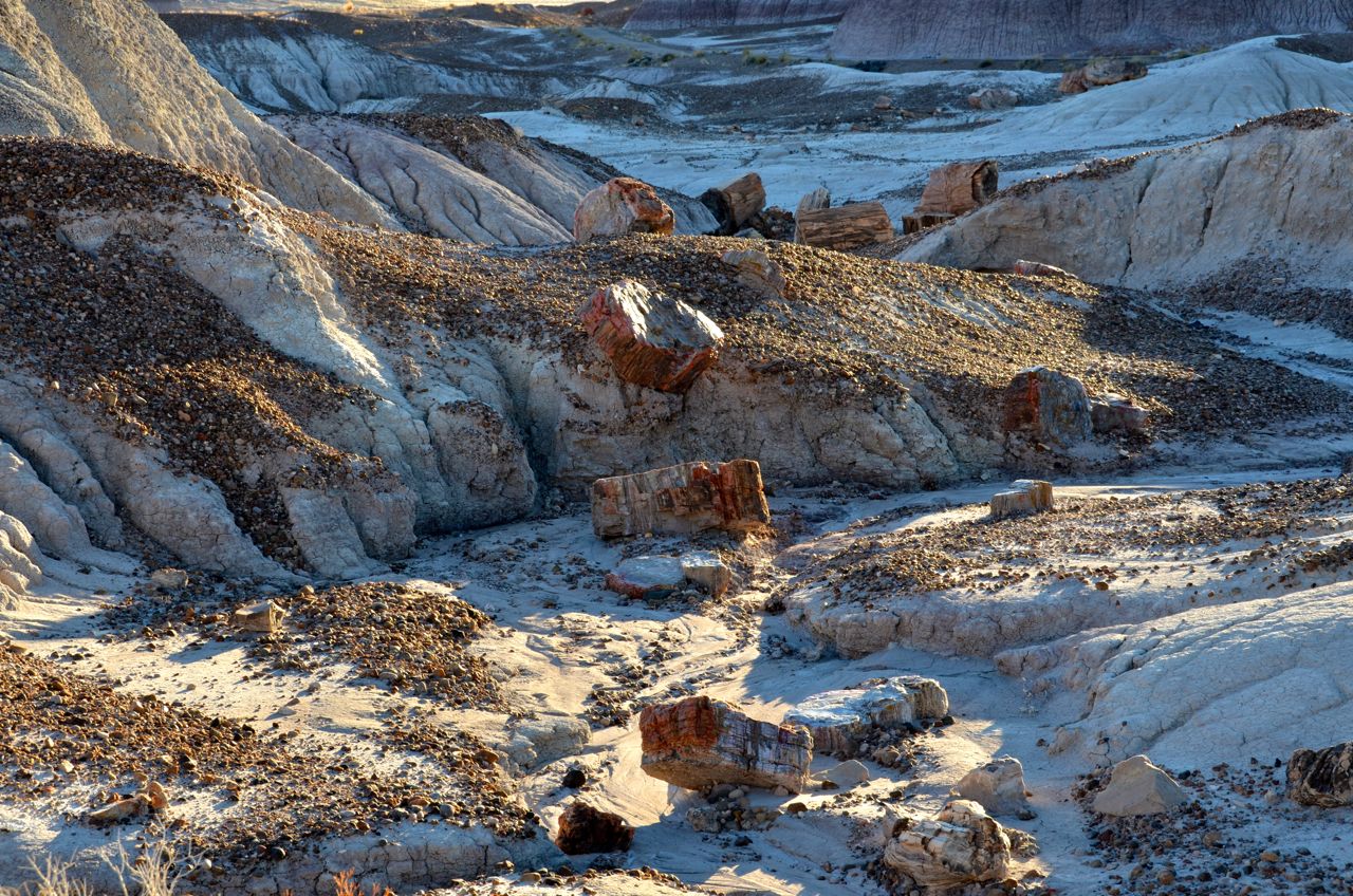
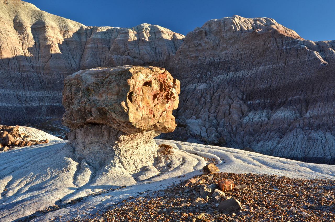
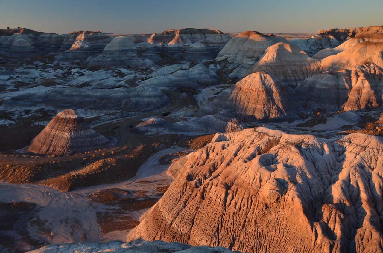
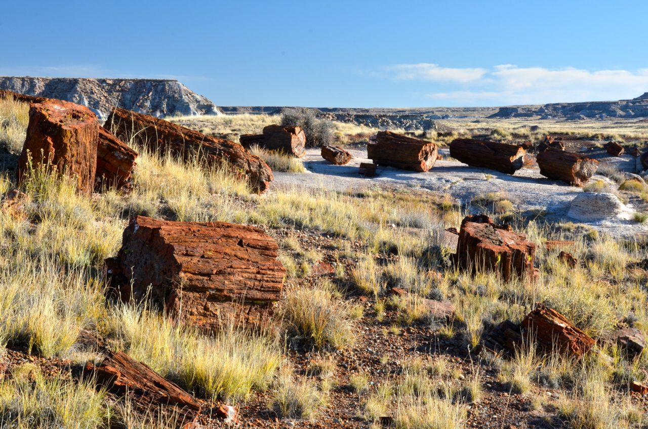
… fixed breakfast, packed up and hit the road for Petrified Forest National Park, a six-hour drive north. I made it there by 3:30, time enough to do a quick 1-mile hike around Blue Mesa, which sounded cool to me. Petrified logs were scattered around like litter…
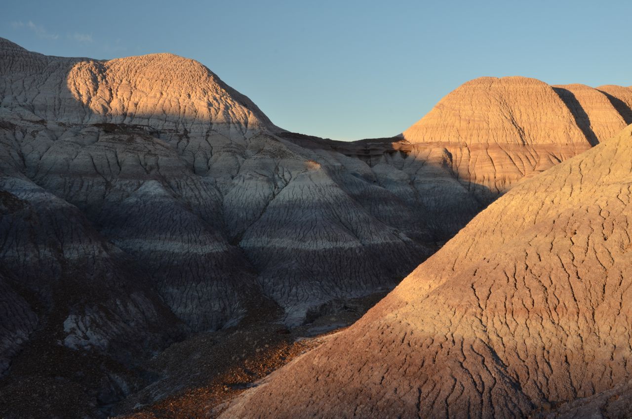
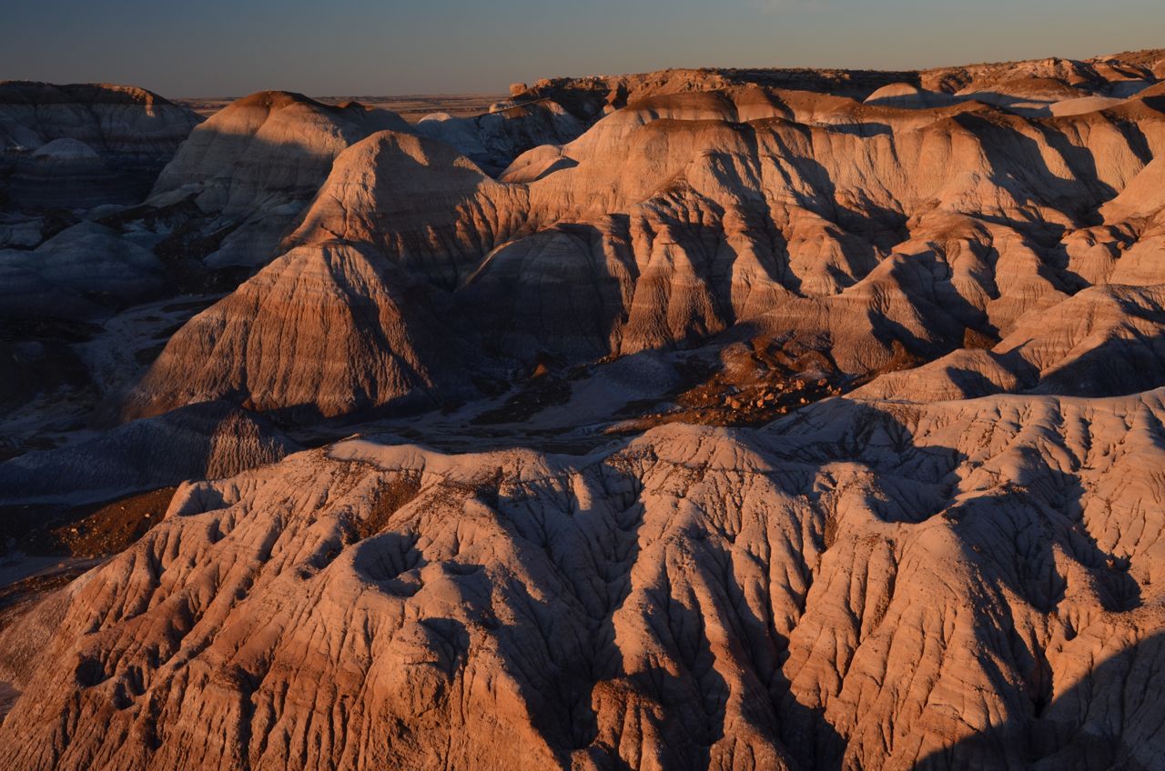
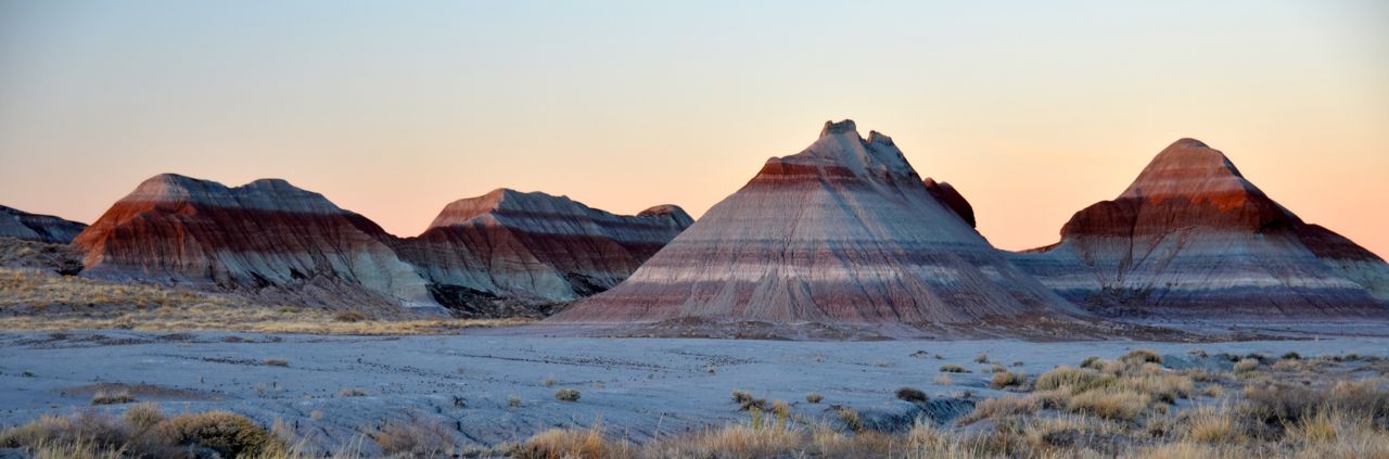
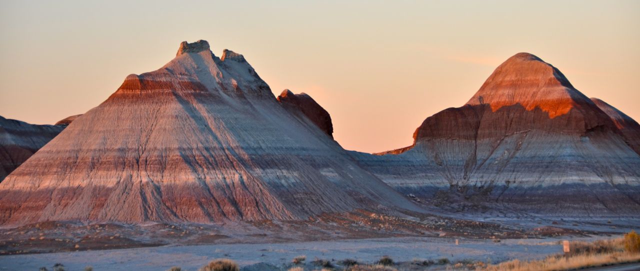
… and then I drove to The Tepees before sunset. I had imagined petrified logs here, leaning against each other like tepee supports, until I read about the petrification process and how all the rock logs came to appear. “The Tepees” are just colorful badlands that look like tepees:
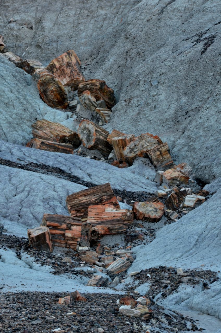
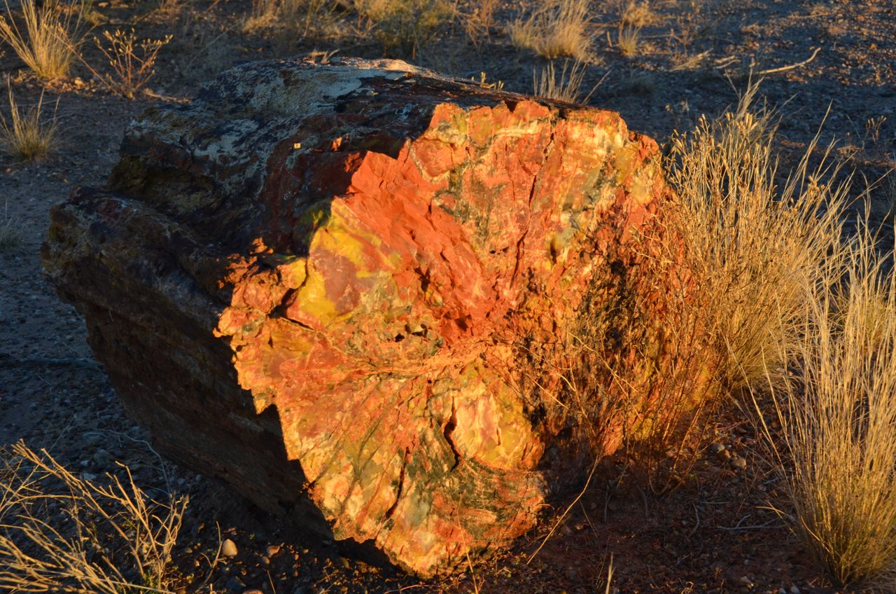
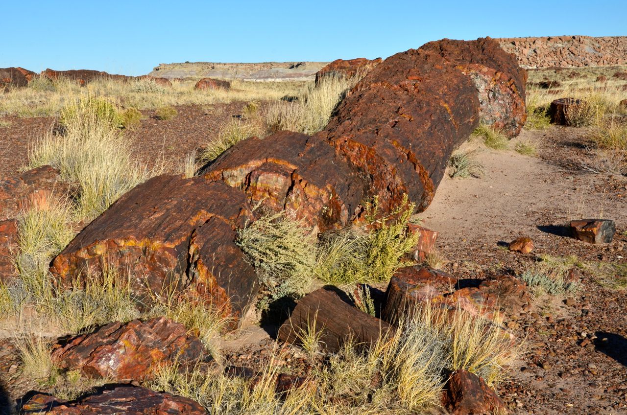
I was very disappointed that the park gate is closed from 5 PM to 8 AM due to the threat of theft, prohibiting any photographs at sunrise inside the park, so I shot some petrified logs around the free campsite on the gift shop parking lot at the southern entrance:
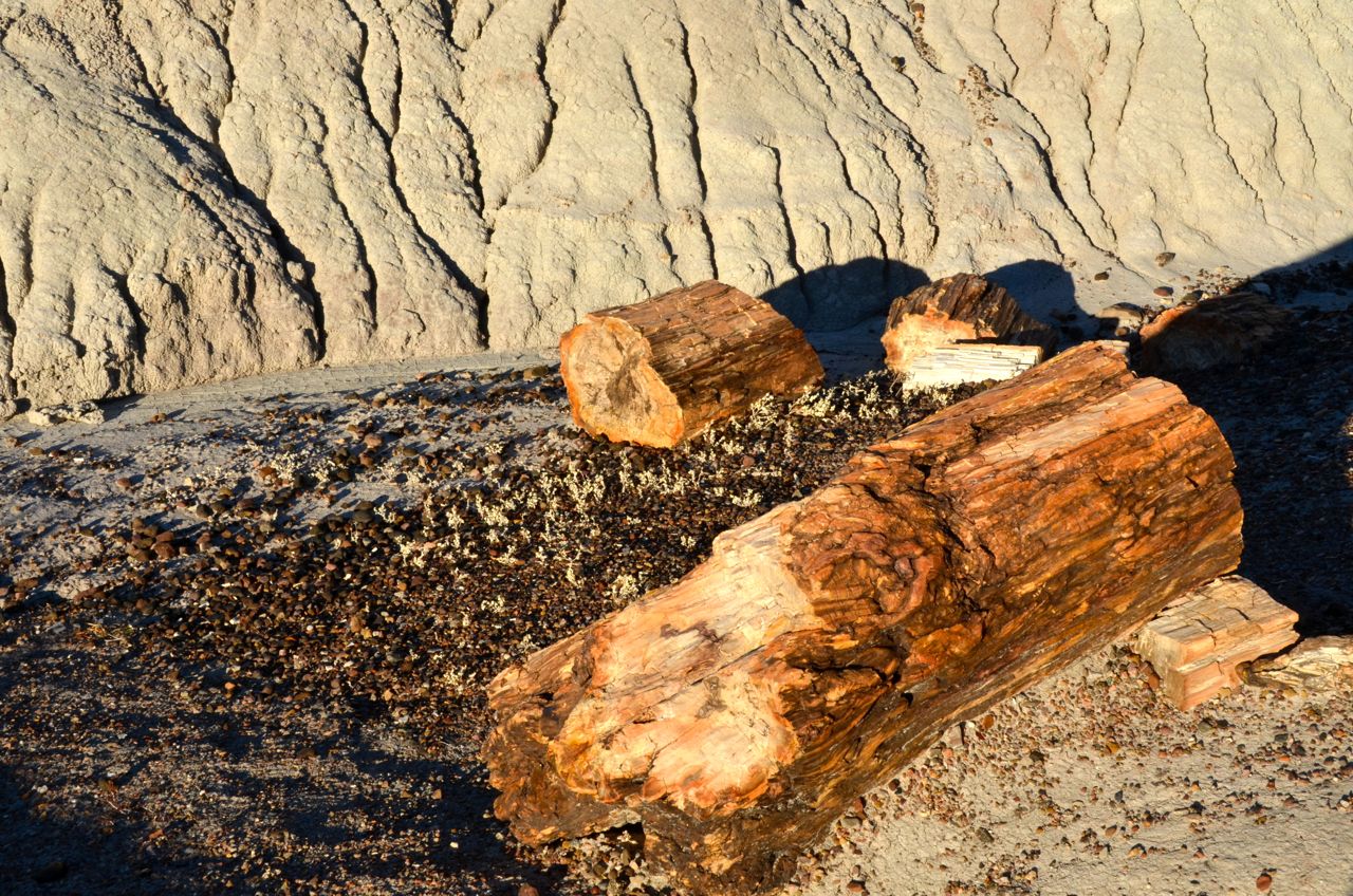
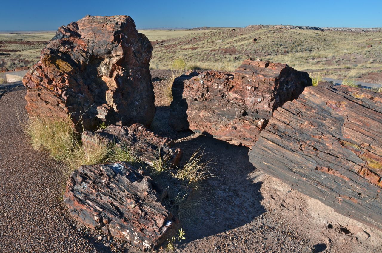
I was the first tourist to be let in when the gate opened, and I made a beeline for the Visitors Center and Museum, which has the Giant Logs behind it, the largest tree trunks in the park, some from trees that grew as high as 200 feet. (For comparison, the tallest known redwood tree is 379 feet tall). The sun was already too high at 8:15 for good lighting on the logs, but I dutifully took some documentary-type shots:

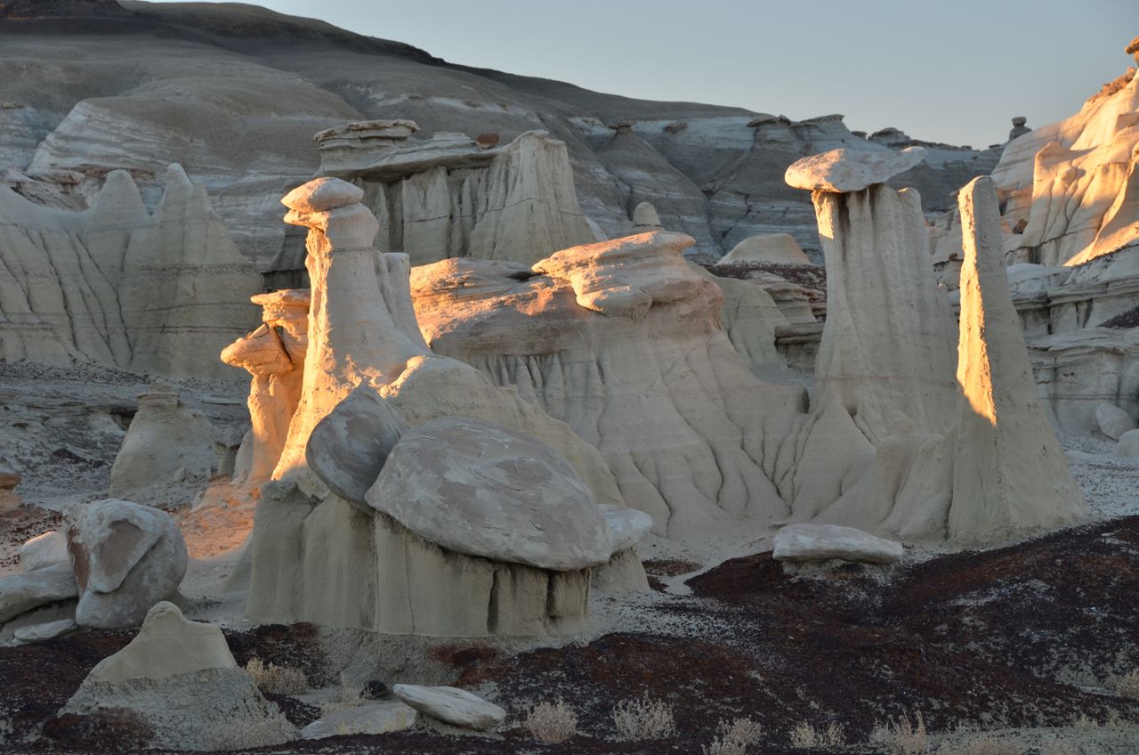
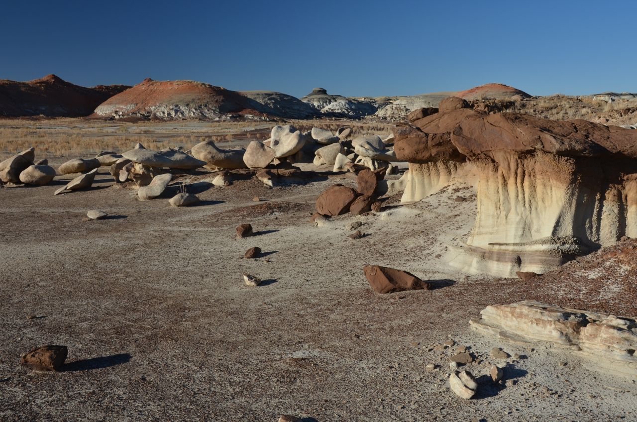
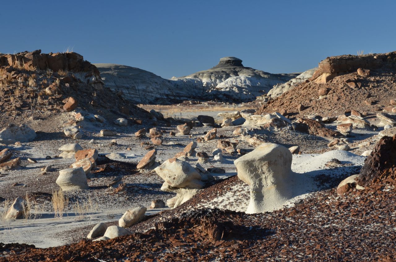
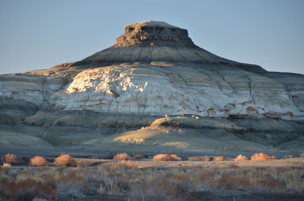
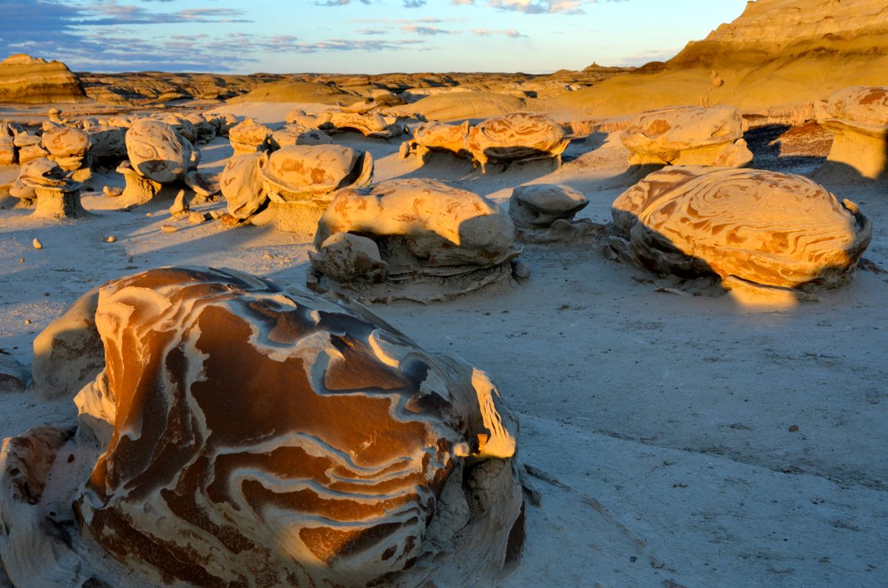
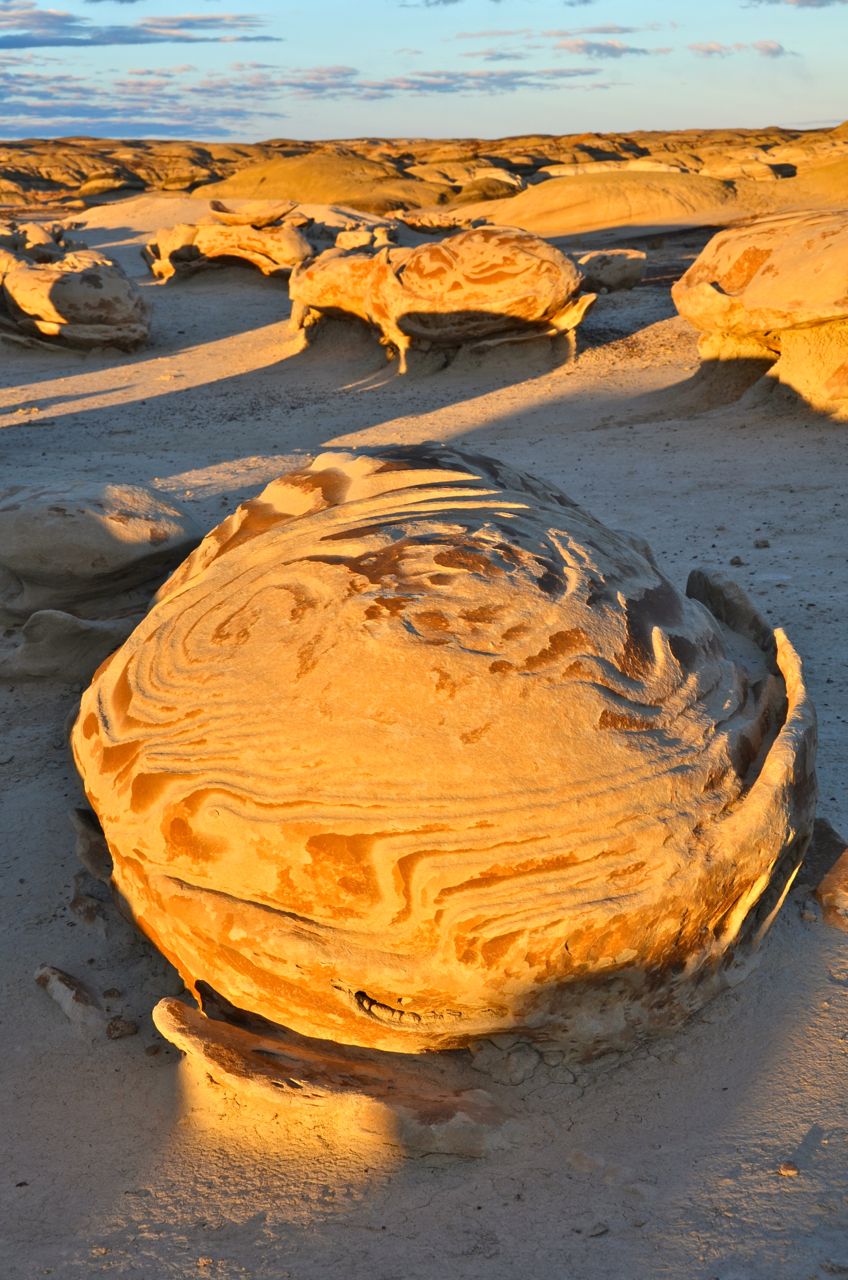
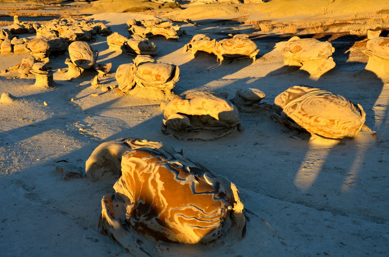
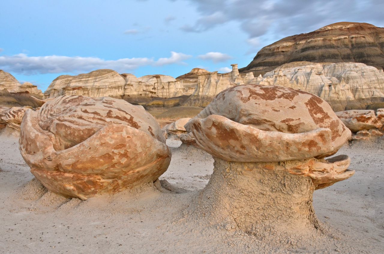
… and then headed out the park at 9 AM. I stopped in Gallup, NM, for supplies and gas, then drove to the Bisti Wilderness on BLM land about 35 miles south of Farmington, NM. I started my hike at 2:30 PM to search for the “alien egg hatchery” aka the “cracked eggs” that my pro photographer friend Greg Jahn told me about (he had captured them with a favorite photo). He emailed me directions to the site, but without a GPS device and coordinates, it was not easy to find them. On the hike, I shot some hoodoos and surrounding scenes:

Using a map and a compass, I hiked over two miles for almost two hours and finally found the eggs. I took a few test shots with my digital camera, and then wandered off just before sundown to see what other oddities might be nearby, intending to shoot the eggs at sundown and afterwards with my Mamiya film camera for better quality shots.
Well, I blew it: When I turned to hike back to the egg site I realized that I didn’t know how to get back to it. The badlands were too disorienting, and after searching for another 20 minutes after the sun had set, I decided to head back to camp, thinking I’d return the next afternoon (I knew I would never find them for sunrise shots, walking in the dark before dawn).
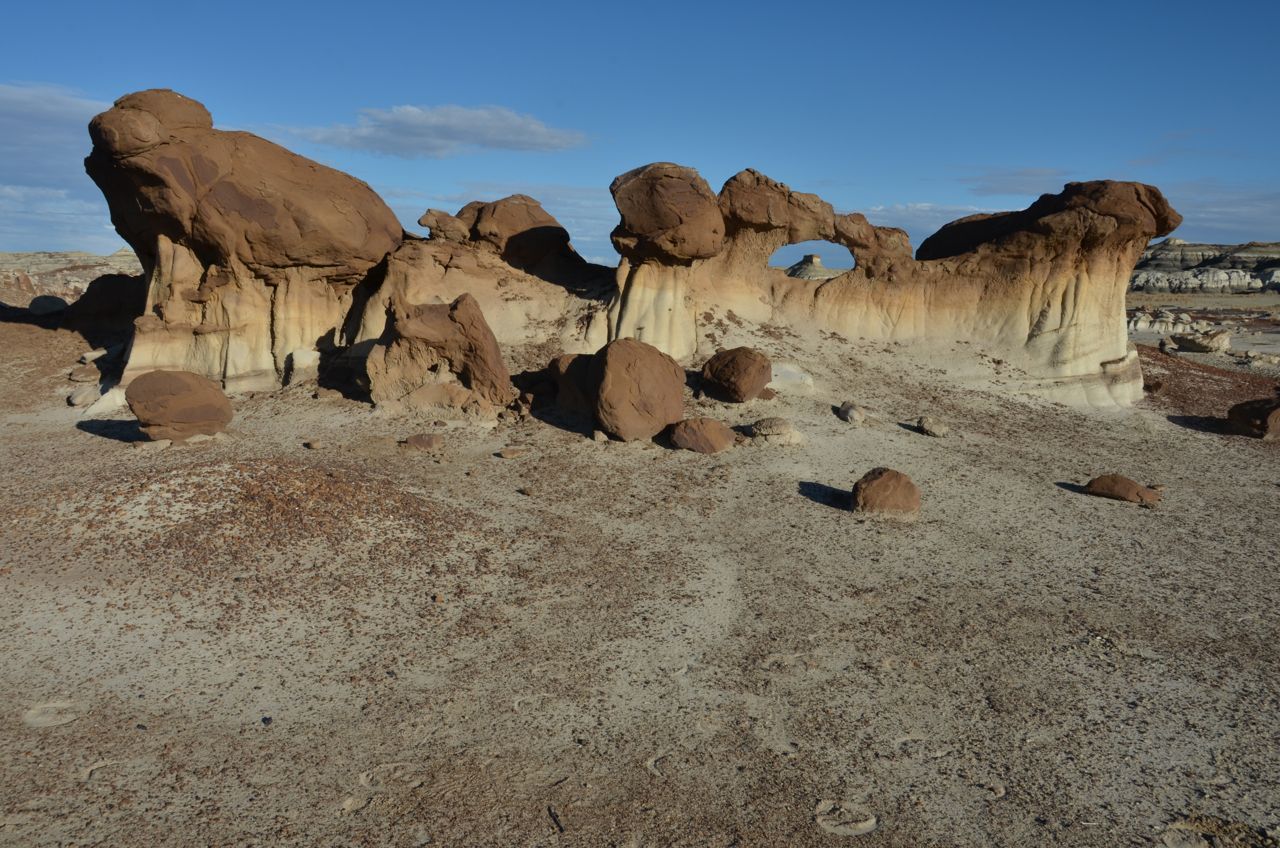
I waited the next day, but it was overcast and windy all morning and into the afternoon, and I didn’t want to chance a solo 4-mile hike in these conditions, considering the snowstorm that was forecast just north in Durango for tonight. I was bummed, but finally, at about 2:30 once again, it cleared up enough to chance another hike to the eggs. I found them and shot them before and after sunset, along with the “Bisti Arch” (hopefully the Mamiya shots will be better):


After visiting old friends in Durango and Dolores, Colorado, I drove about two hours north to Arches National Park in Utah, arriving in early afternoon on Friday, Nov. 20th. It was my final national park on this trip, since I had accelerated my tour in order to make it back to Boise for Thanksgiving. For that reason I postponed visiting Yosemite, Zion and Monument Valley until next year.
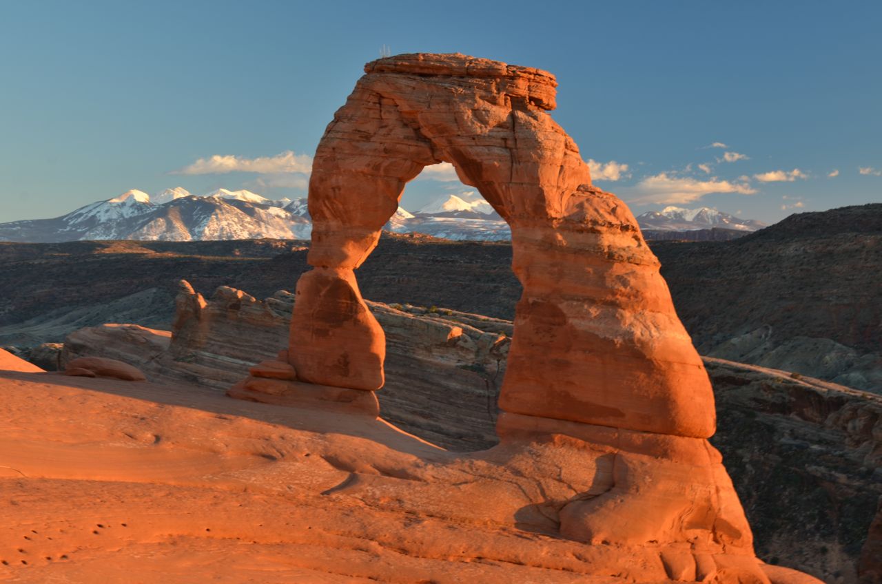
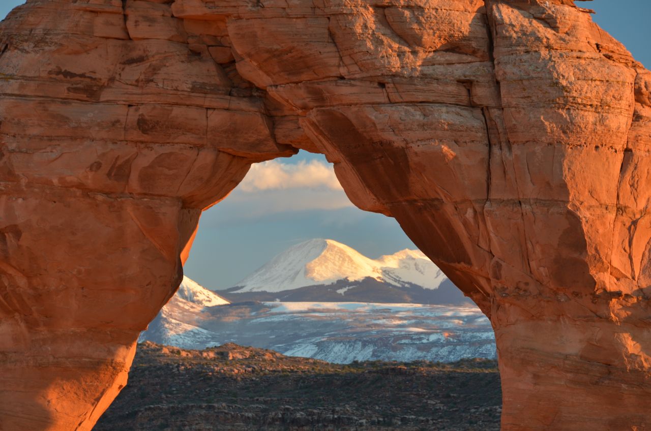
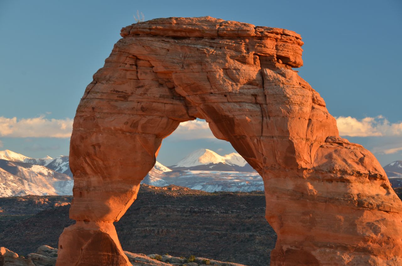
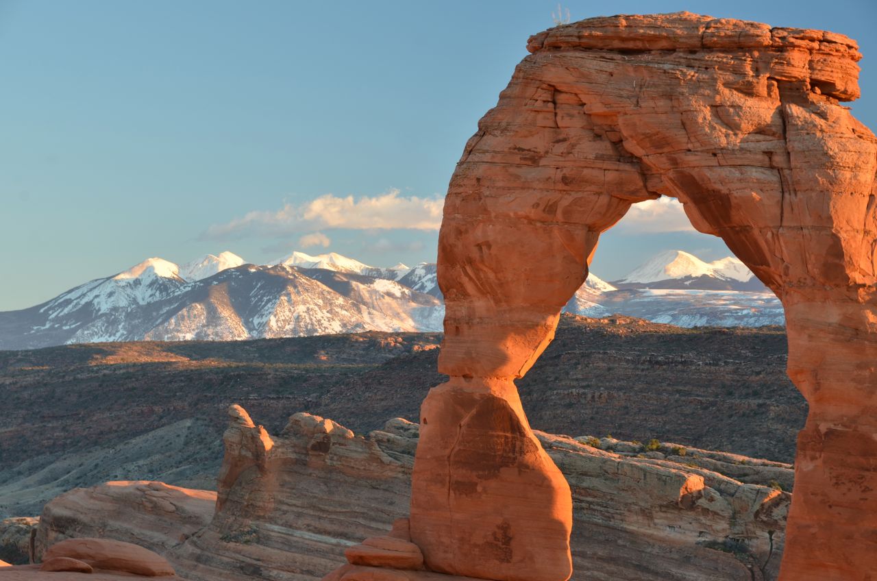
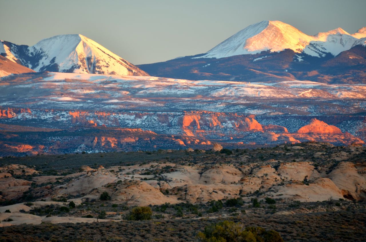
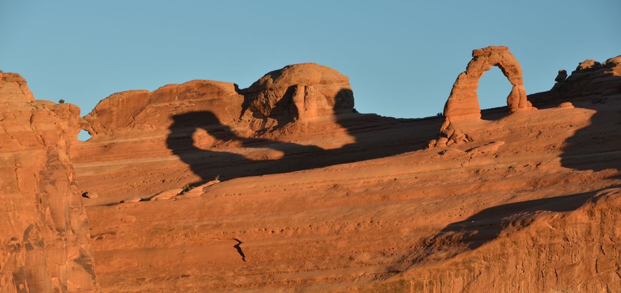
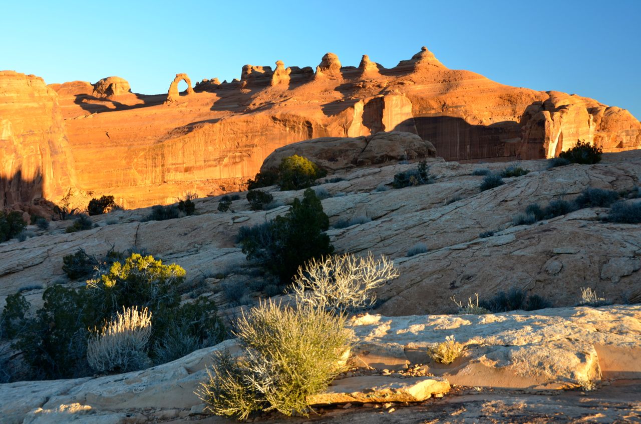
I hadn’t shot in Arches in over a decade, and had no photos worth posting, so I was really looking forward to it. I only stayed overnight last time, but this time I stayed three nights, and really got a feel for the park. I secured a campsite and headed immediately for the hike to Delicate Arch, probably the most photographed natural arch in the world. It was over an hour of strenuous hiking, mostly uphill for about 1.5 miles, and the trail and arch site were packed with tourists. I got there in time for sunset, and it was well worth the trouble. I got lucky shots with no tourists hovering around the arch’s base:
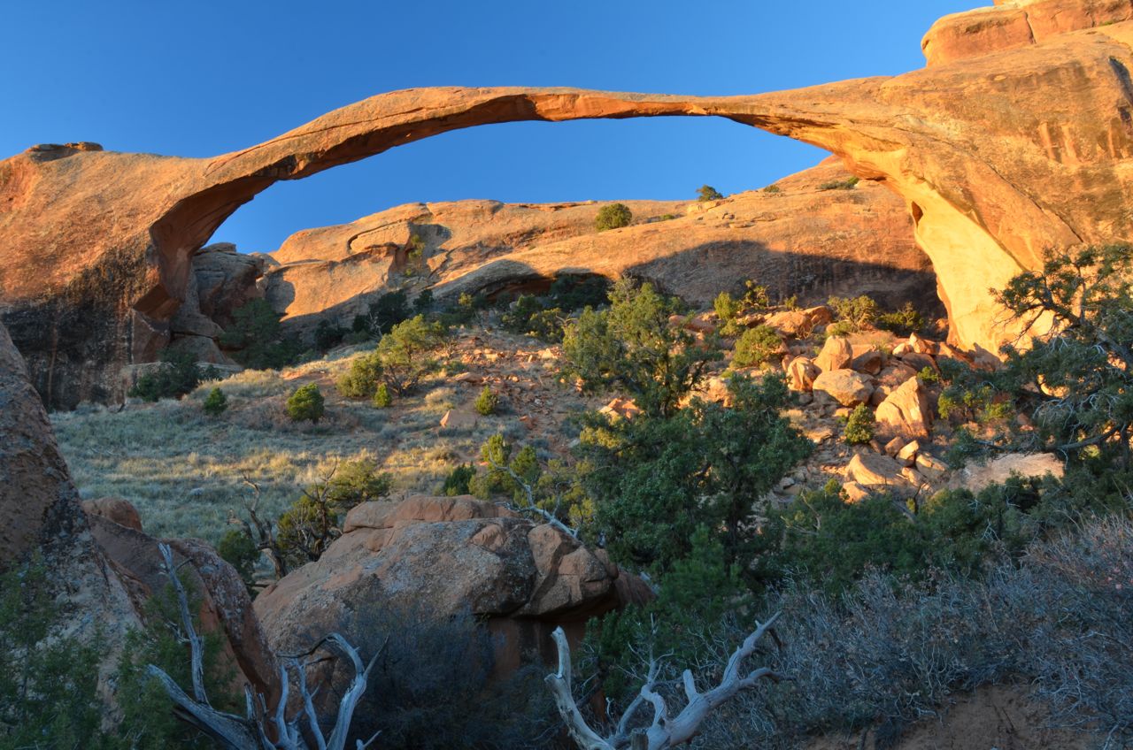
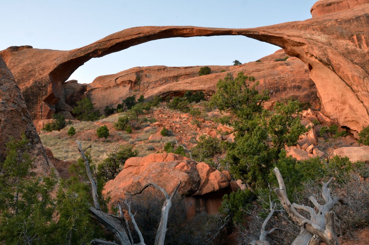
The next morning I got up before dawn and hiked the mile or so to Landscape Arch, which is the one to shoot at sunrise:
Then my friend John from Dolores joined me, and we planned our next shoot for sunset and Sunday morning sunrise. We saw a couple of climbers at the Garden of Eden who were scaling a spire…

… and then we started our sunset shooting…
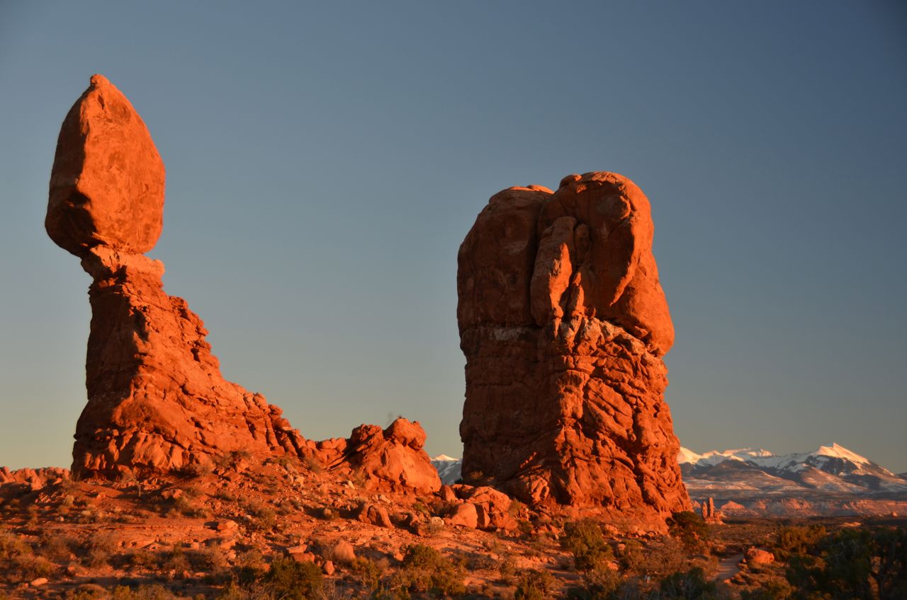
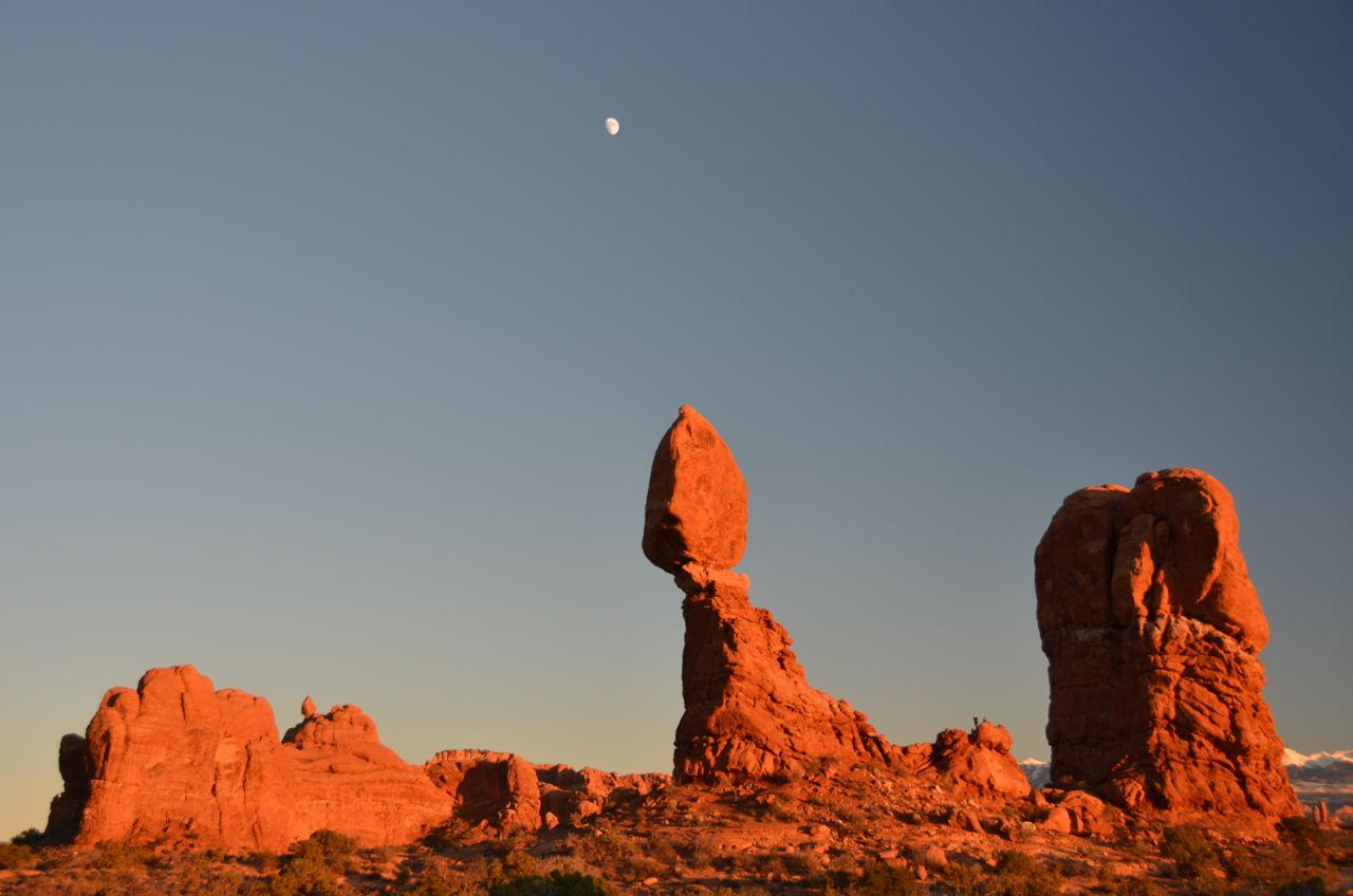
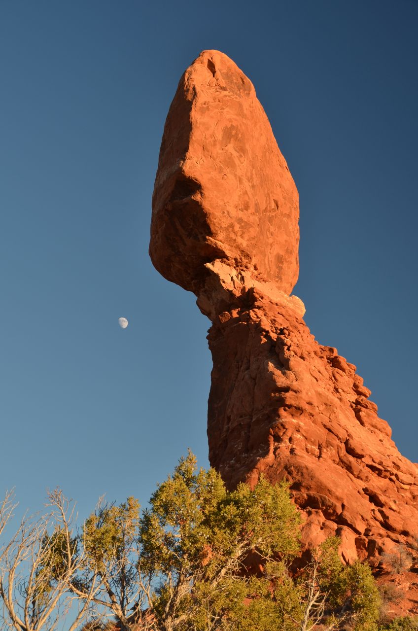
And a few after sunset: 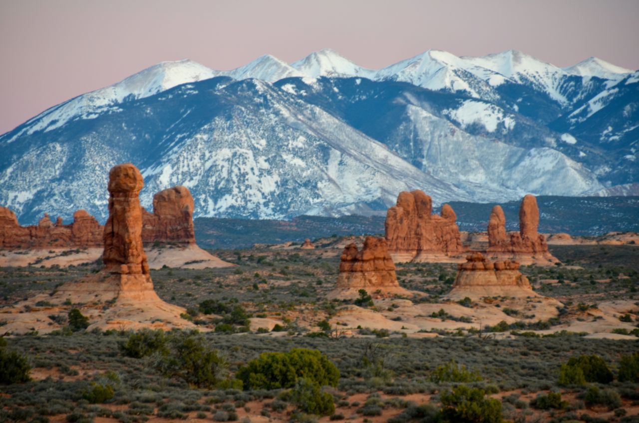

The next morning we made it to our sunrise position with plenty of time to spare:

And then we explored a backroad for a couple of hours, just for the hell of it, before John had to return home:

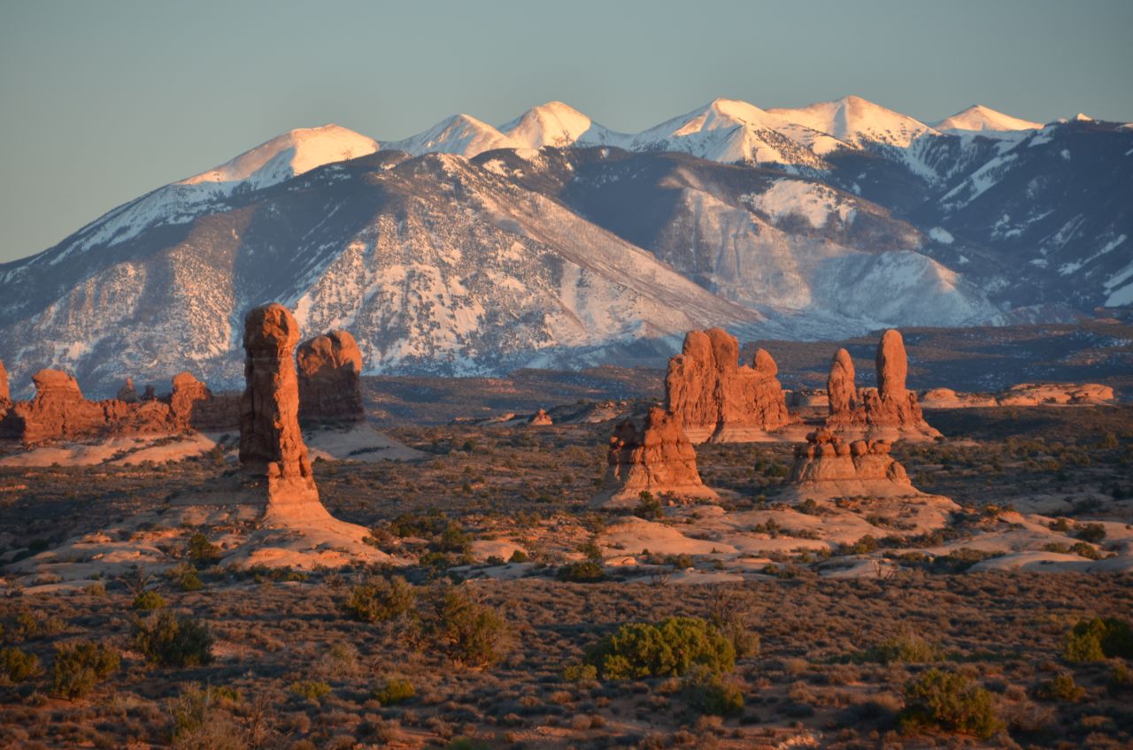
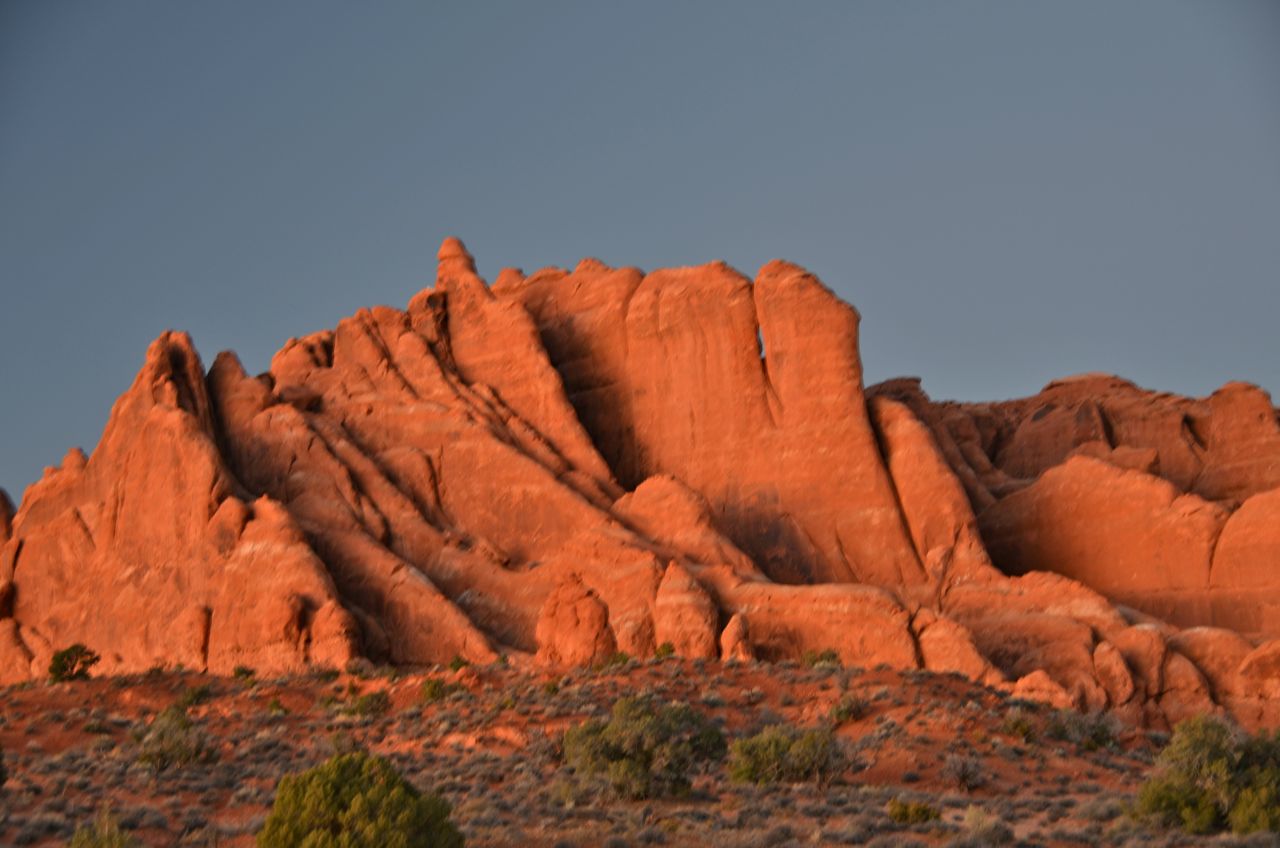
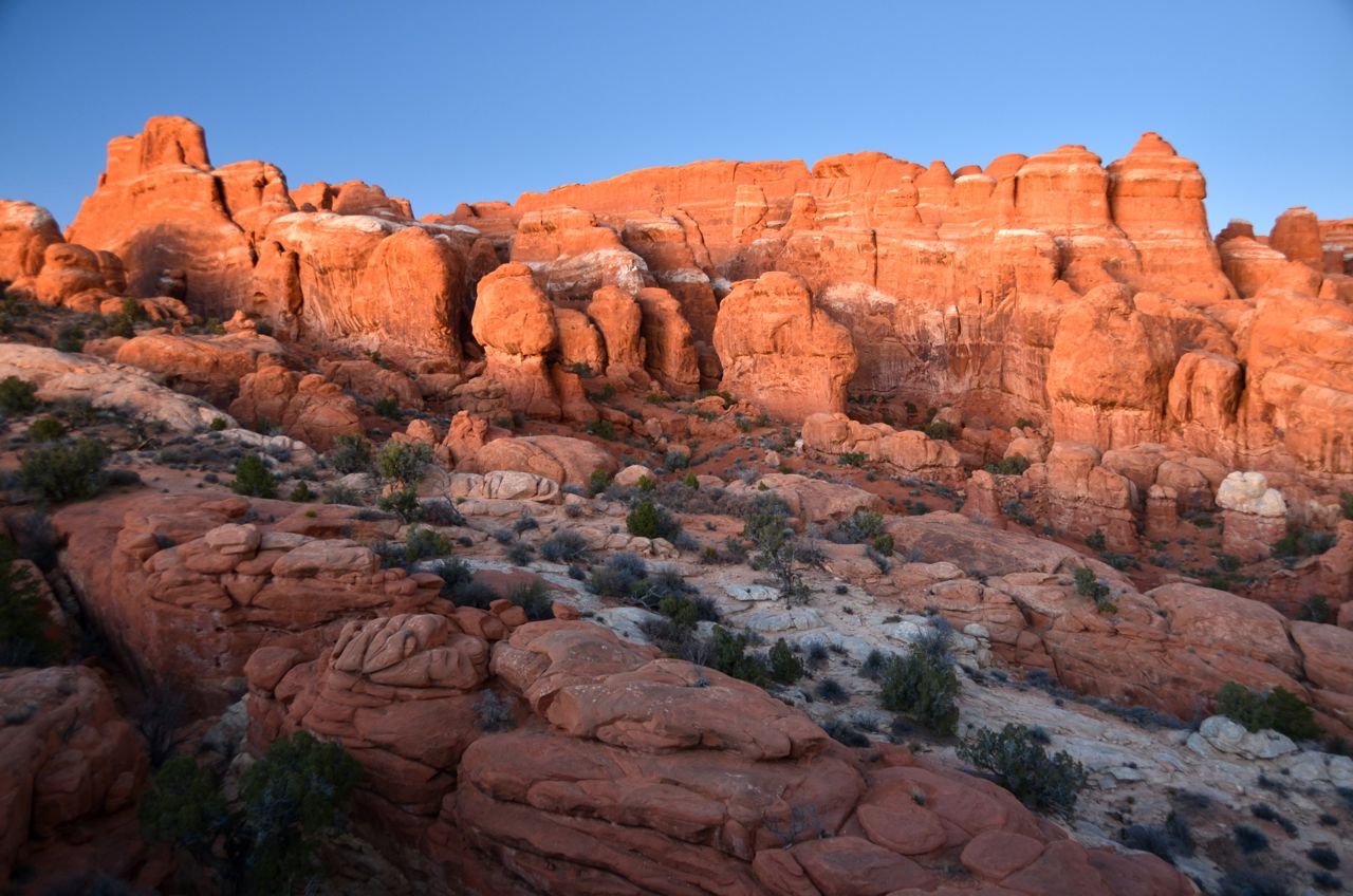
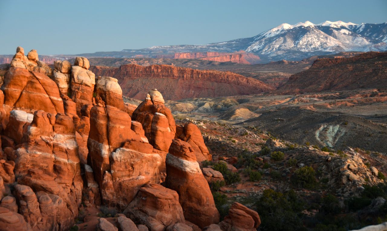
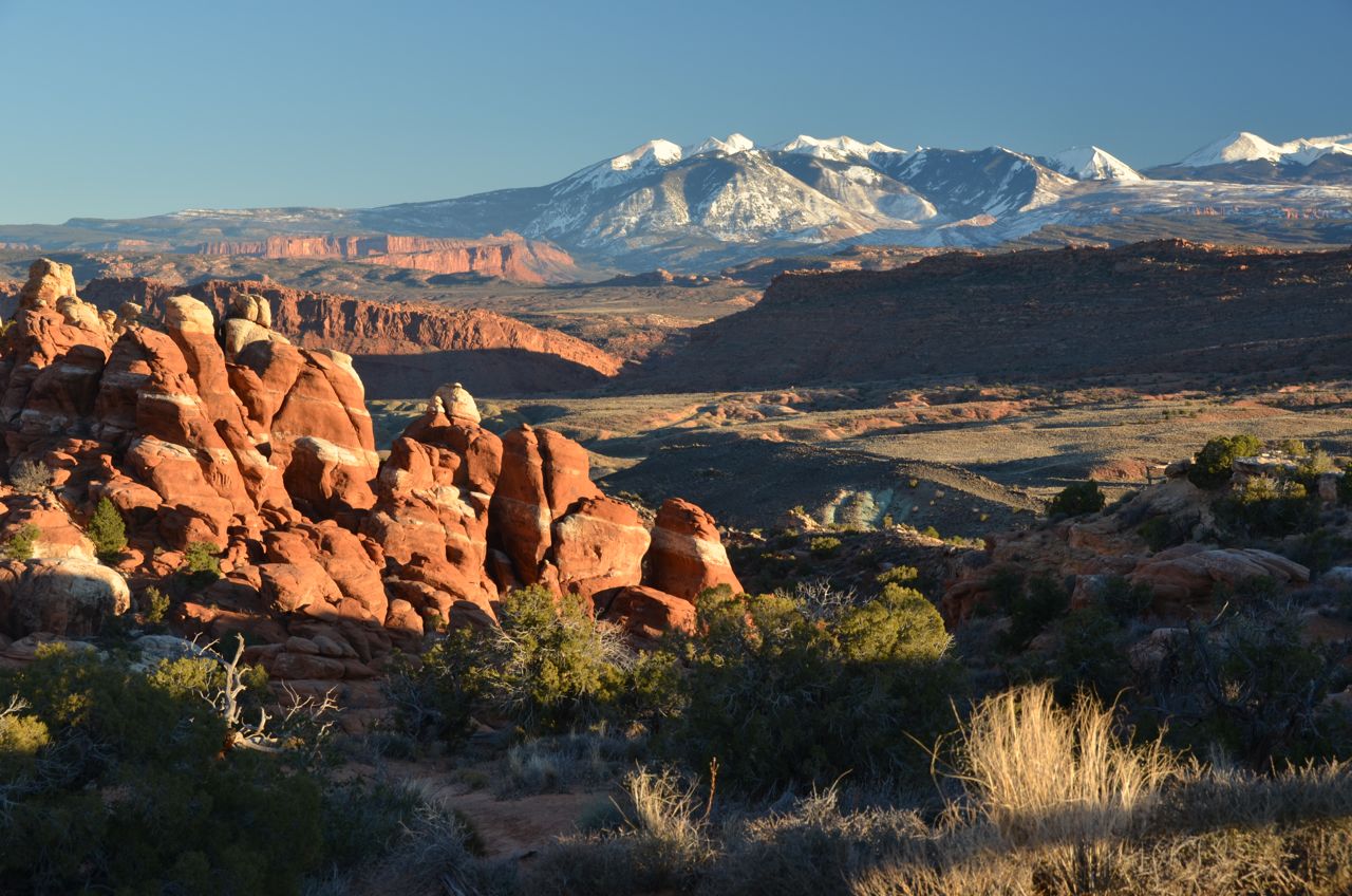
And I continued to shoot hoodoos and “fins” in the afternoon… 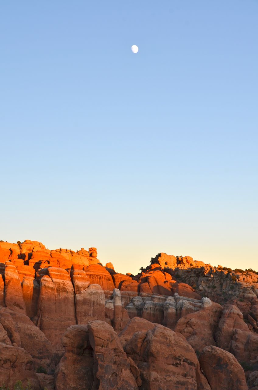


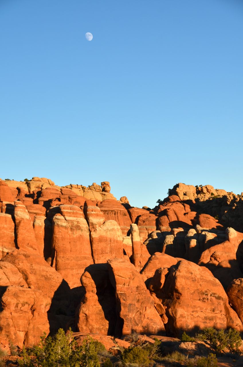

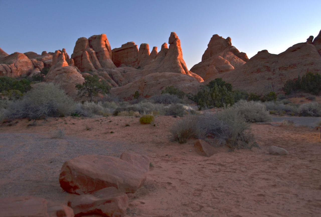
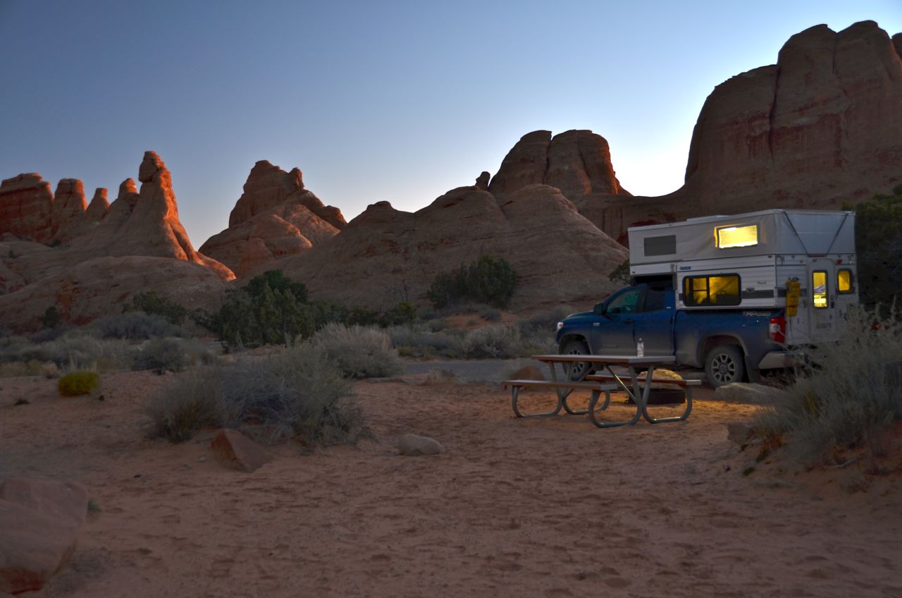
On my final night of camping on this trip I was in this post-sunset scene in the Devils Garden Campground:

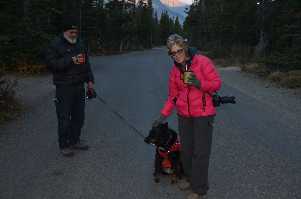
By coincidence, on the last night of this trip I ran into the first friends I made on this trip (in Glacier National Park almost two months earlier), Tim and Molly and their dog Belle. They had driven all the way to the East Coast from Glacier while I had driven in the opposite direction. It was good to see them, and we chatted around their campfire once again, each mentioning Alaska as a possible destination next year. I left early the next morning to hike to the Upper Delicate Arch Viewpoint to catch the arch at sunrise, my last pictures of this trip:


Arriving back home in Boise that night, I counted the miles I drove on this counterclockwise tour of the West, amounting to over 6,000 miles, equivalent to crossing the U.S. twice. I never got a flat tire. My truck received a 25,000-mile and a 30,000-mile maintenance checkup at Toyota in Bellingham WA and in Durango CO, respectively, passing with flying colors, both times with Toyota commenting on how well the tire treads are holding up, considering there’s a camper in the back. Chalk one up in favor of traveling light.
I do intend to make some improvements in the camper to enhance convenience and reduce clutter, which may add a few pounds to the camper’s weight, but not significantly. Even if Alaska is not on the horizon so soon, I want a good balance of user-friendliness, light weight, back-country readiness, and minimum preparation for breaking camp and hitting the road (15 minutes is my current pack-up time). All the better to focus on photography and adventure.

2 thoughts on “The Southwest: Giants, Hoodoos, Alien Eggs, Flying Dinosaurs, etc.”