The only thing about California that I ever thought was extreme is Los Angeles traffic (and now San Francisco area traffic, as I discovered in June 2014 and was reminded last week). But in the first week of November I learned a wider range of extremes that give me a new understanding and appreciation of the state, which calls for a blog all its own. Please note that my use of the word “extreme” here is not necesarily derogatory…
The Most Populous State: California remained the nation’s most populous state in 2014, with 38.8 million residents.
The State with the Largest Economy: California by far has the largest GSP (gross state product) in the U.S., at 2.4 trillion dollars, equivalent to the entire GDP of Italy, which is the world’s 9th largest economy.
The State with the Most Numerous National Parks: California ties with Alaska for eight. I’ve yet to see three of them: Lassen Volcanic, Pinnacles, and Channel Islands, but I need to return to the rest of them, too! They are Redwoods, Death Valley, Yosemite, Kings Canyon and Sequoia, and Joshua Tree. (My previous blog on the “Pacific Northwest” includes the Redwoods of the Northern California coast.)
Well, here are some more extremes in California you may not have known about:
The State with the World’s Largest Tree: California, with the Giant Sequoia “Hoax”
Nov. 1, 2014: At about 3 PM I drove from Pacific Grove, on the Monterey Peninsula, and arrived in Kings Canyon National Park at about 6:00 PM. I was struck by the number and size of signs put up along the road by Central Valley farmers regarding the record drought and government policies, with messages such as, “Is it wrong to use water to grow food?” and “Carter is no longer the worst U.S president in history” (presumably due to the federal government’s water policy) and “Pray for Rain.”
In contrast to the numerous dead or dying crops and groves I saw on the way, the size and apparent health of the giant Sequoia trees in the park belie the ill effects of any drought in history. I noticed the sweet smell of Sequoia as soon as I opened the door of my truck. It added to the feeling that I was in the presence of greatness.
And the first thing I did the next morning was to drive to the nearby General Grant Tree parking lot and shoot the trees and my truck together to try to do some justice to the Sequoias that I hadn’t done adequately to the Redwoods:
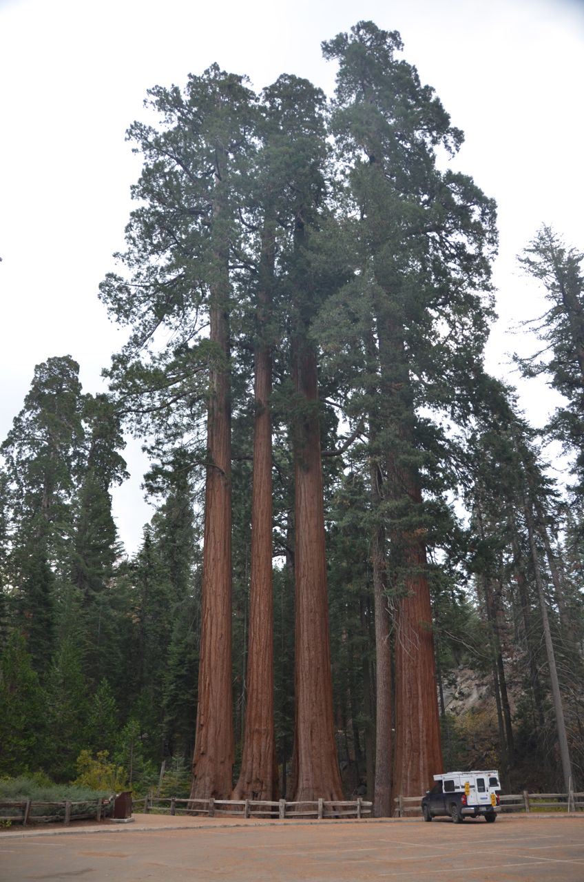
Then I walked to the General Grant and shot that tree as well as some others in the area:


The exhibit signs told about “THE CENTENNIAL STUMP: The tree was cut, sectioned, and reassembled at the World’s Fair in Philadelpha in 1876 where it became known as a “California Hoax,” by dubious easterners.”
The ranger at the Visitors Center advised me that the forecast was for rain today, turning to snow this afternoon with temperature dropping to 18 tonight, snow all day tomorrow and tomorrow night. I decided to see what I could before weather mayhem started, so I drove to Panorama Point. I was cheated out of my overlooks due to incoming clouds, but I took a shot of a scene next to the overlook… 
I knew that Panorama Point was the scene of at least one successful marriage proposal. This rock and tree caught my eye and brought that to mind.
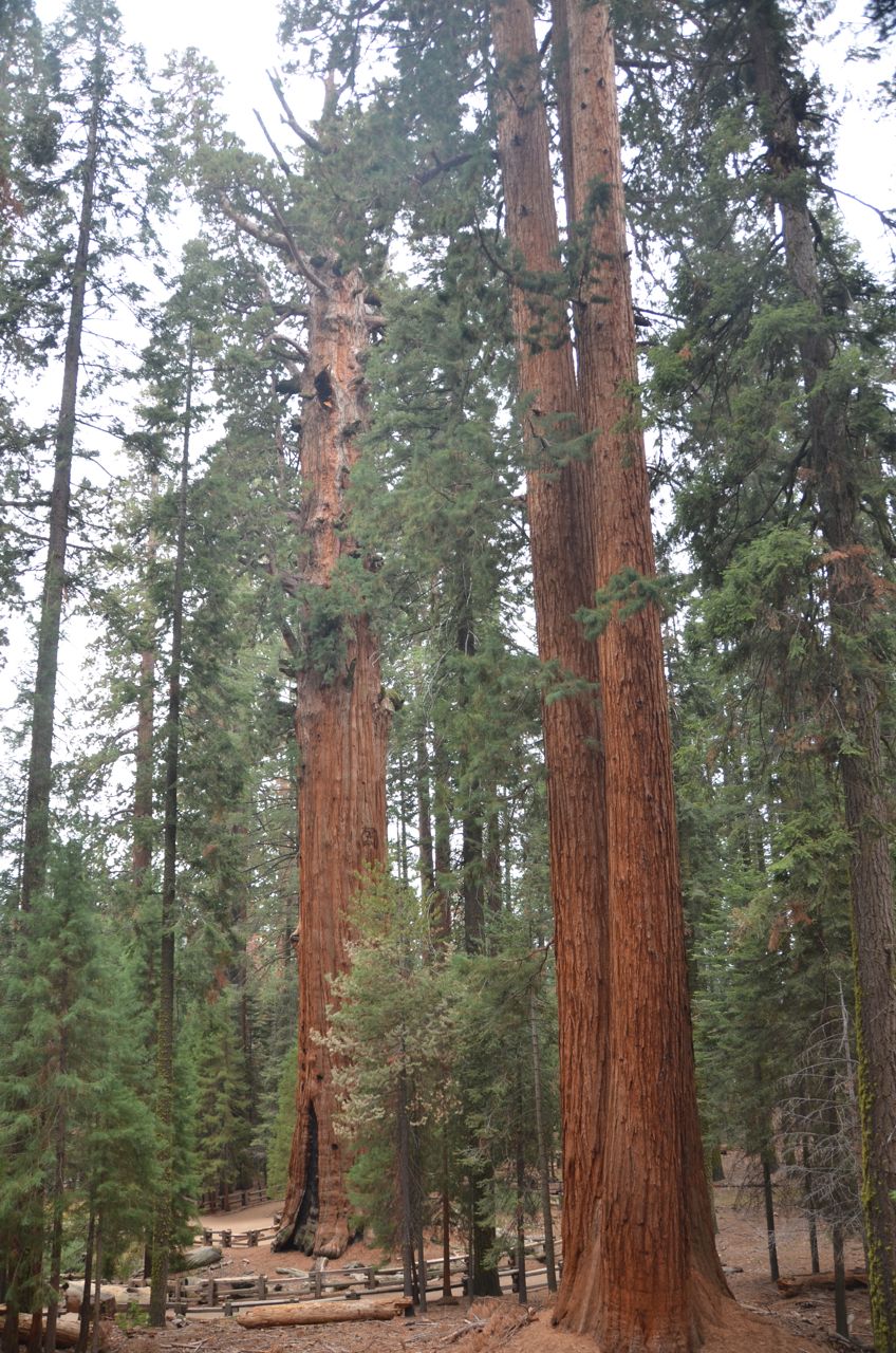
As soon as I got back in the truck, it started to rain, so I drove south to Sequoia National Park. I had just enough time to shoot the General Sherman, the largest tree in the world by wood volume, and I was lucky enough to get a better looking gauge of scale than seeing me in the foreground…

The rain arrived at about 12:30, so I had a quick lunch in my camper and hit the road, hoping I’d soon leave the rain behind and get some sun as I headed south and then east towards Death Valley National Park. (Hah!)
The State with the Baddest El Nino: California
We were warned about this bête noire, and on the day I bugged out for Death Valley, the Sierra Nevada Mountains, including Kings Canyon and Sequoia National Park, were hit with the season’s first big snowfall. Was El Nino the cause of this snow? Meteorologists say that “most of California as a whole won’t really see the effects of El Niño until January.” But Outside Magazine says, “The much-hyped weather phenomenon is upon us… A consensus of ocean and climate models suggests that El Niño will continue to strengthen over the next couple of months before peaking sometime this winter. In fact, the present event is already among the top three ever recorded in terms of its warming effect on ocean temperatures (the most direct indicator of El Niño’s power), and it’s even possible that this one could steal the all-time title from the ‘97-‘98 event, becoming the most powerful in modern history.”
Well, all I know is, it rained the whole way from Sequoia National Park to my campground in Death Valley. And it wasn’t just “rain,” it was the strongest combination of rain and wind I’ve ever driven through, and it stretched out the 5.5-hour drive to about 8 hours, the last three hours being in darkness. I saw three cars that were totaled on the highway in three separate accident scenes before and after Bakersfield, even before I got to Rt. 395 North. One of the crashes was apparently fatal, as all I could see inside the mangled car, as I rubbernecked, was a cowboy hat on the steering wheel, and there wasn’t much room inside for anything else. Rt. 395 North had several signs that warned, “Wind Gusts Ahead, High RV Roofs Not Recommended,” or something to that effect. I’ve never seen such a warning, and I was very glad to have a low-profile pop-up roof and a wind deflector. Imagine driving into Death Valley in total darkness, never having visited before, and having just seen a fatality hours earlier due to this rain and wind.
Well, by sunrise the rain had stopped and I woke up to this scene:

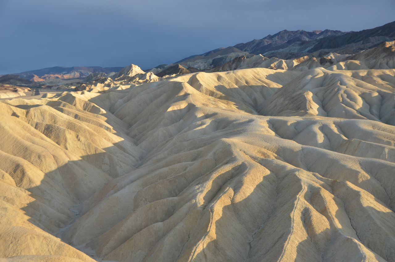
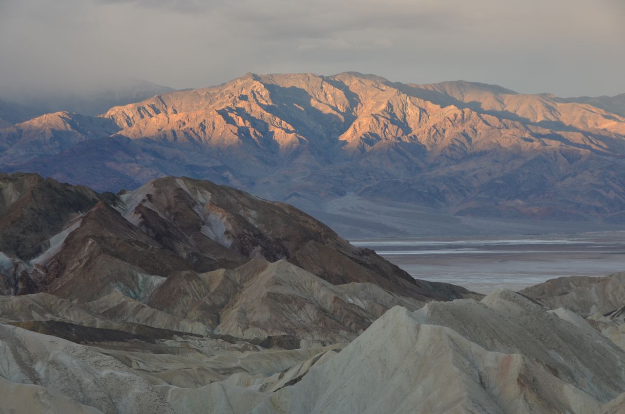
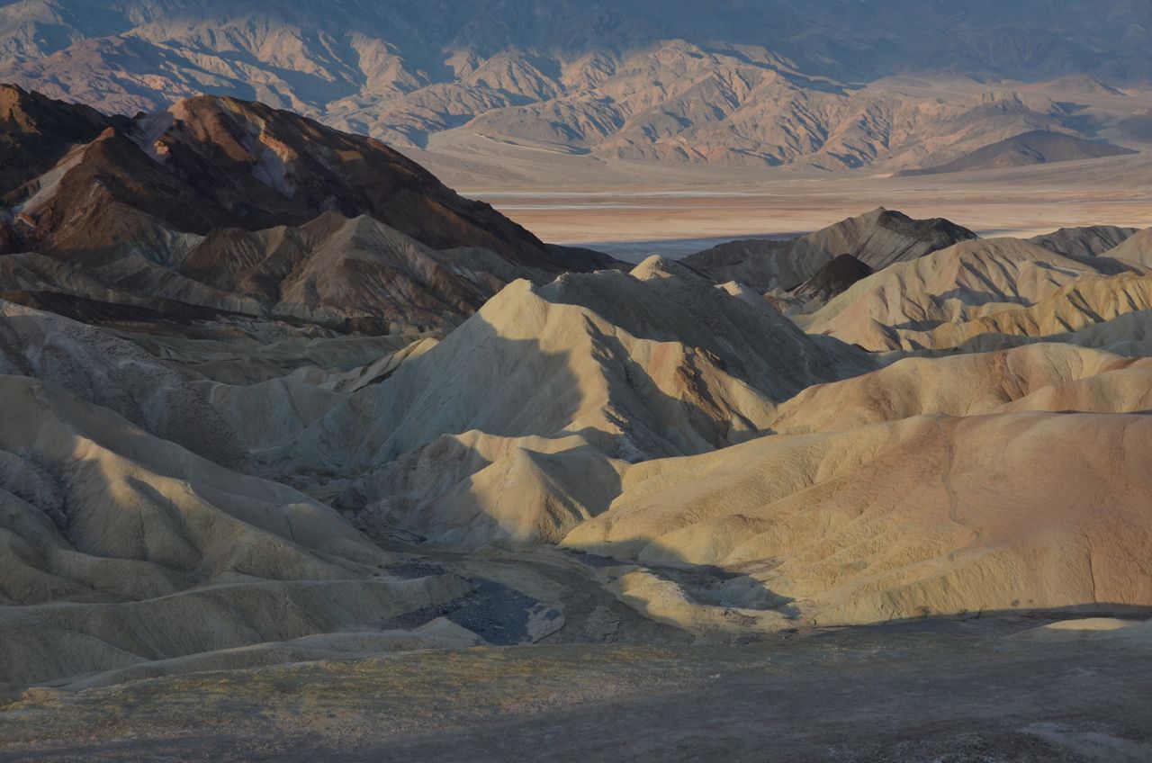
I drove through the park to secure my next night’s campsite at Furnace Creek Campground, hiked around a little, and then drove to Zabriskie Point overlook for sunset, which the ranger and park map recommended for photography at sunset AND sunrise. I’d heard of Zabriskie Point but didn’t know it was a real place in Death Valley. Here are sunset shots there:
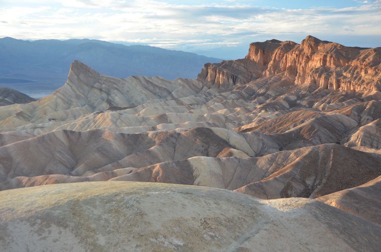
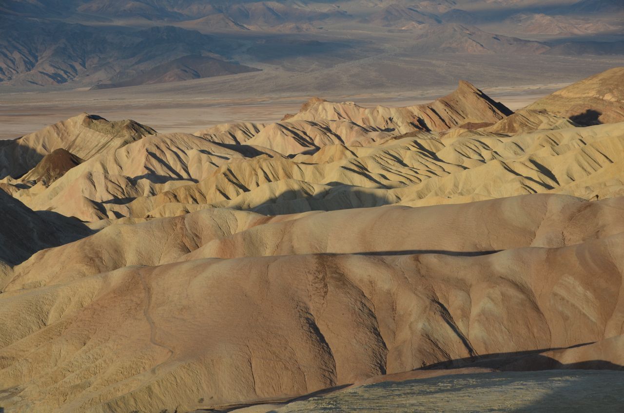
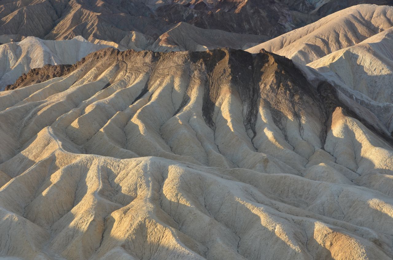
While shooting at this overlook, I met pro photographer Neil Silverman and his wife Susan who provide photography workshops in the field, based in Santa Rosa, CA. They were shooting, too, and we chatted and commented about the shots. He gave me some great technical and equipment tips, and advised me to come to this overlook at sunrise the next day, so I did:
The State with the Hottest Spot in the U.S.: California (Death Valley)
The State with the Driest Spot in the U.S.: California (Death Valley)
The State with the Lowest Elevation in North America: California (Badwater Basin, wet and dry, Death Valley):
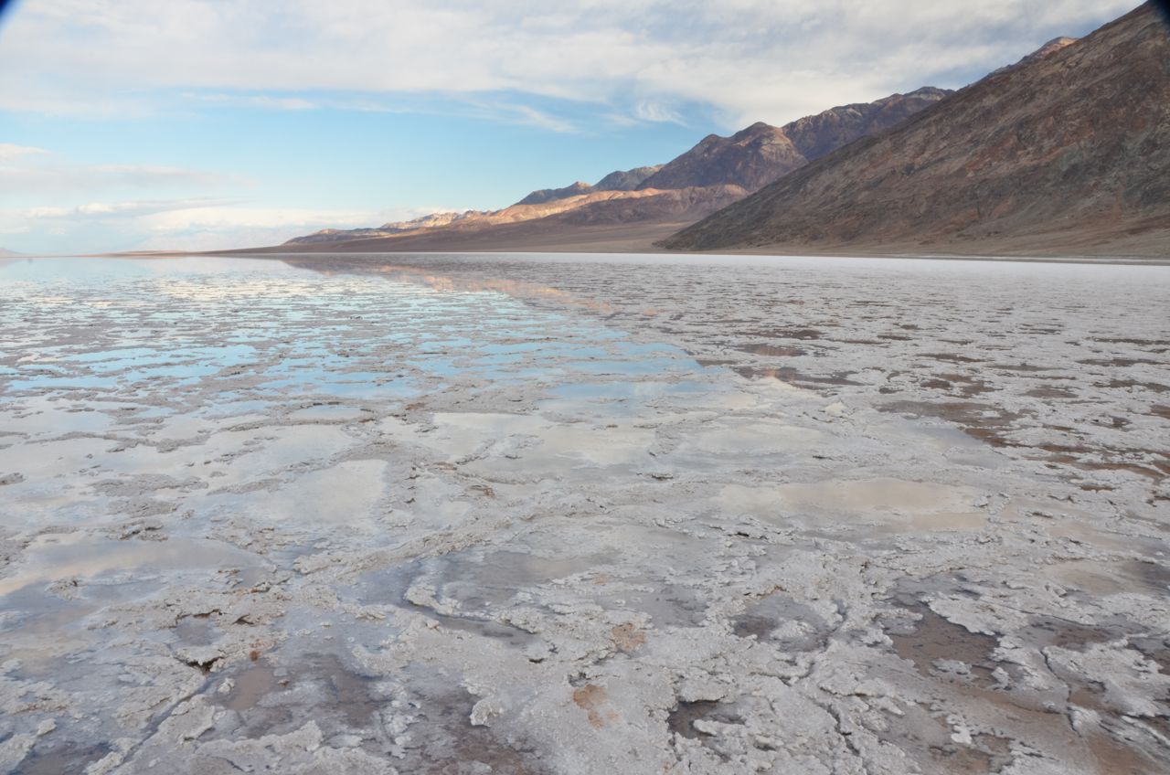

Death Valley surprised me with its diversity of scenery, and going from one extreme to the other: Badwater Basin is at 282 feet (86 meters) below sea level. This point is only 84.6 miles (136.2 km) east-southeast of Mount Whitney, the highest point in the contiguous United States with an elevation of 14,505 feet (4,421 m).
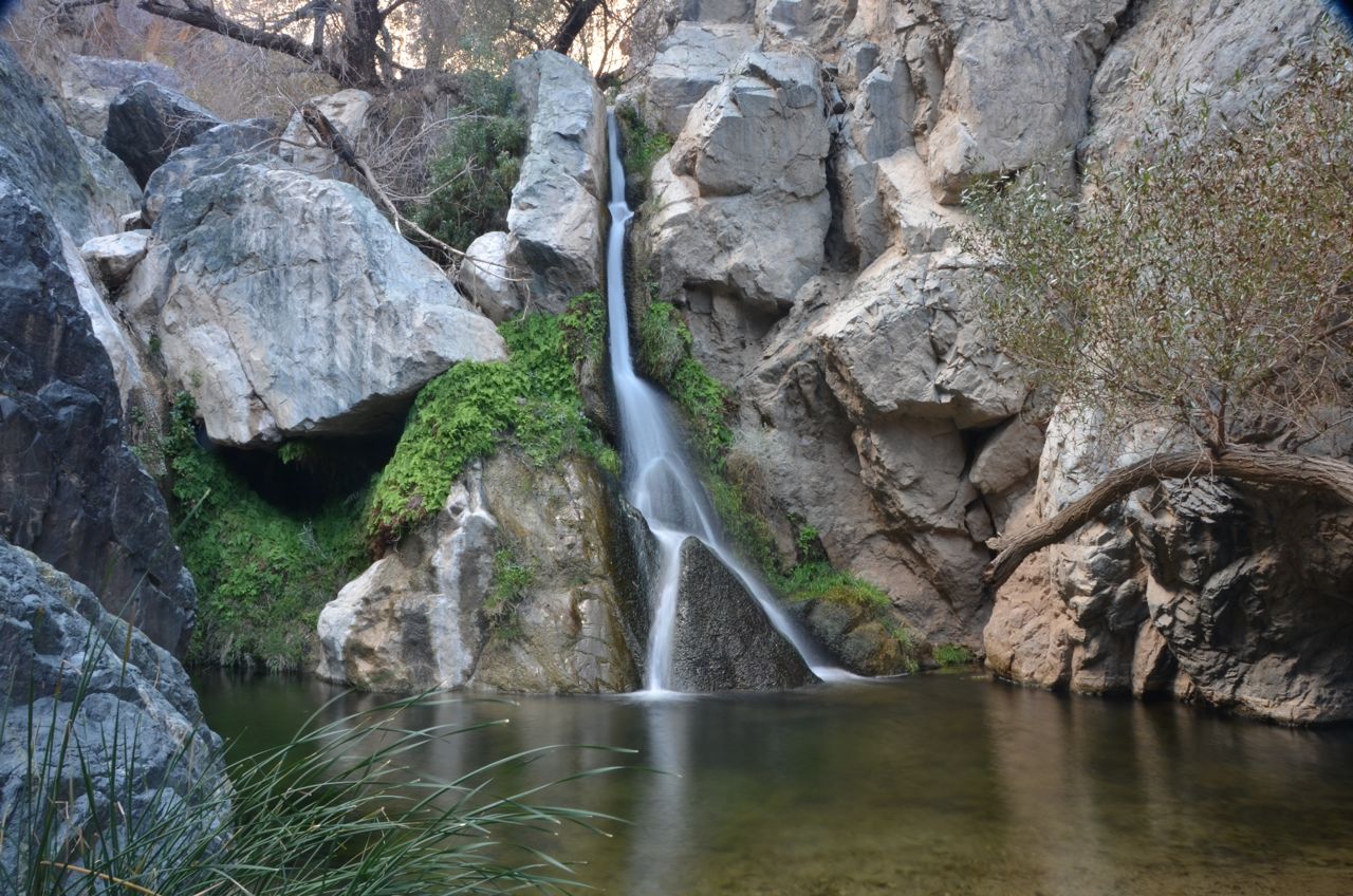
Neil Silverman also advised me to shoot Darwin Falls in the park, and told me of his favorite place to shoot near here called “Alabama Hills,” where camping is free (BLM land) and the scenery is unmatched. I’d never heard of it, but he urged me to drive there tonight, saying I wouldn’t regret it. So, I took his advice, but I had a lot of driving to do for the rest of the day.
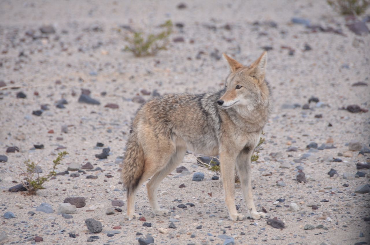
On the drive from Badwater Basin to Darwin Falls, just to the east of Panamint Springs, I had to slow down because cars ahead had stopped to take pictures of some coyotes that would not leave the roadside, probably because someone had been feeding them regularly:

I continued about 2 miles down the main road, another 2 down a dirt road, and then hiked the mile to Darwin Falls:

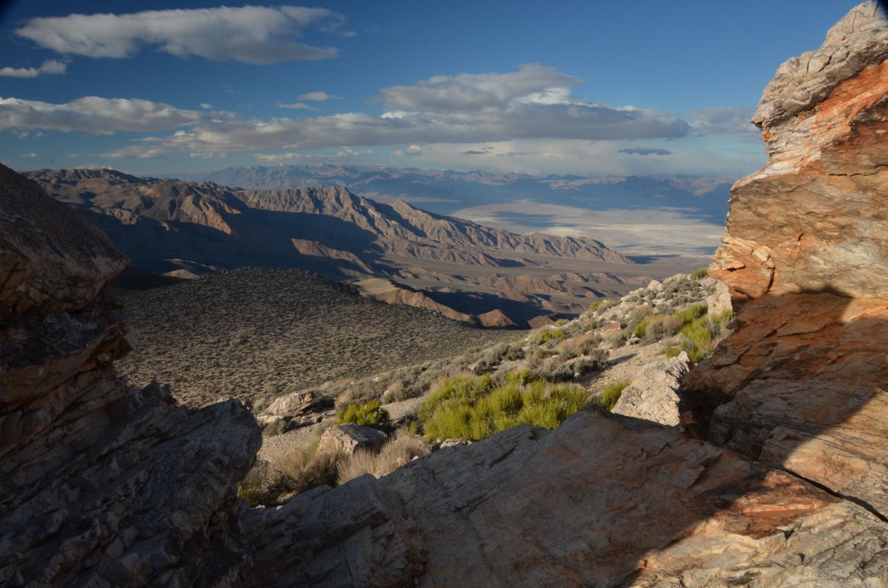
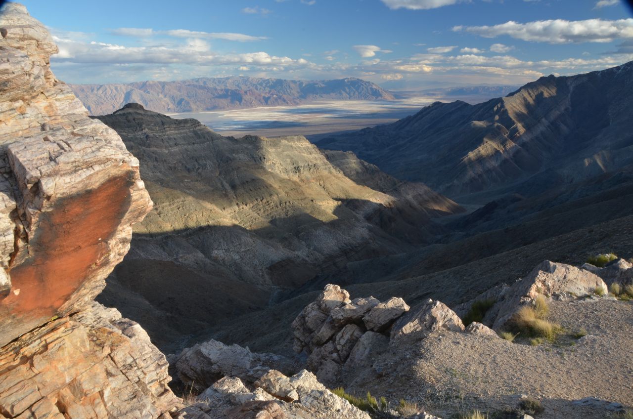
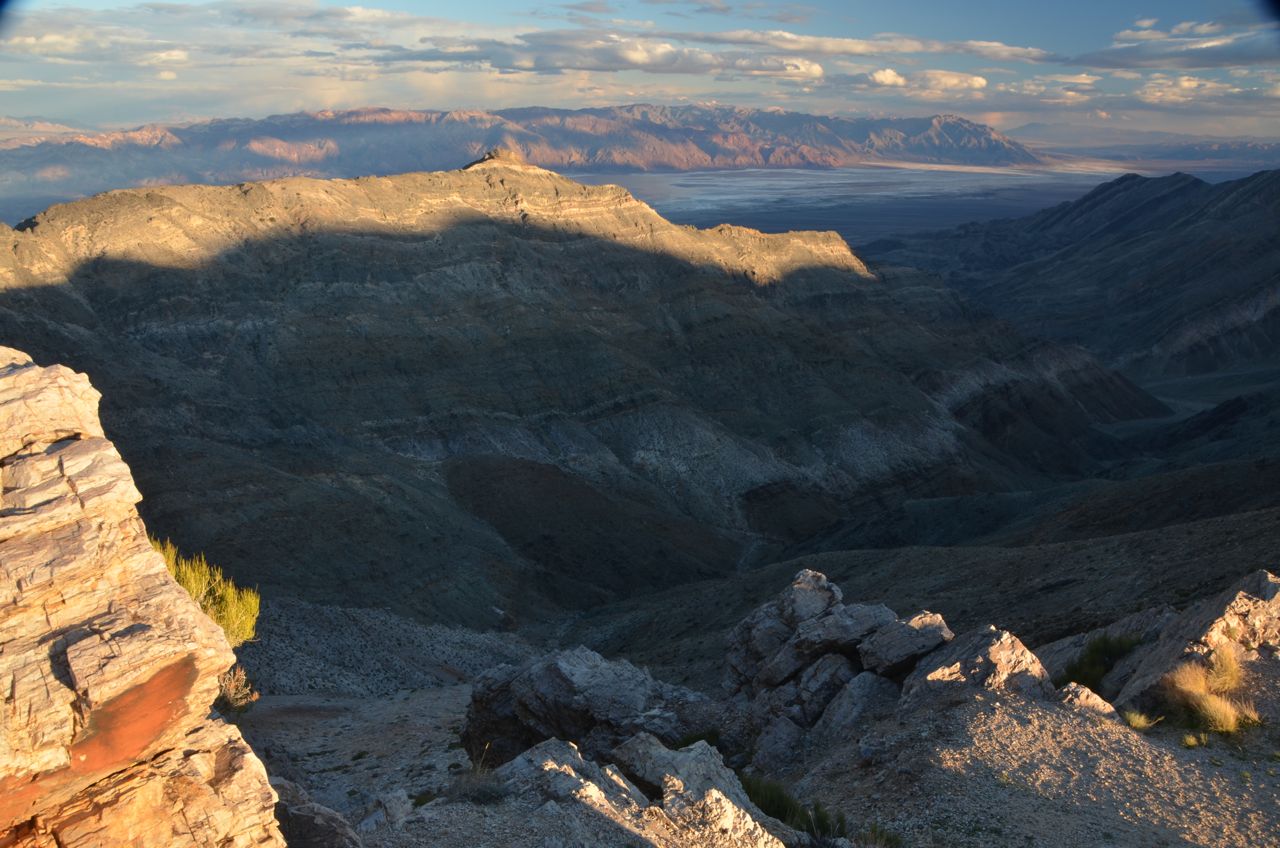
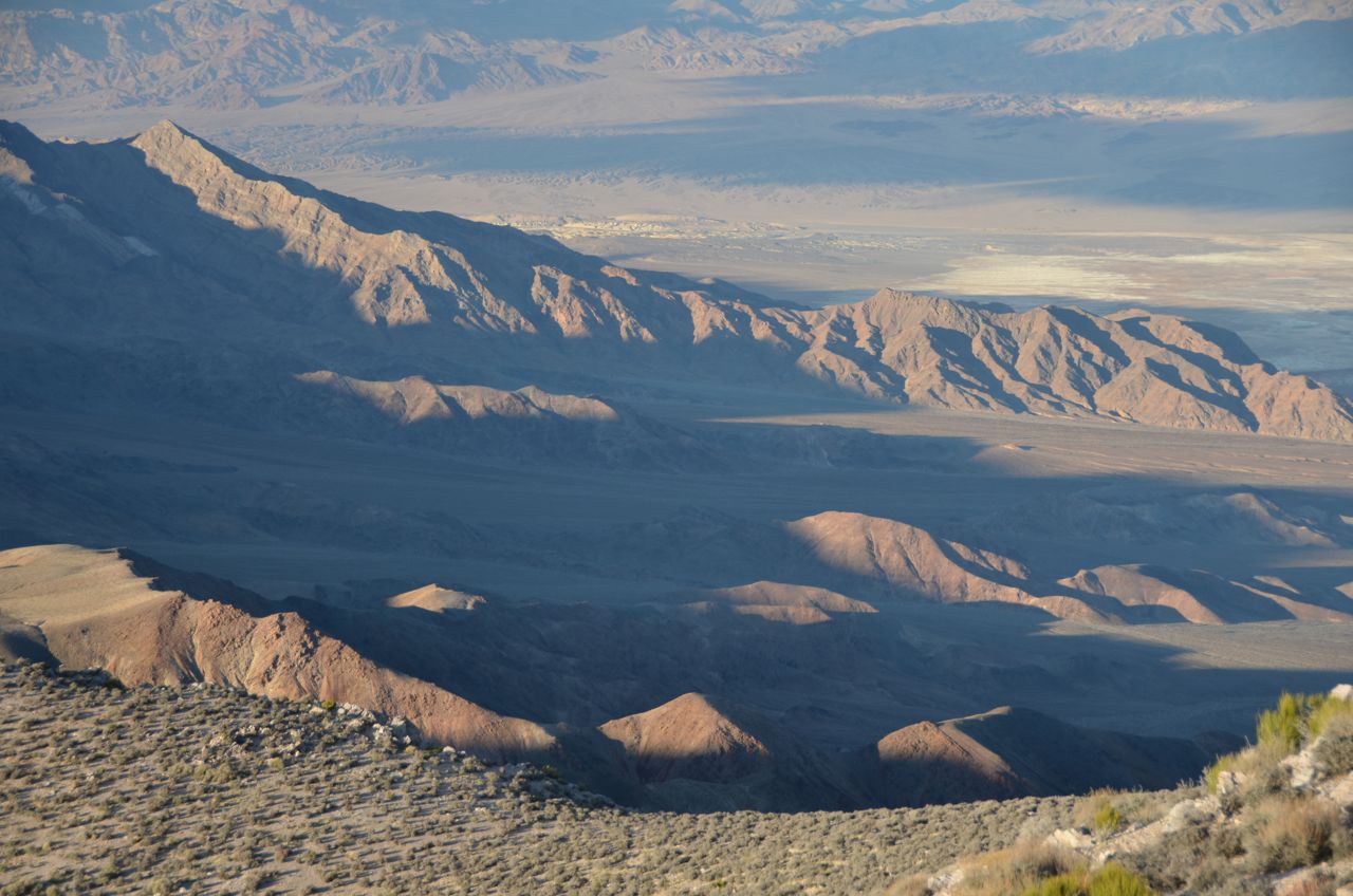
Then I doubled back to Aguereberry Point to catch the sunset light on the western side of Death Valley:
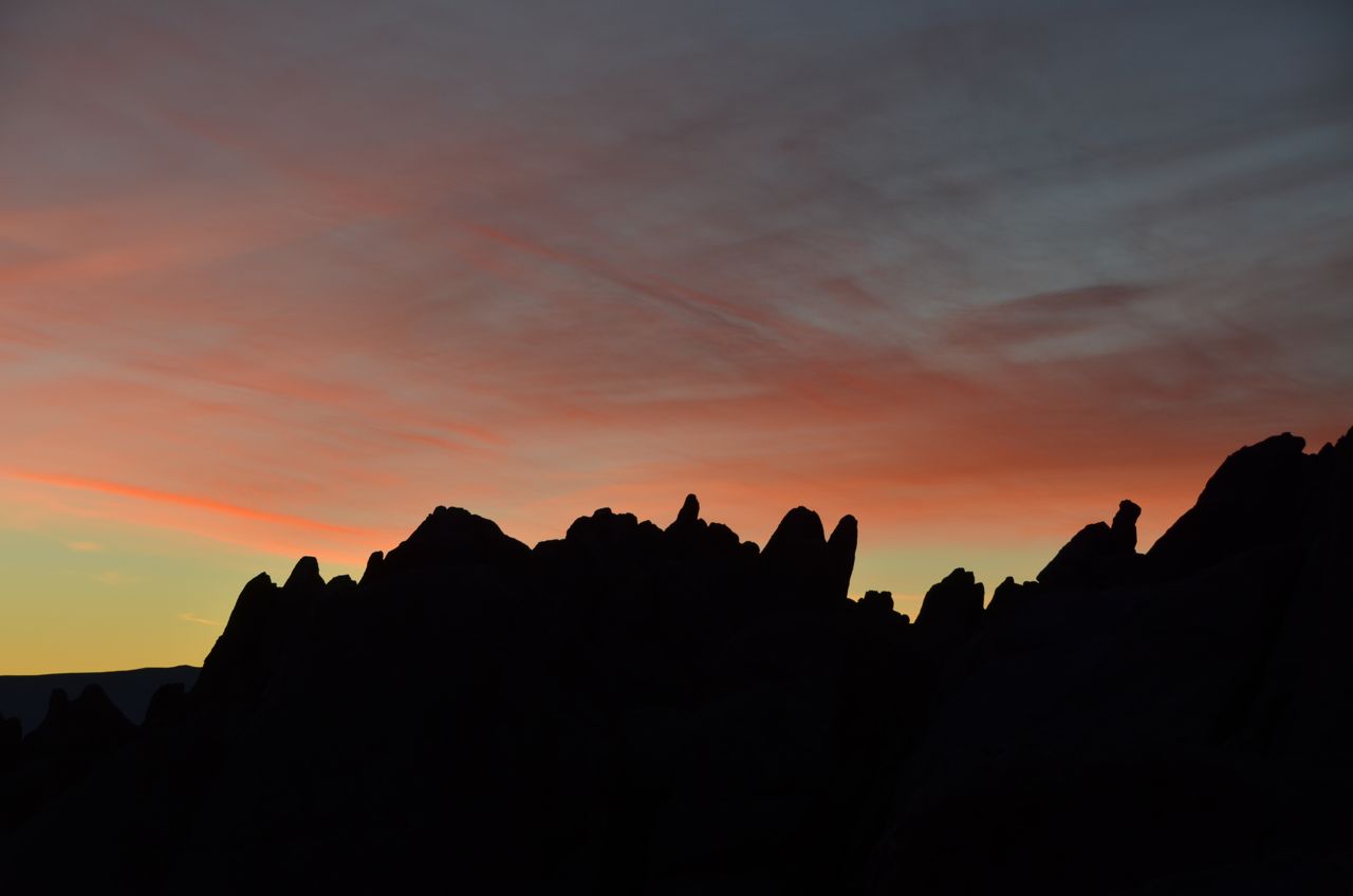
And then drove again through Panamint and Lone Pine to Alabama Hills, arriving at night, again not being able to see what I was getting into. Remembering the directions that Neil Silverman gave me, I drove to the far end of a dirt road loop that was displayed on my GPS. I saw some big rocks next to a vague campsite, a la BLM, and backed into it as far as I could until I risked dropping off the edge. There was no moonlight to speak of, and as I bedded down, the only indication of life around me was the hoot of an owl. The next morning, I opened my camper door just before sunrise and found myself in a movie set, literally:
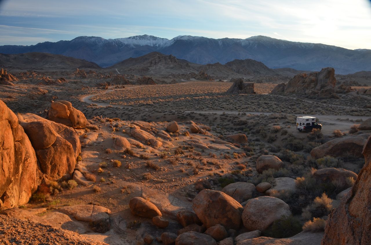 Just as Neil had predicted, I ran around and hopped on the rocks like a jackrabbit with my tripod and camera, trying to find as many shots as I could before the sun rose too high:
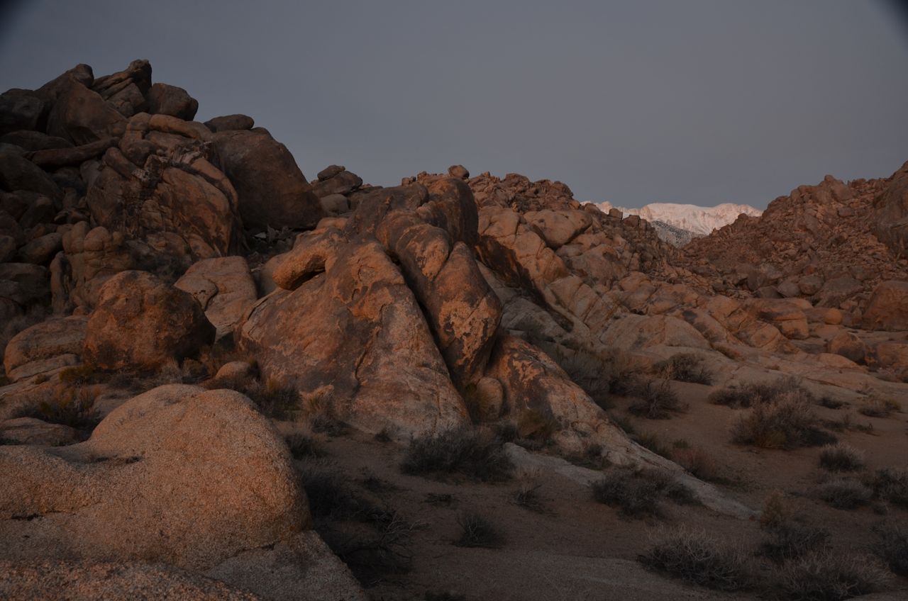
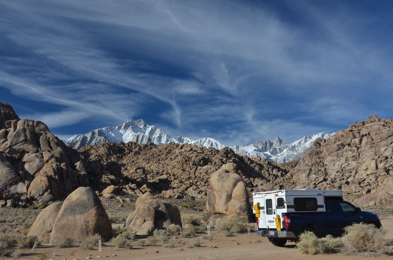
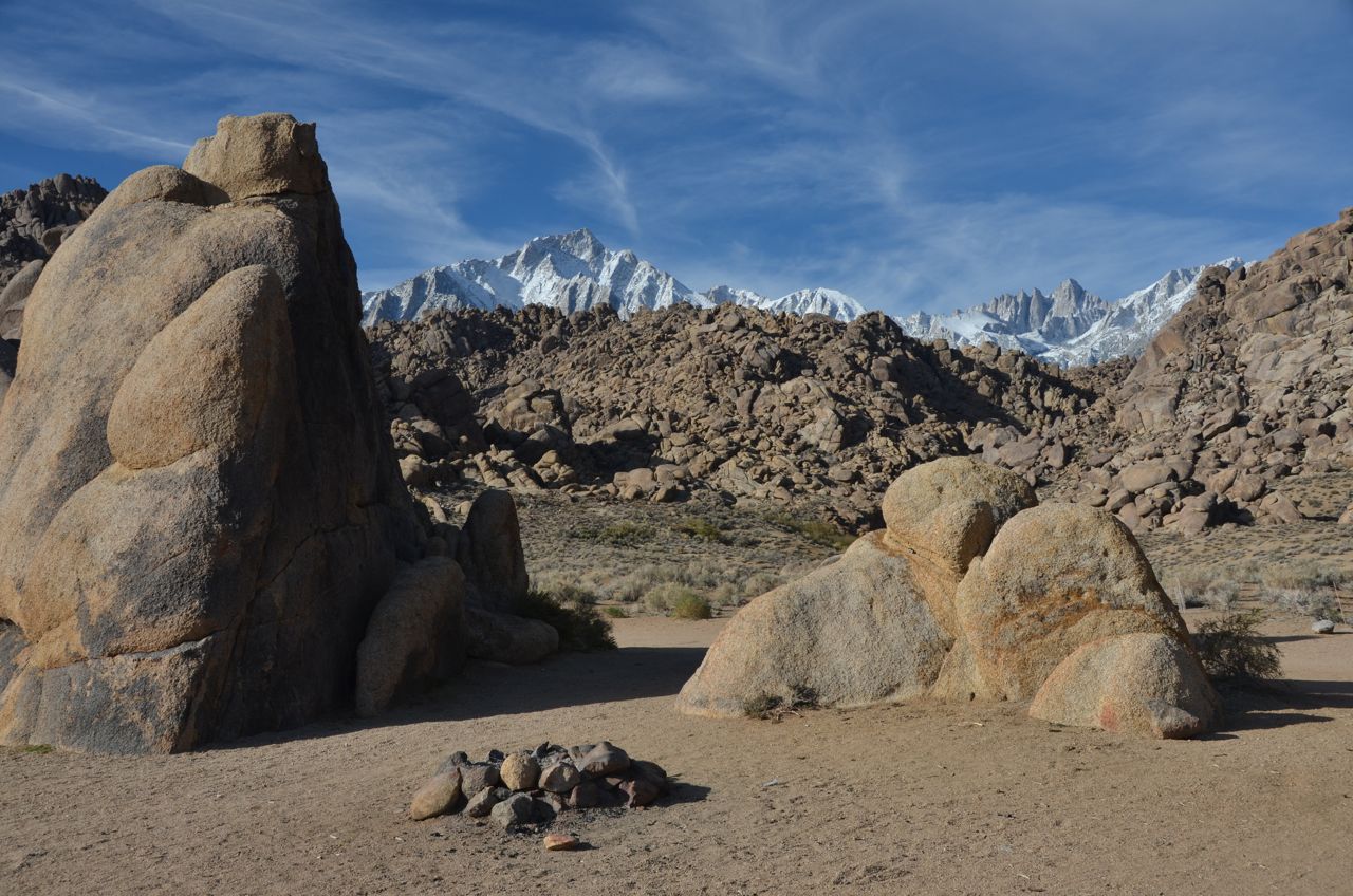
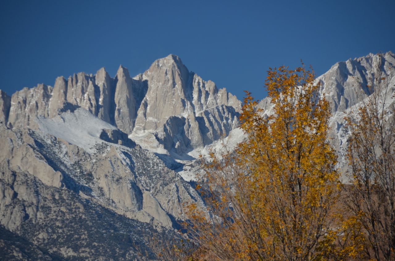
The State with the Highest Peak in the Contiguous U.S.: California (Mt. Whitney, Sierra Nevada Mountains). I was stunned at the scenery and decided not to return to Death Valley in favor of exploring Alabama Hills for a sunset…
 …and a sunrise the next day. Here’s Mt. Whitney before the sun hit it in the morning…

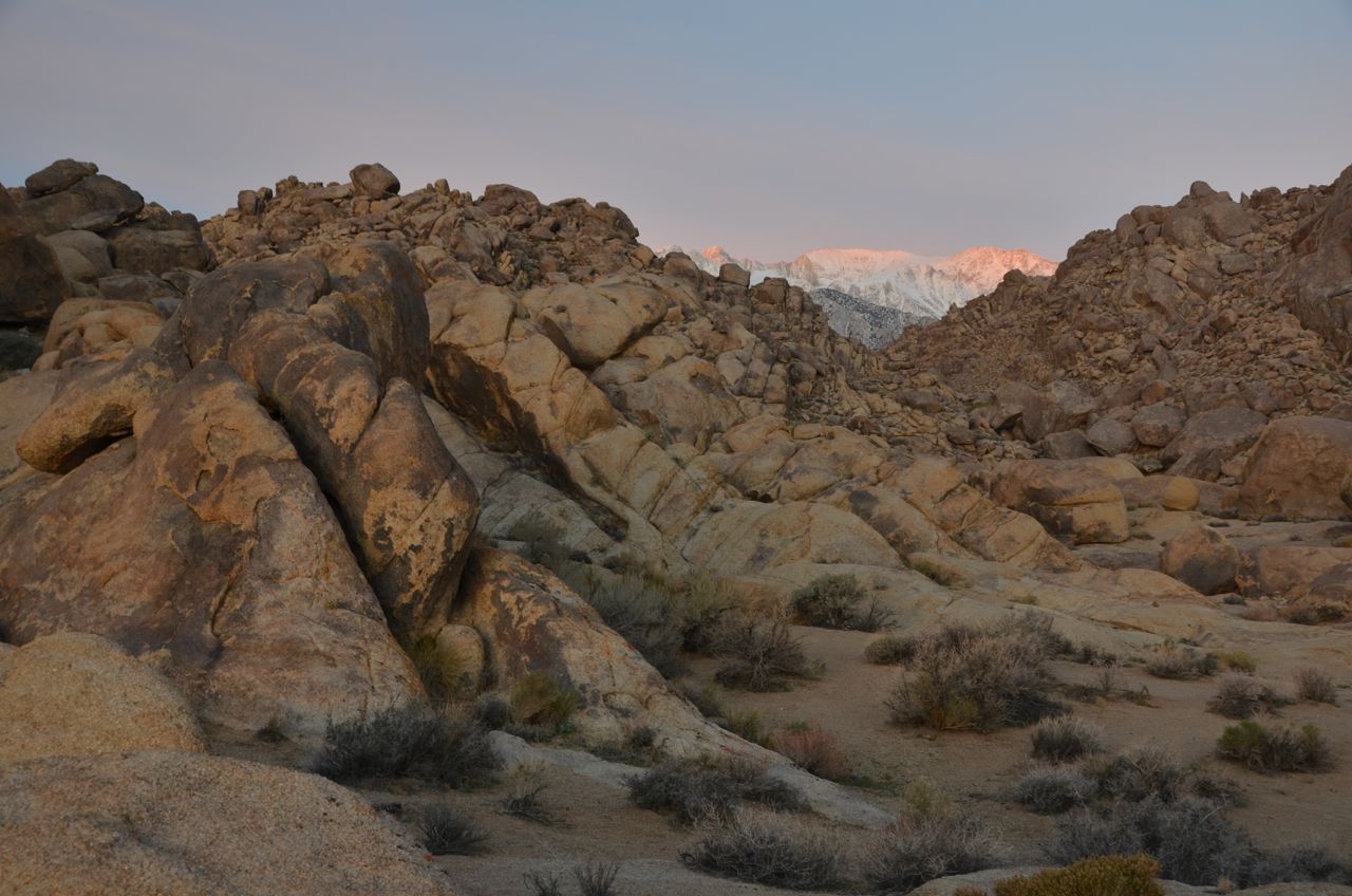
… and then glowing in the morning sun:


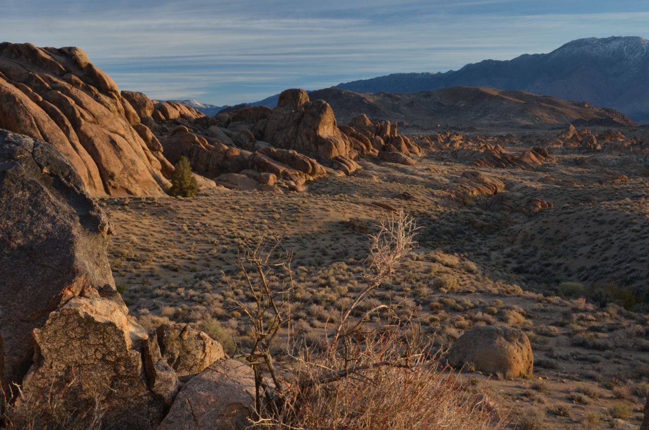
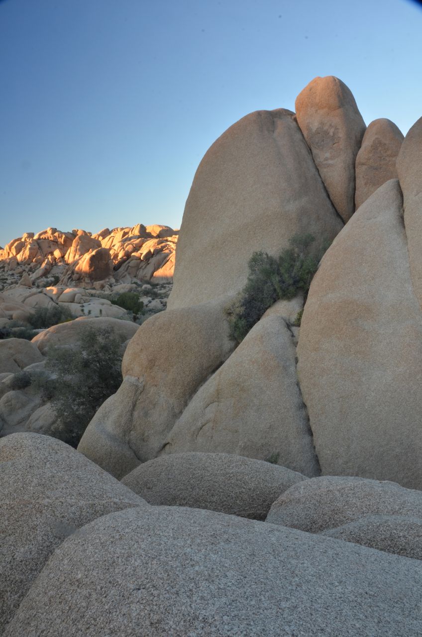
I then drove to a pile of rocks that included the so-called “shark fin” to shoot the last Mt. Whitney photos of the trip:

 But then I saw another shot while sitting in my truck at a Lone Pine parking lot, looking for a latte:
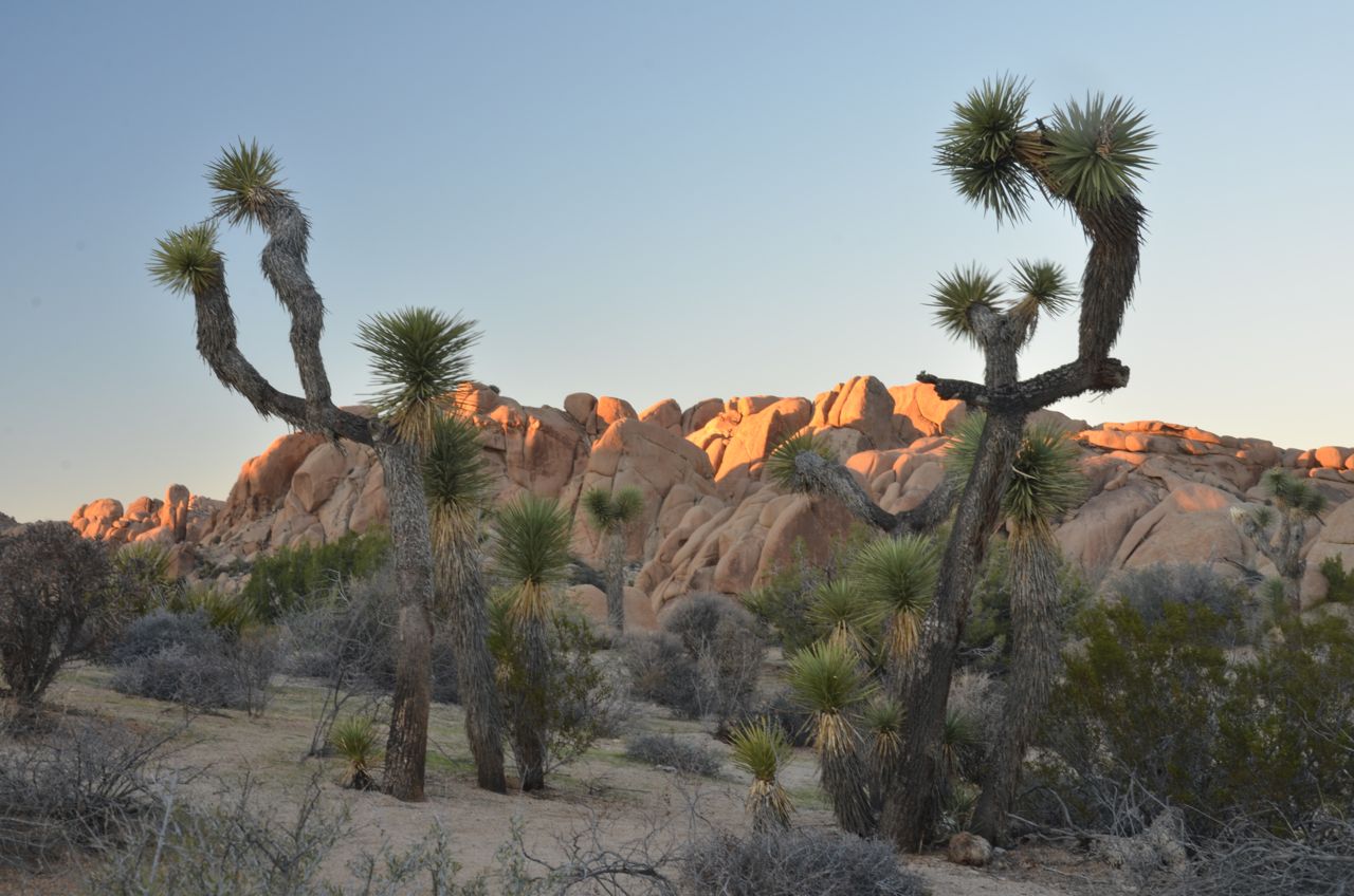
After the latte in Lone Pine, I drove to Joshua Tree National Park, violating my rule to never arrive in a national park on a Friday afternoon, especially a park so close to mega-cities like Los Angeles and San Bernardino. Every campground in the park was full. Oh, the extremes in cache of L.A. gawkers: Aside from lead role wannabes right out of “The Girl with the Dragon Tattoo,” I even saw a Bentley in the Jumbo Rocks Campground. But I parked there and hiked the short Skull Rock Trail and took some shots, catching the last of the sunlight:
And then took some more shots after sundown:


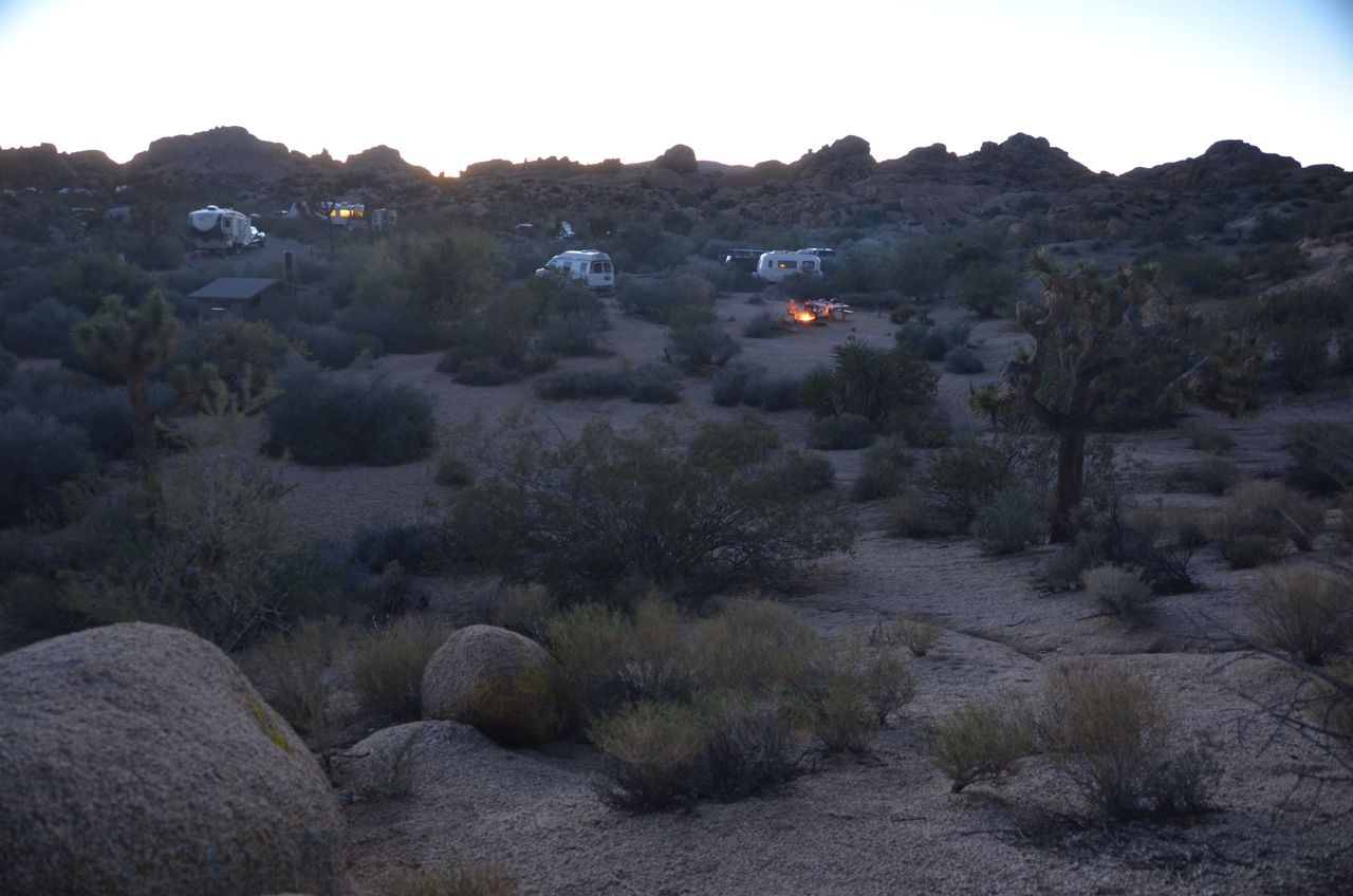
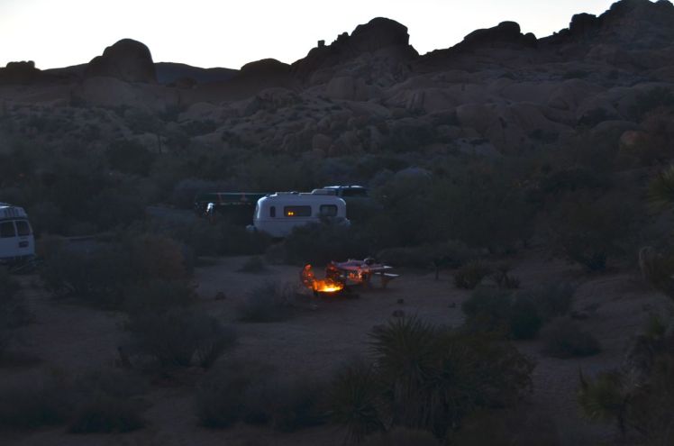
And then hiked back to the campground and shot the scene there…
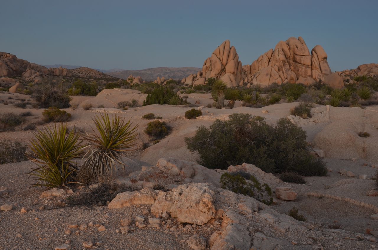
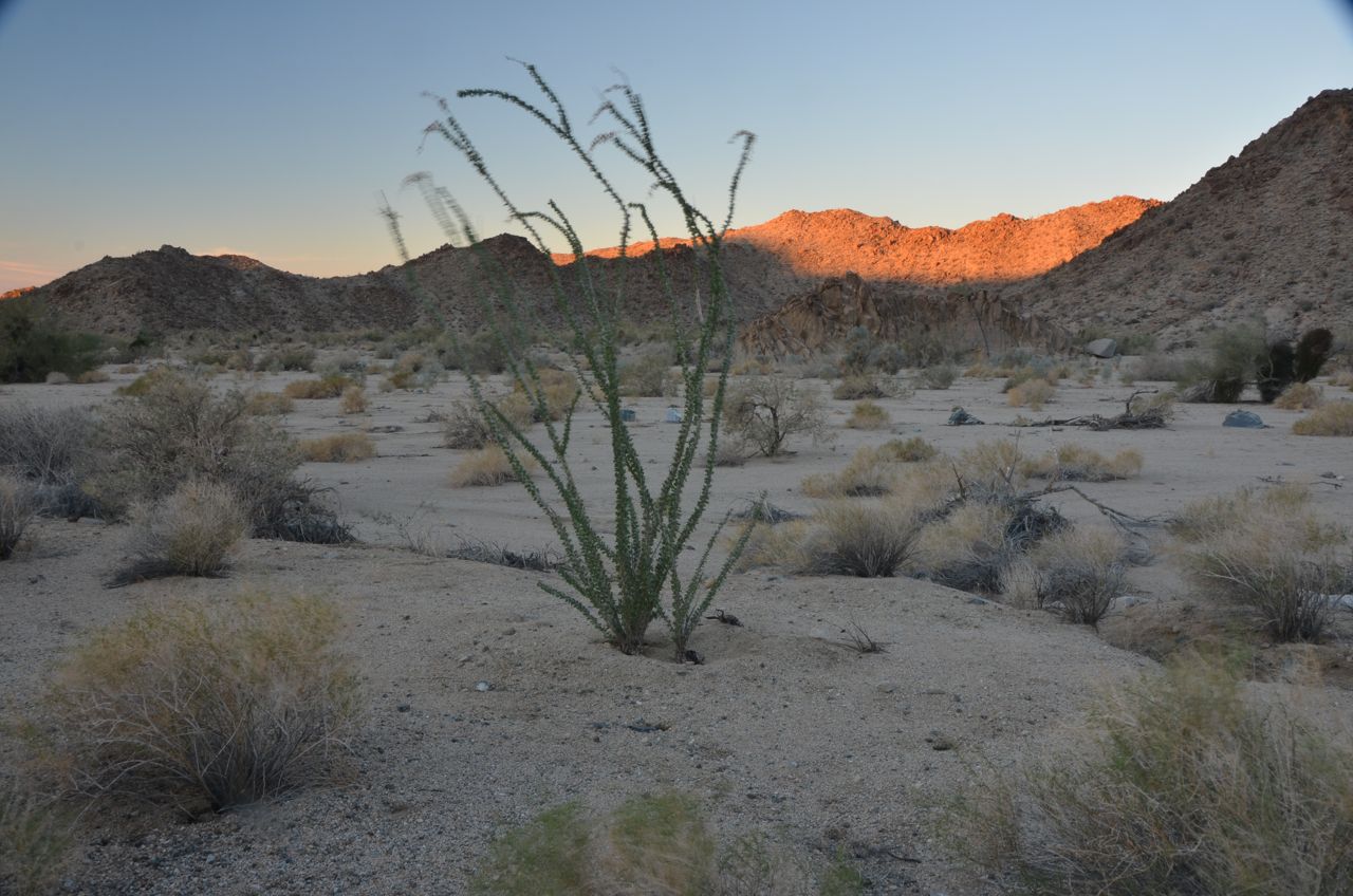
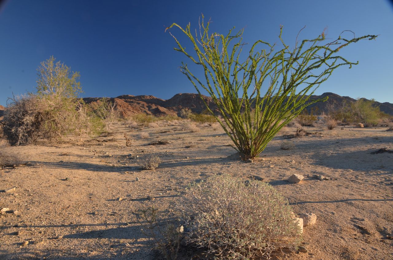
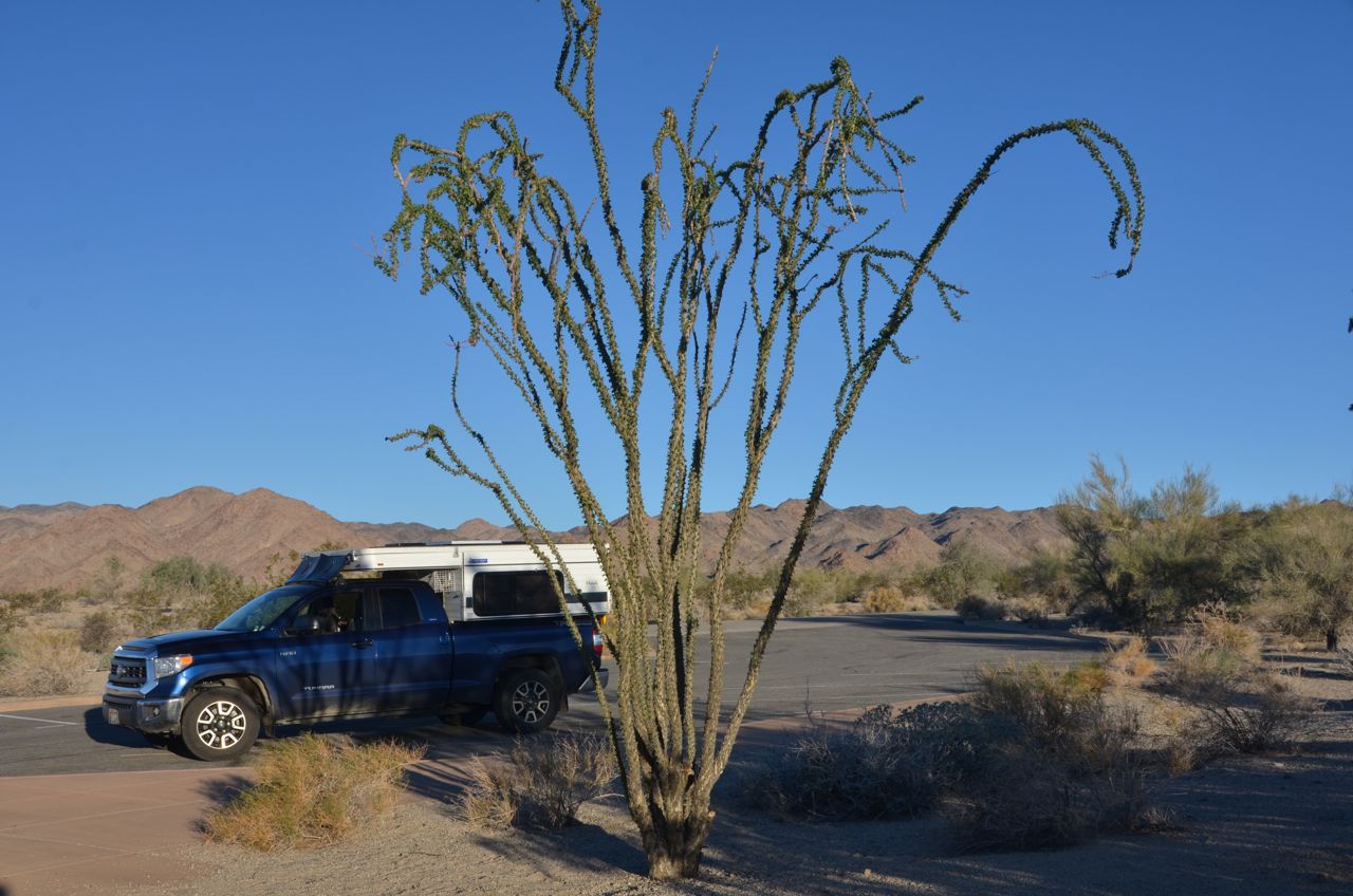
… then drove about 6 miles south of the park to BLM land for free camping, where I was the only camper. I returned to the park for sunrise shots at Bajada Nature Trail at the south entrance. Ocotillo fascinates me (I once had it planted at my house in El Paso in 1996), but the wind was strong this morning, so it was difficult to keep them from blurring:
 Although I only skimmed the surface of Joshua Tree this time (I’d seen more of it 12 years ago), I enjoyed the time I had there before heading for Phoenix to meet an old friend, which brings up another extreme:
The State with the Highest Gasoline Prices in the U.S.: California (actually tied with Alaska and Hawaii). $5.00/gal. for gas at Panamint Resort in Death Valley. The price in Blythe, CA, was $3.45, but I drove five miles, crossing into Arizona, and it dropped to $2.35, and by the time I got to Phoenix it was $2.10. In Tucson it’s $1.95. California’s gasoline tax is actually the fourth highest in the nation, after Pennsylvania, New York and Hawaii, but produces the largest gas tax revenue of any state. In 1977, that revenue was $811 million. In 2012, it was $5.5 billion, mostly from the extreme traffic in the Los Angeles and San Francisco areas, no doubt. My California driving this year contributed considerably.
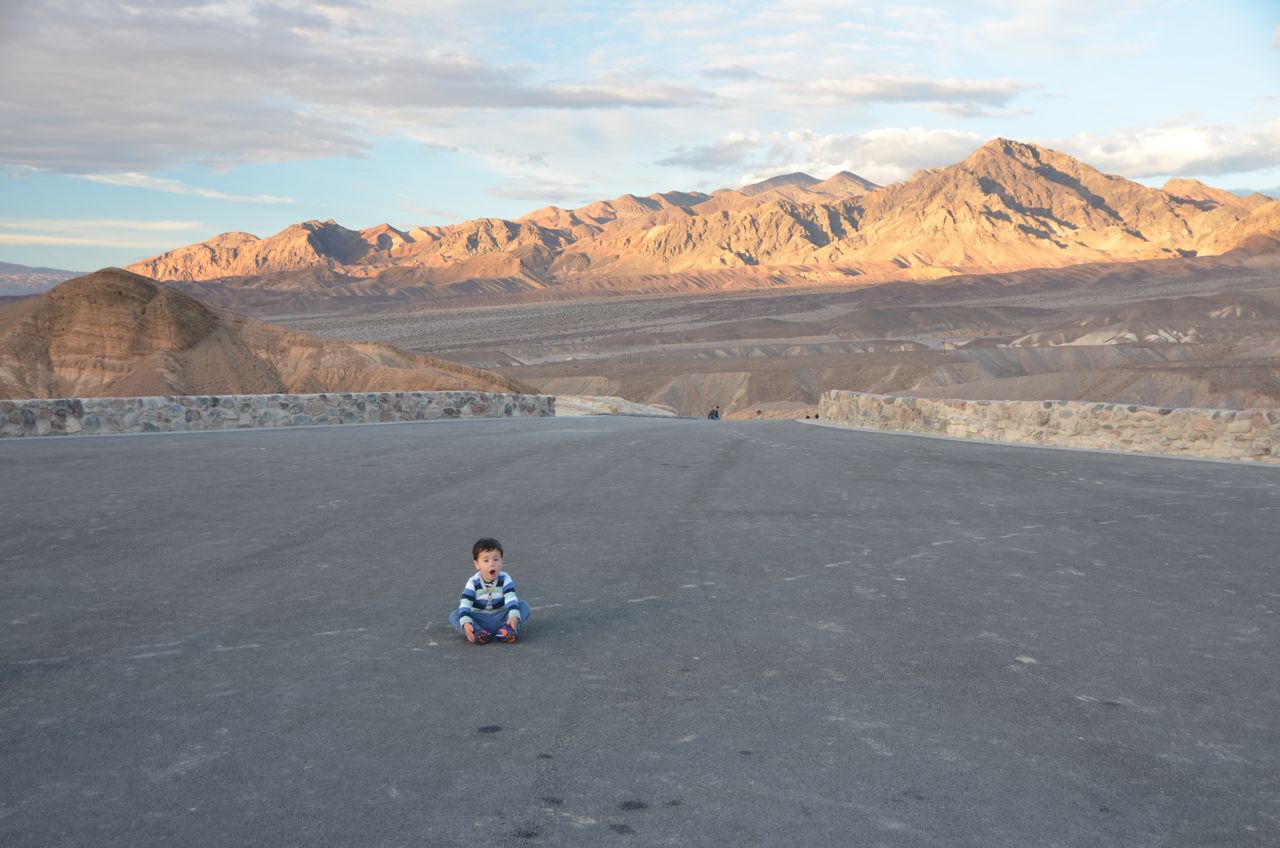
Parting Shot: The State with the Smallest Person in the Largest National Park in the Contiguous U.S.: California (Death Valley)

So much adventure and awesomeness. So, when you spotted the cowboy hat, were there emergency vehicles about?
LikeLike
Yes, they appeared to have been there for about 30 minutes, considering the amount of time I was crawling along in the traffic on the highway. The vehicles were there, but the EMT personnel and cops were just standing around by the time I passed by. It didn’t look like there was anything more they could do at the scene.
LikeLike
Finally got around to looking at your blog. Great stuff, Mike! Happy Thanksgiving to you, Frank, Clair, and most certainly not least, your Mother (give her a hug for me). Deb and I are going camping for the holidays…
LikeLike
Thanks Bob, same to you, happy camping!
LikeLike