I took two road trips in the 2016 spring season before withdrawing to the Boise scene, avoiding the summer crowds in the parks and wilderness areas. The two road trips were very different, but both were satisfying in their own way.
On Saturday, April 23, I drove from Boise to Moab, Utah, intending to grab whatever campsite I could find nearby, given that Arches NP and Canyonlands NP were booked solid well in advance. The plan was that, once I found and claimed a site, I would call my Colorado friends Gordon and John about it, since they were driving from Durango and Cortez on Sunday to meet me for a few days of red-rock camping and hiking. We knew the odds were against us during peak season, so we were prepared to search as far as Blanding, 75 miles south on Rte. 191, to find a campsite in a desert landscape before it gets too hot.
The whole Moab area was a zoo, with the main road (Rte. 191) backed up for a half-mile with bumper-to-bumper traffic, much of it 4WD road warriors right out of “Mad Max.” I noticed all the hotels and motels displayed “no vacancy” signs. I also noticed many of the visitors were already arriving with outlandish vehicles for the 24th Annual Moab April Action Car Show, scheduled for the following weekend. As far as I could see, the one thing Moab didn’t need was more of the anachronistic, environmentally abominable, internal combustion engine. I wasn’t optimistic that I’d find a campsite soon.
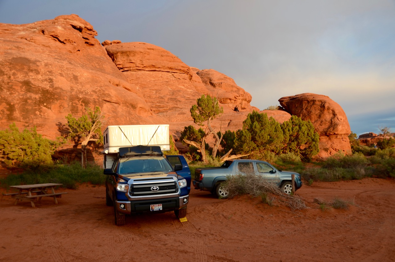
I didn’t even bother to enter Arches NP, but turned east on Rte. 128 just south of Arches, which followed the Colorado River for a few miles. At about 4 miles in I lucked out: I arrived at noon at a riverfront BLM campground called Hal Canyon, just as a British camper and his kids were packing up from the largest and best campsite I’d seen so far (Site #11). “I left some firewood, too,” he said in that charming accent. I grabbed it, reserving it for 2 nights, with an option for a third if everyone liked it. It had a level pad for my truck and room enough for two more cars to park, and it had a river view. It cost us only $7.50 per night with my lifetime senior discount. John arrived the next day and stayed three nights, remarking on my luck. Gordon arrived the next day, also impressed.
The downside was that it was close to the road, so it was noisy, especially with so many motorcycles on the weekend. (My preference in any vehicle is quiet stealth, not “rolling thunder”– please!) But it was quieter at night, and we’d be hiking during the day, so it turned out perfectly acceptable. The motorcycle traffic had died out by Monday, anyway. Gordon and I even stayed for a fourth night. It was too remote for cell phone service, so no internet, but the canyon walls weren’t too high to keep satellite radio out.
I shot some views around the campsite and on a hike that we took on the south side of the road opposite the campsite:


The paddle boards looked like fun, I’ve tried one on a Boise lake (Idaho River Sports) but not yet on the Boise River. On our last day here (Wed.), as we were packing up around noon, just before all hell broke loose with wind, rain and hail, Gordon took this outstanding shot of his tent: 
We got wet, and so did his tent, we just couldn’t pack up fast enough before the deluge. We drove to Moab for lunch, about 30 minutes away, on our way to Canyonlands NP. The campsites at the park’s Squaw Flat campground were all booked and no one had vacated even after repeated heavy rains, so we had to camp at a commercial site called Needles Outpost. But it was just outside the park boundary at the Needles entrance, and the manager was a friendly hippie plumber who’d been on the job only a week, so he was still happy and eager to please. And we liked the price ($15 total, same as the BLM sites without the senior discount), with privacy and scenery, so we draped Gordon’s tent over my awning poles to dry and ended up staying two nights:

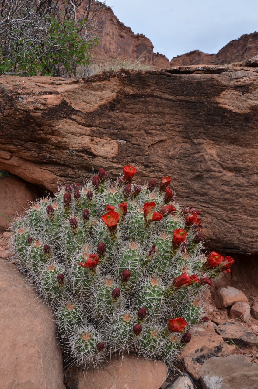
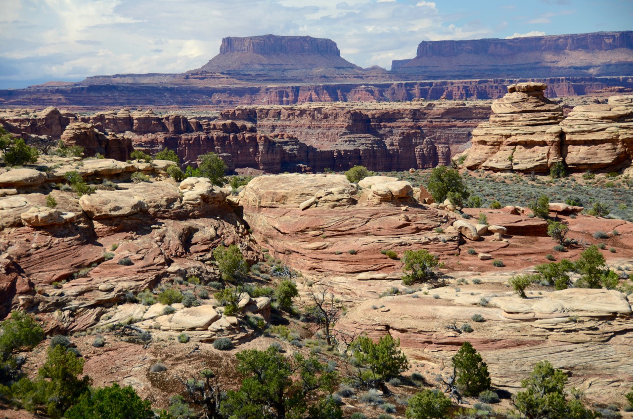
We drove to the end of the Needles District road and found a parking space on the side of the road, along with a throng of other tourists. We hiked a couple of hours on the Big Spring Canyon Overlook and on the Slickrock Foot trails, much of it under rain or the threat of it:
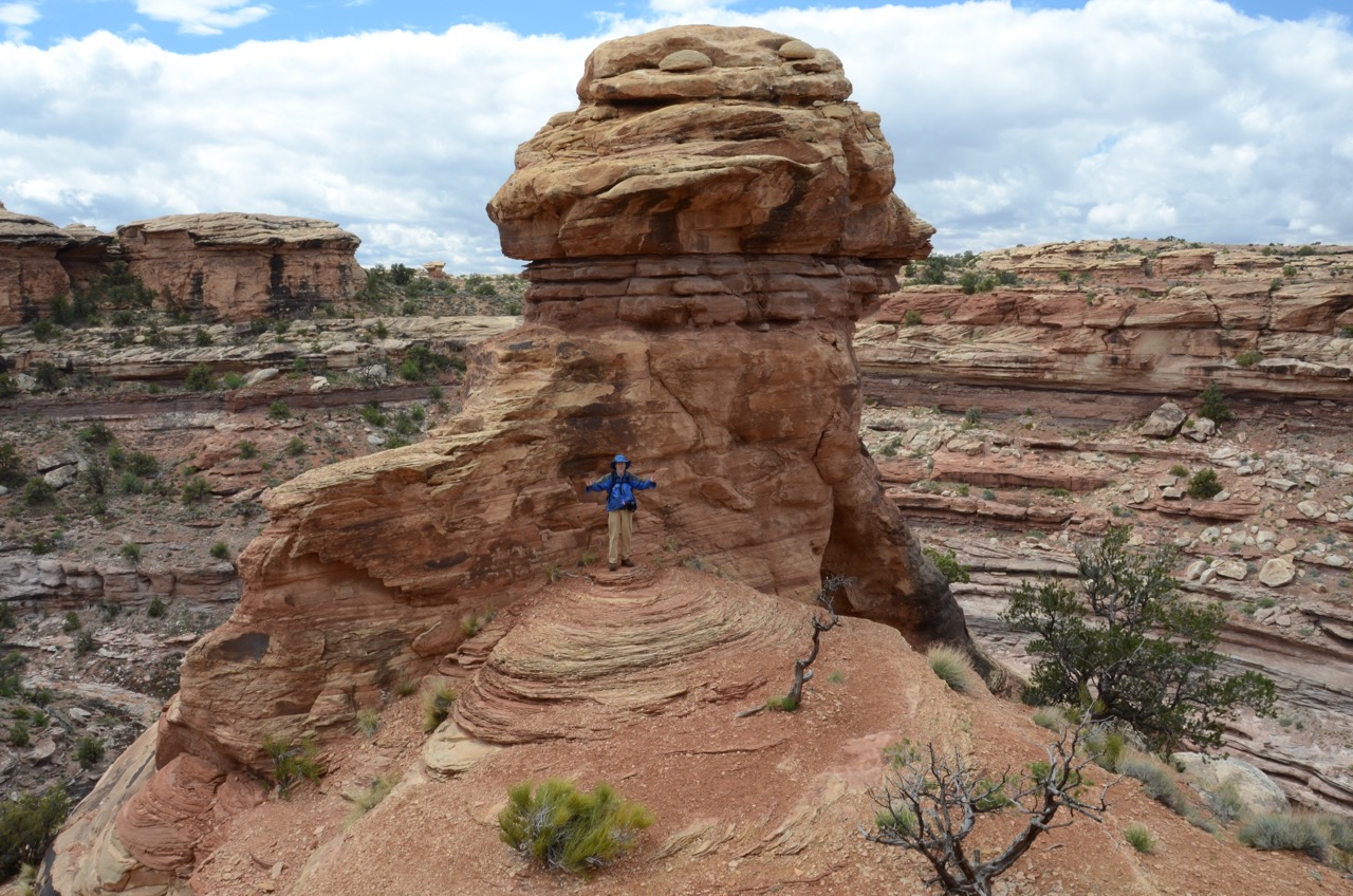

 On the Slickrock Foot loop trail, we saw a fifty-ish woman running the whole loop as if she were training for a marathon, complete with running shoes, shorts and jersey, and leathery skin. It took us about 2 hours to hike the loop, but a thunderstorm with lightening was approaching, so we cut the loop short and hiked very fast out of there, making it back to the truck just in time before the downpour. Of the throng of tourists, all but the two of us and one other had already bugged out.
The next morning we packed up and parted ways. It wasn’t a typical desert outing with all the rain, but we had fun. On the way out of the campground a friendly Colorado couple treated us to a tour of their new Tab trailer, which I had seriously considered buying before deciding on my truck camper in June 2014. Another definite highlight of this Utah outing was us being hunkered down in my camper, rain on the roof, drinking Bota Box “Redvolution” wine, eating crackers, baby carrots and Gordon’s fiery hummus from Durango, listening to fine Sixties and Seventies tunes on the SiriusXM “Deep Tracks” channel, and discussing differences between men and women.
On the way back to Boise I stopped at Buns and Brews in Spanish Fork, where two cute blondes served my latte at 8 AM. I recommend it.
On Monday, May 23, I launched my rig for a couple of Idaho destinations that my photographer friend Greg Jahn recommended. The first was City of Rocks north of Gooding, and the second was Mt. Borah, the highest mountain in Idaho. The contrast to my recent Colorado Plateau experience a month earlier around Moab was stark: I was the only camper at all my Idaho campsites, and the camping was free. I drove for hours in the Lost River Range, home of Mt. Borah, without seeing another soul.
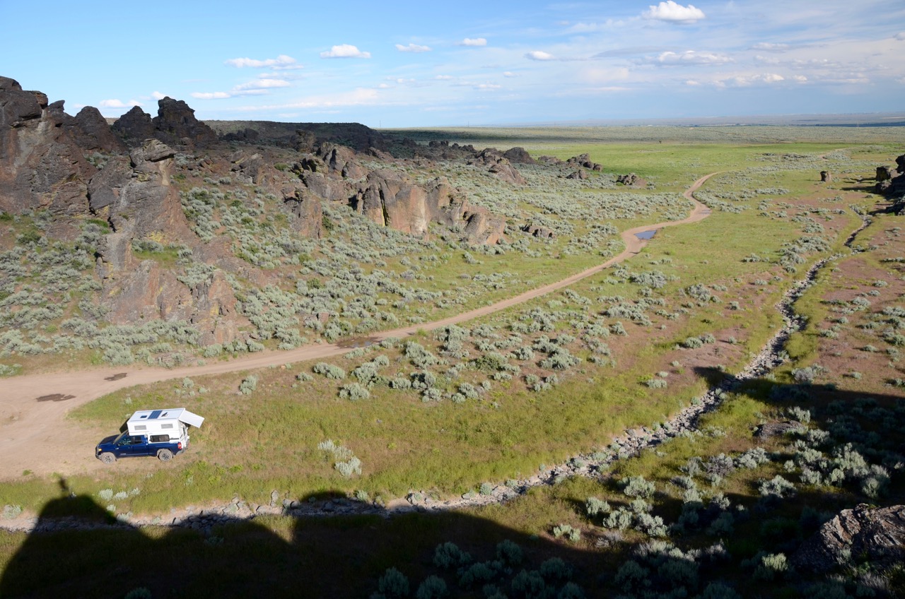
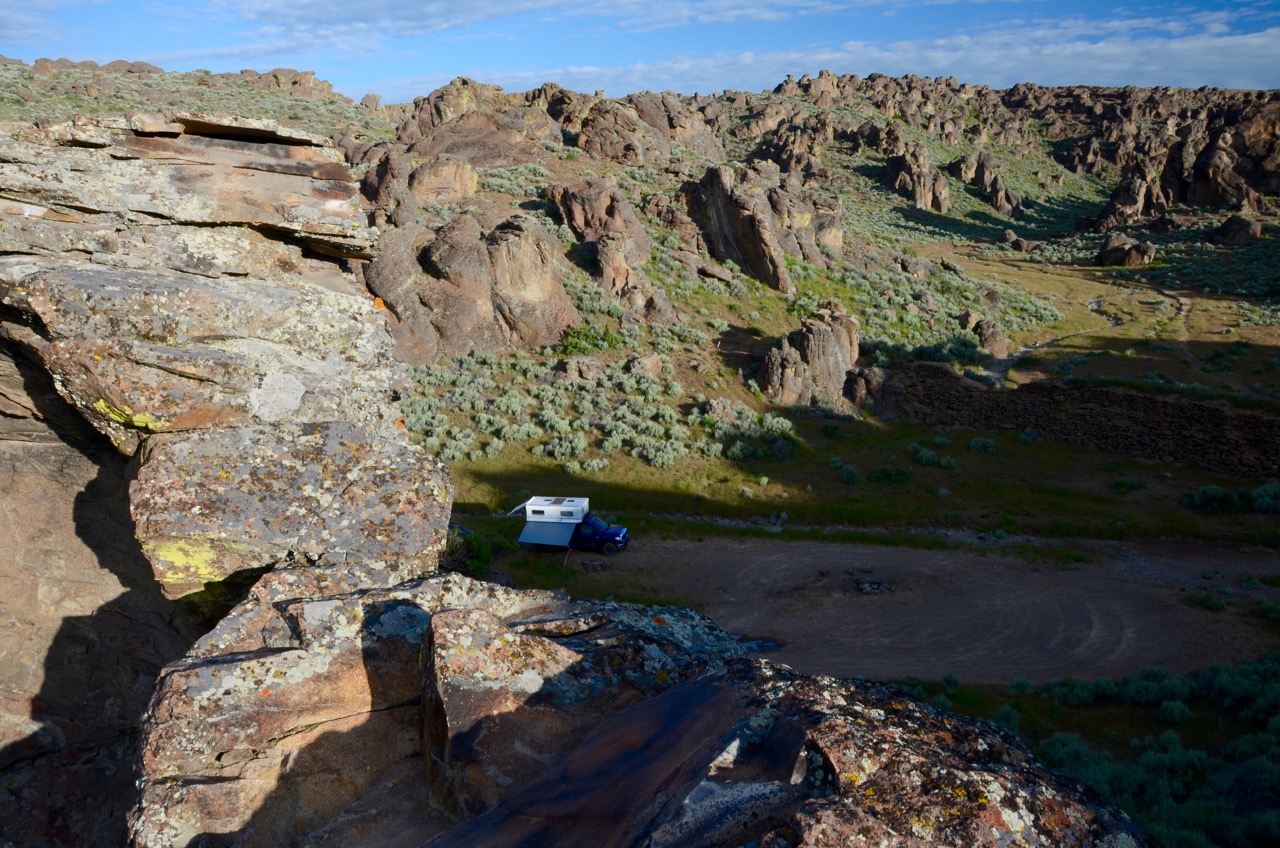
It only took a couple of hours to reach the City of Rocks trailhead. I popped up my camper and deployed the awnings and hit the trail, not really knowing how far I needed to hike to find “Little City of Rocks,” which was named on the BLM map, but not with any distance shown. I hiked for about an hour up the canyon until I came to a fork in the trail. With no idea which way to go, I turned back. But I did take some shots along the way:


 I took the opportunity to continue reading “The Rise of Theodore Roosevelt” by Edmund Morris, which is an entertaining and appropriate companion to exploring The West. (Thanks to my Boise neighbor Suzanne for lending it to me!) The next morning I took parting shots at sunrise, one from a cliff and one from my hammock…
 I then headed for Mt. Borah by way of “scenic attractions” off Rte. 75: Mammoth Cave and Shoshone Ice Caves which appear on the Rand McNally atlas. I pulled off the highway onto a dirt road and drove about a mile and ended up at “Mammoth Cave and Bird Museum.” Okay… this sounded something like “Alligator Farm and World’s Largest Candy Apple,” not a bonafide official site but just a tourist trap. I took some photos of the several peacocks roaming around…
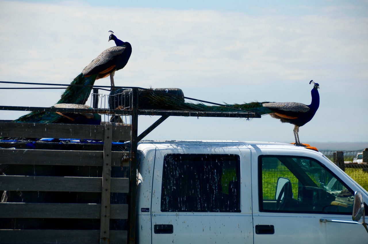


… and the proprietor showed me a framed photo of the cave in which I’d have to carry a lantern and pay $10 for the privilege. I declined, having experienced Carlsbad Caverns National Park in New Mexico, and continued on my way up Rte. 75. Shoshone Ice Cave (“20,000 Tons of Ice!”) was another commercial tourist trap and I ignored it. For lunch I turned onto a dirt road to the west to Timmerman Hills, and enjoyed the view: The road to huge Mt. Borah (12,662 ft. high) took me east on Rte. 20 past Craters of the Moon National Monument, which I’ve seen before, with huge lava fields on both sides of the road to Arco (“the first community in the world ever to be lit by electricity generated solely by nuclear power”), where the road turns north on Rte. 93. The road had made me sleepy, and I saw a huge “ESPRESSO” sign standing outside a cafe in Arco, so I pulled in. A huge blonde woman took my order for a skim latte with a double shot, and I looked around for an appropriately huge espresso machine. Nope. The huge blonde’s mother (I assumed) started working the smallest espresso machine I ever saw, even smaller than the one I have at home. It barely heated the milk, and the drink tasted weak, and they charged me the huge Starbucks price. But I drank my mid-afternoon pick-me-up with a couple of squares of dark chocolate from my camper’s fridge and was rejuvenated enough to tackle the final leg to Mt. Borah.
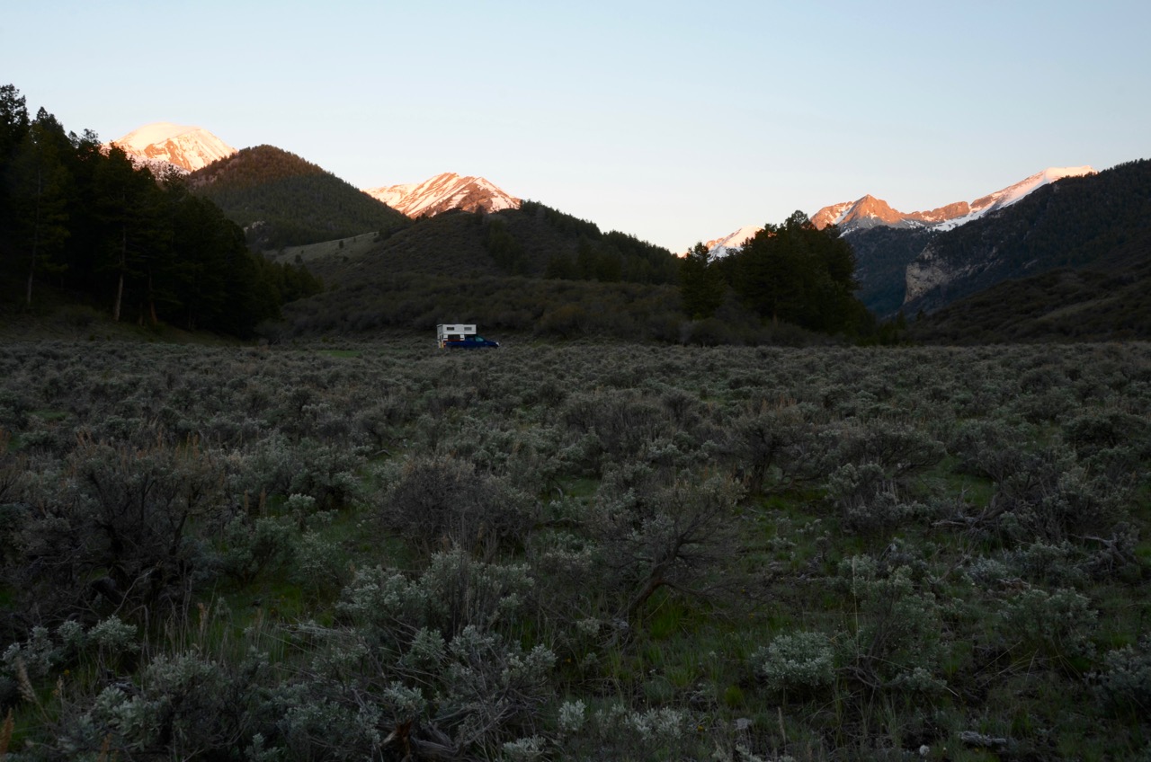
As Greg Jahn indicated, and my Garmin, Google Maps and Idaho atlas show, a few miles north of MacKay, a gravel road called Doublespring Pass Road leads to a 4WD road on the right, marked with a sign to Carlson Lake (4 mi.), Horseheaven Pass (4 mi.) and Upper Pahsimeroi (12 mi.). I drove the 12 miles to the end of this road ( NF-117), plus a couple of miles of tire tracks that kept going. I put the truck into low 4WD gear and crawled up a steep, narrow path until I reached a saddle at about 8,500 ft. with a view of Mt. Borah to the northwest and the Lost River Wilderness and the Pahsimeroi Valley to the southeast. I stopped to camp here and took some photos, albeit under clouds:


 A perfect place to camp, right? As the sun went down I saw that the clouds were clearing the peaks, and I looked forward to a clear sunrise shot of Mt. Borah and the nearby mountains. I made dinner and went to bed at about 10 PM.
I couldn’t sleep. Something was nagging me: What if it snowed in the middle of the night? At this elevation it could snow a lot, and I’d never be able to find the tire tracks that led me here. Aside from the snow covering the tracks, the trail had disappeared from the GPS screen miles earlier. And what’s more, I wouldn’t have the traction to make it down the hill from the saddle without sliding and crashing. I tossed and turned. No, I told myself, I was being paranoid, as I’d seen when I went to bed that the weather had been clearing.
At about midnight I heard some light precipitation hitting the camper. A few minutes later I gave up trying to sleep and I jumped out of bed, grabbed the headlamp and opened the door to peer out into the darkness, expecting to see a light rain, as it had done, off and on, the whole day.
I was shocked at what I saw. It was a blizzard! The ground was already covered with snow, which started to obscure the tire tracks. The outdoor thermometer showed the temperature had dropped from 65 to 35. I made a hasty effort to secure pots and pans and water jugs, etc., and threw on my pants and a jacket and hat and grabbed the keys. I didn’t even bother to drop the roof. Securing the camper for the road in the normal way would have taken at least another 5 minutes, far too long in this emergency. Fortunately I didn’t have the leveler to deal with, as I hadn’t needed to put it under a tire to level the truck when I arrived, so one more minute was saved packing up.
I turned on the engine and gingerly made a three-point turnaround in the middle of the saddle, scared to get too close to the edge. I could barely make out the tire tracks that I had followed, and I even had to guess the path in places where I could see only one tire track. I felt a pang of fear, but I was relieved to feel good traction as I crawled head-first down the hill at about a 30-degree angle, until I reached a level part of the path about 150 feet down.
The scariest part seemed behind me, but there was a tilt in the path on a narrow ridge that I’d forgotten about. I felt the truck slide to the side a bit, right at a steep ravine where I knew I’d never emerge if I slipped over. But I had no choice but to move forward if I could.
My low gear and good tires got me through that final hazard, and the back-road trail soon became more defined. But the snow was coming down hard, and just to be sure, I decided to drive the whole 12 miles of 4WD trail to the turnoff at Doublespring Rd., which was a good thousand feet less in elevation. Aside from many startled birds, I saw several antelope running across my path, my headlights reflected in their eyes as their shadowy figures dashed through the falling snow. I was sorry to wake them up from their snowy beds at 1 AM.
It took me about 50 minutes to reach the safer campsite at the junction, and the popped-up roof lasted the journey with no apparent damage, even on that rough road. But it took another hour for the adrenaline to dissipate so I could finally sleep.
That saddle just seemed like a perfect photographic vantage point, though!
The next morning I headed back up the 4WD road to look for Carlson Lake. It snowed some more on the way, but that didn’t slow me down. What did alarm me was a sudden bogging down of my tires in deep mud. I have no winch and there was nothing to anchor a winch line to anyway, so I envisioned myself escaping the snow and being trapped in mud instead, waiting for a weekend warrior to show up at least two days later. Maybe I could use the leveler to gain some traction, but I’d never tried that before.
I put the truck in reverse and slowly backed out in low gear. I knew I’d reached the end of my search. I had arrived at the 4-mile mark on my GPS where the lake was supposed to be, but no lake was in sight for another quarter-mile, as far as my eyes could see to the next ridge, and I was in no mood to risk mud bogs like this to search any farther for a lake that appeared so small on the map, anyway.
I turned back and decided to check out Christian Gulch about 5 miles north of the junction, off Doublespring Pass Rd. It was a pretty canyon road that diverged into two others at the end, climbing both canyon walls, which I followed in search for a campsite with a view. I finally was stymied due to lingering snowdrifts blocking the road and tight squeezes through trees, so I turned back and settled in a sage field about halfway up the gulch, out in the open to catch the sun for my solar panel. Although it dropped to freezing that night, with frost, I camped here in comfort, alone and with no fear:


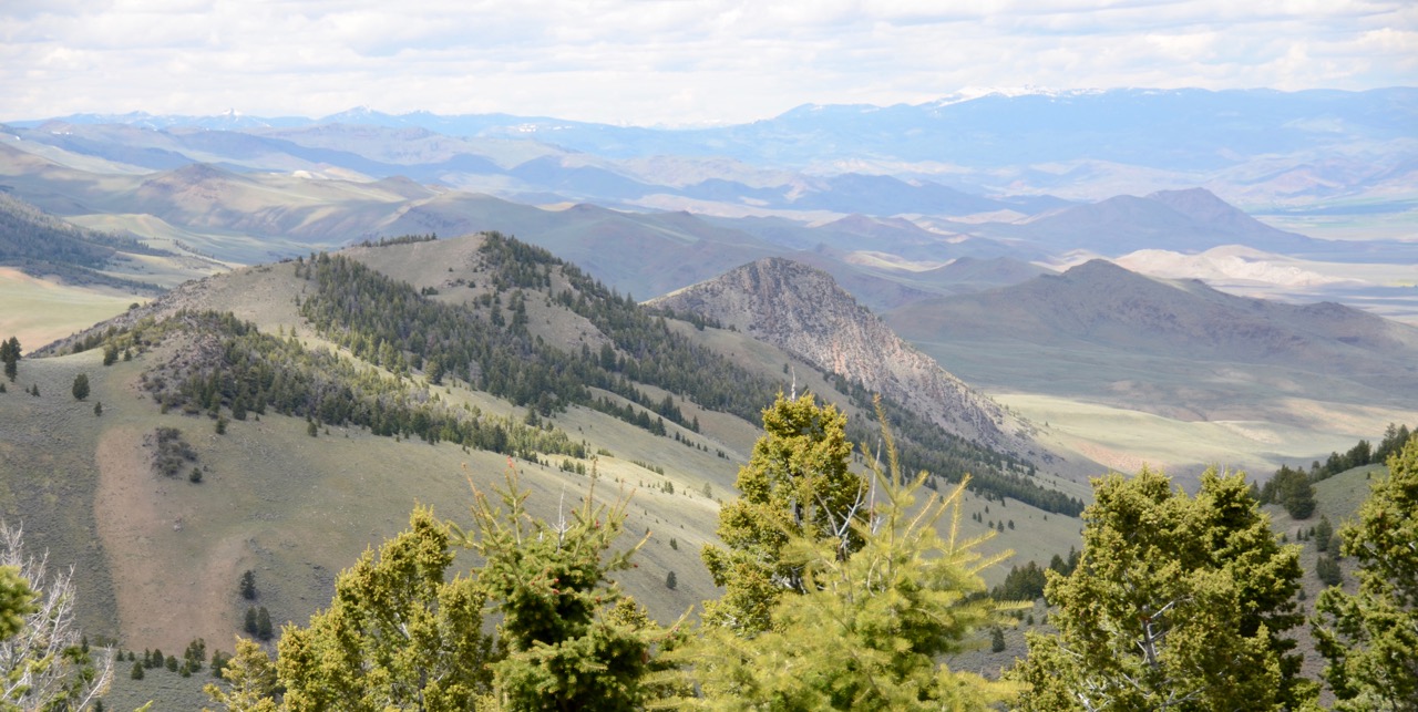
The next morning I headed farther up Doublespring Pass Road to the next canyon called Rock Spring Canyon. I explored all the roads there, marked a suitable campsite on my GPS for the future, and headed to the next canyon north called Dry Canyon, which took another hour or so.
There’s something to be said, all of it good, for driving up a mountain in the Lost River Range to the tune of “Dark Necessities” on the Red Hot Chili Peppers’ new album called “The Getaway” on SiriusXM radio on a sunny, 50-degree Thursday, with no other vehicle visible for miles, and plenty of food, water, gasoline and propane aboard a reliable truck riding on tough tires, and fully charged batteries in my camper, cameras, laptop, GPS and cell phone, the window open and the smell of sage all around. And oh, that magic feeling: Nowhere to go.
One thing about the City of Rocks and the Lost River Range area: Apparently, happiness here is a warm gun. I’ve never seen so many speed limit signs and other government-posted location signs destroyed or damaged by gunfire. I did see some local campers here and there, presumably hunters judging by their gear, and we do wave to each other as we drive by, but honestly, there’s something to be said for an isolated campsite to give me that warm and fuzzy, gun-free feeling.
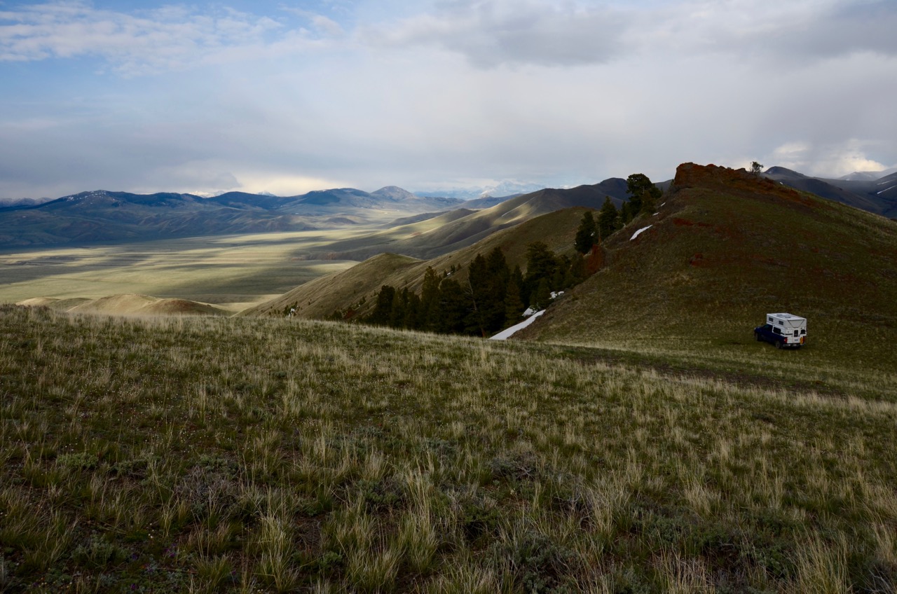
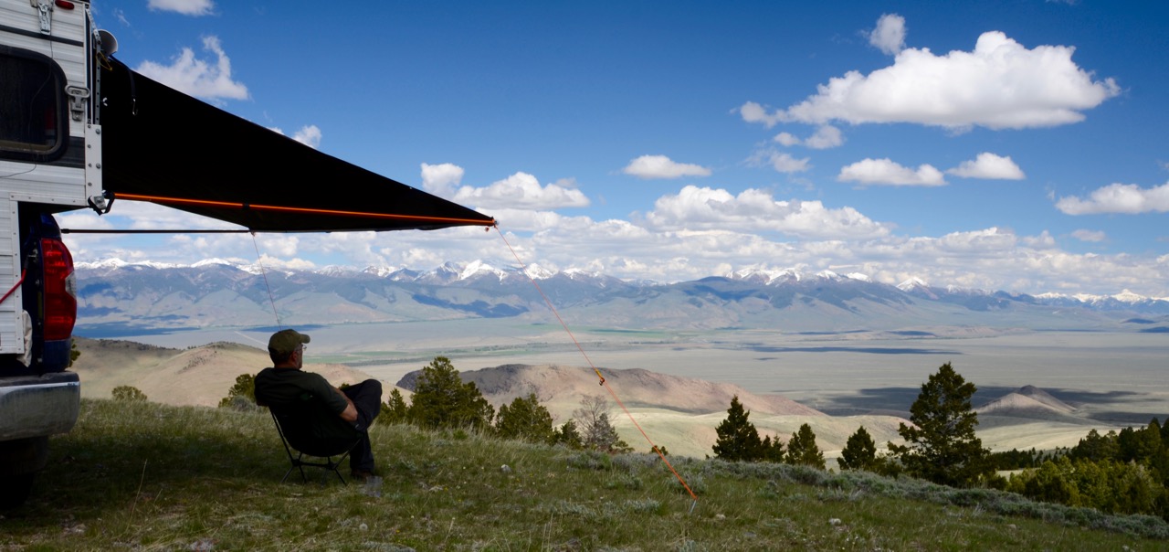
Well, folks, I’m here to tell you, I finally found a remote campsite with a view to die for. Again crawling up a ridge in low 4WD gear, I came to a level area at about 7,600 feet:

 I parked, deployed the side awning, ate lunch, and hiked about an hour to the top of the ridge, another thousand feet, which gave an outstanding view of the Pahsimeroi River Valley below me to the northeast, the Lemhi Range mountains on the far side of the valley, and Grouse Creek Mountain directly behind me to the west:


I spent the rest of the afternoon under my awning, enjoying the view with wine, binoculars and book:
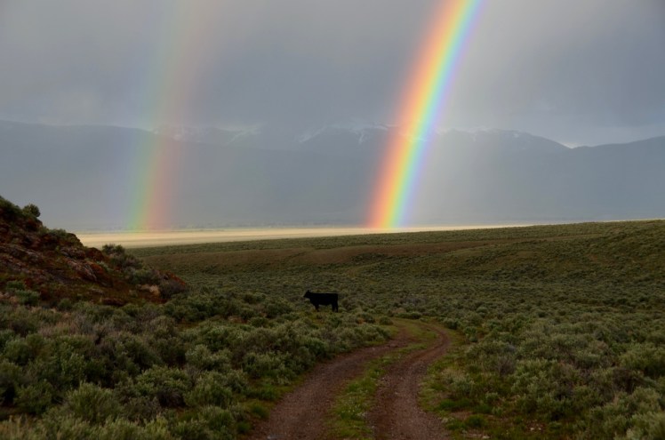
At 6:57 I rolled up the awning, at 6:59 PM I entered the camper to cook dinner, and at 7:00 PM it started to rain and hail. After dinner I looked down the ridge and my evening was blessed with a rainbow: 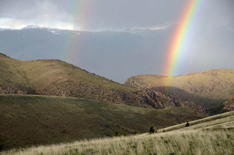
I went down the ridge to investigate further, maybe to get my pot of gold that I’ve heard about. Well, my Irish luck had run out, apparently. I was cheated: Instead of gold, there was just a stupid, dietary anachronism and environmental abomination, one of the “hoofed locusts”:

2 thoughts on “Local Color: Rocking in Utah and Idaho”