“Canada is the pocket of sanity in the Western Hemisphere.” – Bruce Cockburn at Vancouver Island Music Festival, July 15, 2017.
“North to the Future.” – Alaska state motto.
However much Canada might want to divorce the U.S. due to irreconcilable differences these days, the countries are joined at the hip. It happens that sane Canada is on the way to “the last frontier” of Alaska, which is known by aficionados as the Holy Grail of North American road trips, the ultimate adventure short of intercontinental overland travel.
Overland outfitters do their best to promote their 4×4 products and services by citing all kinds of hazards that could throw your Alaska road trip out of whack, such as bad roads, bad weather, maniacal logging truck drivers throwing gravel everywhere in their wake, dangerous animals, and of course, a Canadian ban against guns. Well, I’m here to tell ya, in 1986 my friends and I beat the odds on our first try in a 1967 Chevy Malibu convertible, with little to guard against those hazards aside from a boom box, a cooler, and sun hats, with nary a need, want, nor thought of guns.
A good friend, Valerie, recruited me for that Alaska trip under ideal circumstances: A summer road trip by three friends who had no job-related conflicts. Val was driving her red convertible from Minneapolis-St. Paul to Anchorage via Fairbanks, and it didn’t take much to get me and another mutual friend, Dave, to assist. It was a fun, two-week trip, and despite the ringleader’s insistence that we drive with the top down the whole way, it was an easy and uneventful trip, save for one radiator breakdown in Dawson, Yukon Territory, which Dave heroically fixed in short order; and it was a one-way drive, as I flew back East after we made it to Anchorage. (And truth be told, we rough-and-ready travelers all took pride in doing the whole trip with the top down.)


Thirty-one years later, I decided to do it again, but with some key differences: I now have my own truck and camper that provide some protection from bears, which is especially comforting when bedding down after an indulgent salmon dinner; I carry a battery of camera gear that goes way beyond the manual-focus Nikon FE2 and 75-150mm lens I used in 1986; now there’s a commitment to a job, namely my photography, which often means rising before sunrise for the best light; we would drive back, not fly, which doubles the driving time, thankfully on paved roads these days, whereas much of the roads in 1986 Canada were unpaved; and I’m 31 years older, with some of the usual physical and mental quirks that one would expect.
On this trip I was lucky to have one of my oldest friends as a travel buddy. Chris Lok is a Canadian whom I’ve known since junior high school in Cairo, Egypt, in 1966. Our shenanigans back then included jumping a freight train bound for the industrial town of Helwan (ending with us walking back at night, sneaking through an Egyptian Army camp with barking, big-sounding dogs), and occasionally riding atop the passenger train from our suburban Maadi neighborhood to the downtown Cairo Hilton, just for a lark, to name a few. He, too, recently retired, so we both had plenty of free time, and, between us, our citizenships and cell phone plans would cover the whole route, with no unfamiliar road rules or camping restrictions, and no roaming charges. And two bodies on this epic road trip are safer than one, not to mention more fun, and more productive, since Chris spotted photo ops that I would have missed. And his camping tips and help made life on the road a lot easier.
The only additions I bought for this trip were a hand-held GPS for hiking, a pair of rubber fold-up treads to place under the tires in case of mud, a two-foot-long shovel, and a set of four stacking 6-inch-square platforms to use under the jack. (Spoiler alert: We never used the treads or that GPS, and the platforms we used only to level a picnic table, and the shovel we used only to bury a dead rabbit.) And after months of rowing at home and training at the gym, I felt fit to hike in the mountains. (More on that later.)
July 10, Monday: I left Boise, Idaho, at 11:00 AM, escaping the weekend’s triple-digit heat in search of a campsite in the cooler elevations of the Cascade Range in Washington. It’s a pretty boring drive on I-84, so I’m glad to have my Audible books to make the time go faster. Bill Bryson’s A Short History of Nearly Everything is as good as you’ll get in a combination of entertainment and fascinating information.
The first notable hazard I ran into was in Yakima, Washington: High prices. The same six-inch Subway tuna sub costing $4.74 in Boise cost me $8.00 in Yakima. I didn’t notice it until it was time to pay for it. I won’t get fooled again, Subway.
I found the National Forest campground called Swauk Creek on Rte. 97, where I was the only camper, and slept like a log in the cooler elevation, for $2.50, which is the half-price cost for pass-holders.
July 11, Tuesday: I got up early and drove through some beautiful country in the Cascades, stopping in a roadside park…


… and reaching Birch Bay State Park around mid-day, just 10 miles south of Canada. It was perfect weather, and I parked at the beach and stayed until dark, which cost me $10 for a day-pass. I shot a few folks enjoying the park, including a foreign-speaking family I guessed were from Eastern Europe:


The campground was an outrageous $35 per night, so I drove about five miles away to a rest stop off the I-5 freeway and crashed for free. I had to wear earplugs because the railroad tracks were within spitting distance, literally a quarter-mile away.
July 12, Wednesday: Rising early again, I drove to Blaine, WA, and had a latte and coffee cake at the Peace Arch City Cafe, which I recommend. I hung out on their deck for about an hour. At about 9 AM, arriving at the Canadian border, I was worried they’d decide to search my camper for drugs and tear it completely apart, which would put me hours behind while I packed it all over again.
I watched as each driver ahead of me handed their passport over to the booth. I was encouraged, as it took less than 30 seconds to get their passport back and continue on their way. But I was scruffy-looking and had a camper on a pickup with Idaho plates, quite different from the commuting locals ahead of me. To make matters even more tenuous, when it was my turn, I had the following conversation with the young Canadian border officer after I handed her my passport:
Officer: Good morning.
Me: Good morning.
Officer: Could you remove your sunglasses, please?
Me: Oh, of course!
Officer: Where do you live?
Me: Boise, Idaho.
Officer: How long have you been driving?
Me: I left Monday at mid-day.
Officer: Is the truck registered in your name?
Me: Yes.
Officer: Could you lower your rear window?
Me: No, it doesn’t… OH, you mean this window… Yes…
Officer: Yes, I wanted to see if there’s anyone in the back seat. Are you employed?
Me: Self-employed photographer.
Officer: Are you carrying any weapons like bear spray or guns?
Me: One can of bear spray, which I’ve never used, but no guns.
Officer: Do you normally carry a pistol with you on trips like this?
Me: Yes…
Officer: Why don’t you have it with you now?
Me: OH, a pistol?! No, I don’t own a gun. Sorry, I’m a little hard-of-hearing, I thought you were talking about spray.
Officer: Who are you visiting in Canada?
Me: An old friend.
Officer: How long have you known your friend?
Me: Since high school.
Officer: High school in the U.S.? Or in Canada?
Me: No, in Cairo, Egypt.
Officer: Where does your friend live?
Me: In Vancouver. I’ve got his address on my GPS…
Officer: When was the last time you visited Canada?
Me: Um… A year… and a half ago?
Officer: Where are you headed?
Me: Alaska.
Officer: How long are you going to be in Canada before you get to Alaska?
Me: One week in Vancouver, then we’ll take two weeks to go up, then two weeks to return to Vancouver.
Officer: Is your friend accompanying you to Alaska?
Me: Yes.
Officer: You’re both going in this truck?
Me: Yes.
Officer: Have you heard about the wildfires?
Me: Yes, my friend told me.
Officer: How are you going to get to Alaska with the wildfires blocking the way?
Me: I don’t know, I was leaving that to my friend. He worked for the Ministry of Interior, so he knows about that stuff.
Officer: Do you have any pets with you?
Me: No. But I wouldn’t mind having a cat to ride with me someday.
Officer: A cat? How would that work?
Me: Well, I’ve seen folks on the internet who’ve done it and it seems to work just fine, some with two cats.
Officer: But if they get out they’d run away.
Me: Yeah, so you have to leash them.
Officer: Leash them… yeah. Okay. [Handing me my passport] Have a nice trip.
Me: Thanks!
It was a five-minute conversation, so I was glad the extra questioning didn’t end up badly. As I drove on, I was also glad to see my GPS automatically convert kilometers to miles, so I was able to monitor my actual speed and distance easily. I got to Chris’s house at 10:10 AM with no mishaps. The route from Boise to Vancouver was a leisurely two days.
We got out the maps and planned our route, more or less. My main goals were to shoot wildlife, to visit Wrangel-St. Elias National Park, the largest in the U.S., and to visit the Kenai Peninsula, Haines, Homer, and Fairbanks, and to get back to Idaho in time to shoot the solar eclipse on August 21st. Chris’s goals were to visit Tombstone Territorial Park in Yukon for the first time and return to Kluane National Park, also in Yukon, where he spent three summers working and another summer climbing in the 70s, but he wanted to return to Vancouver by August 15th to play guitar at a wedding.
Our first major accomplishment was agreeing that we had plenty of time to go where we want, and that we’re both flexible, and that detours are available to bypass the roads that are closed due to wildfires, even if it takes us a day or two out of the way. I gave Chris an orientation of the camper, and we did some shopping to prepare for the trip. And we ate lunch outside on the iconic Sylvia Hotel sidewalk and enjoyed Vancouver:


")

July 14, Friday: (Bastille Day. I always think of that. I’ve been pairing July 14th with the French Revolution since I was twelve, for better or for worse. Maybe it’s especially relevant these days.) Chris and I headed out on his Suzuki DL1000 motorcycle to the Vancouver Island Music Fest. The following photos were shot a year earlier by friend Paul Martin when Chris and Paul visited Boise from Vancouver on their motorcycles:
")
")
I’d owned motorcycles in my twenties and thirties, until I almost had a serious accident by riding too fast back in 1985, and I hadn’t ridden one since, so I was a little nervous with the proposition of riding one for such a distance, over three hours one-way. But we both had protective suits and Chris turned out to be a very safe driver. We had a great ride to the house of his friends who live in Comox near the festival, and had a very pleasant time that weekend, with lots of laughs APRÈS music. The festival featured a very eclectic lineup that delighted the audience. Highlights for me included Bruce Cockburn and Barenaked Ladies for the finale. Some shots I took at the festival:


July 17, Monday: Riding the motorcycle turned out not to be a problem. The problem occurred when we arrived back at Chris’s house and I had to dismount. I was unaware that the curb was so close to the rear wheel, and my foot landed on the curb’s edge, twisting my ankle. I limped for the next 24 hours, and although the pain then went away for daily activity, it proved to be a wake-up call when hiking in Alaska and Yukon. Being fit has its limits of usefulness sometimes.
NORTH TO ALASKA

DAY 1, July 18, Tuesday: We departed Vancouver at about 2 PM, drove all afternoon and into the evening, and saw how the wildfires had obscured the mountains with all the smoke. The news said that 150 wildfires in British Columbia had forced evacuations of 40,000 people, and we saw several makeshift signs showing where the evacuees could take shelter in local hotels. Since we got a late start we ate dinner at a restaurant instead of making our own, and then hit the road until we found a rest area beside a river to sleep along Hwy. 5, well south of Valemount. The train tracks were very near, and Chris didn’t sleep well, but my earplugs allowed me to sleep well enough to drive the next day.
DAY 2, July 19, Wednesday: We got up at 6 AM, made breakfast, and hit the road at 8 AM. We found a welcome espresso stop in Valemount around mid-morning:

After finishing A Short History of Nearly Everything, we made lunch at a rest stop, and hit the road with another audio book called Bossy Pants by Tina Fey, which often made us laugh out loud. We recommend it. (And the tail end of Bryson’s book was so interesting that after Tina’s book days later we started his all over again, which sustained us for hundreds of miles).

At about 6:30 PM we finally pulled into our campsite at Fraser Lake provincial park. In perfect weather with no more smoke in the air, Chris made a fantastic salad for dinner. We took a hot shower in the camp for free, and then he got out his guitar and I got out the wine and laptop and we hosted the mosquitos for a very pleasant evening of music and blogging, all for $27 Canadian dollars (about $20 USD). The “Park Operator” who took our money warned us about a two-year-old black bear who might show up searching for food, and advised us to keep the camper door closed tonight.

DAY 3, July 20, Thursday: The farther north we drove the more spotty the satellite radio service, until it disappeared altogether around Gitanyow, British Columbia. Not much farther than that we started to see signs like “Wolverine Culvert” and “Bear Glacier.” We stopped at the pullout for a view of Bear Glacier, our first one of the trip.


We finally arrived at Stewart and crossed the border into neighboring Hyder, Alaska, which has seen better days. There appeared to be only one restaurant open, and no other active business. The town looked almost deserted, whereas Stewart on the Canadian side was bustling by comparison. We parked at the wildlife viewing stop that supposedly had bears feeding on salmon. We parked and paid our $5 per person day-pass to U.S. Fish and Wildlife, and spent about 90 minutes waiting on the elevated walkway, along with a horde of other shutterbugs waiting for a bear. I saw one brown bear waaay off in the distance downstream, for about 10 seconds, before it disappeared in the foliage. We saw 3-4 bald eagles, but the closest one that perched was also obscured by branches and would not fly out to pose for us, despite the abundant salmon in the river. Gulls were the dominant wildlife there, feeding on dead salmon.
So, we blew off the government-run tourist trap and drove back to the one seafood restaurant open in Hyder, which operated out of a converted school bus with a kitchen attached. But they didn’t serve beer, and wouldn’t allow us to bring our own, and wouldn’t give carry-out, so we declined service and drove to the King Edward Hotel in Stewart and had a beer and a halibut dinner, which was overpriced at $40. There was no U.S. border checkpoint, but we had to laugh about the Canadian checkpoint when returning from Hyder: The Canadian border officer asked us if we had bought anything in Hyder that we were carrying back into Canada, but the only thing to buy in Hyder was a halibut sandwich.
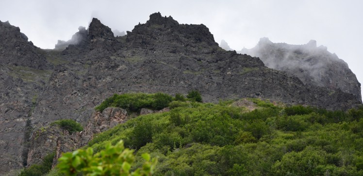
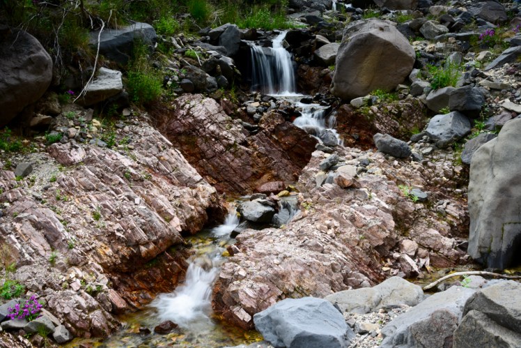
We drove about 7 miles outside of town to a lake with a campsite for the night. All-in-all, it was a day of mixed results: No bears feeding in the river, no clear shot of bald eagles, an overpriced meal, and the one gas station was closed by the time we finished our dinner, so we’d have to drive back into town the next morning to gas up before continuing north. But our campsite was free and it was right on the lake shore with a beautiful view of the mountain behind the lake. We could see and hear the waterfalls cascading down the mountain from the glacier at the top. Using our binoculars we saw about a dozen goats high up the mountain as we sat at the edge of the lake and drank Bota Box wine and Irish whiskey from Chris’ s flask. We also saw a pair of loons on the lake, and they treated us to their distinctively northern cry just as we retired to the camper for the night.


All of the wildlife we saw so far was too far away for photographs, but we were enjoying the beauty, weather, and sounds of nature, with fewer mosquitos than we anticipated.
DAY 4, July 21, Friday: We got up at 5:30 AM so we’d have time for breakfast before we drove into Stewart for gas and coffee. The best cafe in town doubles as a toaster museum (yes, a museum of toasters through the ages), called Toastworks. They have great espresso and baked goodies, play great music (e.g., Joni Mitchell), and have a gourmet chef. We took some time to snap some photos around Stewart:


On the way to Yukon we saw two black bears and a red fox. So far, though, selfies were proving far more reliable and abundant than wildlife shots…

We got to Teslin Lake and camped in a park just north of the town. We were lucky to find a campsite right next to the lake and away from the road. Today’s photos include:


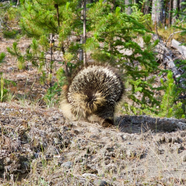
DAY 5, July 22, Saturday. We left at 8 AM and slowed down on the highway for a porcupine that was crossing the highway. I tried to stop and take a photo, our first wildlife shot, but the critter was much faster than he looked, so I only got a shot of his rear as he waddled up the hill:
We pushed all the way to our northernmost Canadian destination, north on the Dempster Highway to a campground near the Tombstone mountains, northeast of Dawson City, Yukon. There were only two campsites left, and we grabbed the best of the two, which would give a good orientation to the sunlight on the solar panels. Another camper came in right behind us to grab the last site, and that was when we discovered why our campsite was not occupied: A dead rabbit was decomposing in the foliage next to us and the wind would sometimes bring the smell into our space. I got out my new shovel that I’d bought for digging our tires out of mud, and invented a new use for it: Covering a rabbit corpse with dirt. It worked like a charm. And we had arrived in time to catch some nearby scenes with sunlight, which lasted at least until we bedded down at 10:15 PM:
")
")
")
")
DAY 6, July 23, Sunday: We got up at 5 AM and drove immediately up the mountain to a viewpoint about a mile away from the campground to shoot the main attraction at sunrise. The rock spires called the Tombstones allegedly could be seen in the distance to the west, but it was too cloudy for good shots. In hopes of a clearer view later, we took a snooze for over an hour, which we needed, but we never did see the sun or the spires.
We went back to our campsite and made breakfast, then drove to a trailhead about 5 miles back down the road. We hiked up the three-mile mountain trail towards another viewpoint, supposedly with a view of the Tombstone spires. But smoke from wildfires was really bad for views and health, so I stopped about 30 minutes short of the viewpoint and waited for Chris to complete the rest of the trail. He returned an hour later, reporting that wildfire smoke did indeed obscure the Tombstone spires. It took us longer than normal because my ankle didn’t like going down the steep path, the rocks twisting it like so many curbs. We hunkered down at camp.
DAY 7, July 24, Monday: Under overcast skies again we got up early, made breakfast and departed the park, heading back to the main road and to Dawson City. After lunch and laundry we drove the Top of the World Highway, and crossed the northernmost border crossing in all of North America (which took all of two minutes at the border stop). Now in Alaska, almost immediately we saw a caribou herd on the horizon to our right:
")
")
We arrived at the state recreational site near Tok, and grabbed a campsite.
DAY 8, July 25, Tuesday: We made it out of the roadside Alaska state campground at about 8:30 AM and headed for Tok, about 40 miles away. We did some shopping and got fuel and coffee, and headed for the north entrance to Wrangell-St Elias National Park at Slana, where we chatted with the ranger about what to expect. We drove southeast down the 30-mile Nabesna Road, mostly dirt, to a nice, free campsite beside a river. It turned out to be our one and only night in the park due to the weather:


")
The clouds were discouraging, but suddenly Chris started running for his camera as he alerted me to a break in the distant clouds that revealed higher, snowcapped mountains. The distance made good shooting difficult, so I got out my 900mm lens and took a couple of shots as the clouds shifted, before they finally obscured the view again, giving us a brief but dramatic taste of the character of the park’s interior:


DAY 9, July 26, Wednesday: A couple of miles further down the road was a loop trail that appeared to be the shortest (about 3 miles one-way) in the area, so we decided to hike it to a ridge that allegedly had a view. In mid-morning we started hiking up Jack Creek Trail:
")
")
")
About half a mile short of the ridge, with the “trail” getting steeper and deteriorating into rocks, I knew my ankle would suffer coming back down, so I stopped and waited for Chris to continue and return. I had lunch and shot some nearby subjects in the meantime:

")

Chris came back an hour later and reported that he’d reached the ridge top and saw some goats and the view of the Copper River down the other side, but now it threatened to rain, so we headed back down as fast as my bum ankle would allow. It rained for the last half-mile, and we decided to leave the Nabesna area that afternoon, with the intention of trying for McCarthy Road to the south that takes you more into the middle of the park. We drove as far south as the state park campground called Dry Creek State Recreation Site, where we camped for the night for $15.
DAY 10, July 27, Thursday: This morning the weather was worse, and the National Weather Service predicted more rain for the next few days, so we punted Wrangel-St. Elias and headed for Homer, and our spirits lifted immediately with that decision, as the weather update promised some sun in Homer. Besides, I’d been dreading the slow road to McCarthy, which the ranger at Slana had warned us was a “horrible” six-hour drive, full of tire-biting hazards that keep the local towing services busy.
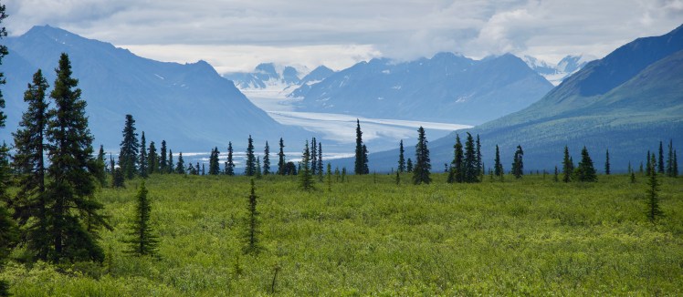
We passed the following glacier scene on the way to Anchorage:
We transited Anchorage ASAP and drove to Exit Glacier in Kenai Fjords National Park near Seward and found a wonderful, free campsite on the riverbed with a slight breeze and lots of elbow-room. Chris mentioned it looked like bear country, and almost immediately he spotted a bear foraging far off on the mountain, which I shot with my 900mm lens.


A young father with a flowing beard strolled by with his five-year-old son and asked about my camper, saying he was thinking about buying one like it for his Toyota Tacoma. I gladly showed him the interior and we chatted with him. It turned out he had just put a bid on some private property that we had noticed near our campsite in Wrangel-St. Elias, and was waiting on the bank’s approval. He told us he and his wife worked at the Alaska SeaLife Center in Seward, and said he would reserve free tickets for us, under his name of Nathan, if we wanted to visit the center, a $60 value. (We hadn’t planned on going, but this gave us incentive enough to check it out.) He gave us another tip: “The Denali Highway is absolutely beautiful,” which we filed in mind for future reference.
DAY 11, July 28, Friday: We packed up right after breakfast and drove the 15 minutes to Seward. At the SeaLife Center ticket counter we dropped Nathan’s name, and sure enough, a couple of free tickets were waiting for us. We really enjoyed the self-guided tour, and bought a couple of postcards in the souvenir shop and walked to the post office, and had lunch in town before we tackled the long road to Homer.
We took a side trip up the western coastline past Kenai to a busy campground at Capt. Cook State Recreation Area at the end of the road, intending to check out the nearby Kenai National Moose Range in the morning. On this Friday afternoon the campsite was filling up. A truck arrived towing a hay-trailer full of adolescent girls who were singing Christian songs. Earplugs saved me once again. (We noticed this whole area on the Kenai side of the peninsula is full of churches and religious slogans.)
DAY 12, July 29, Saturday: We got up before sunrise and made for the road through the moose reserve that went south towards Kenai. We didn’t have long to wait: Even before we entered the reserve, we saw this cow and calf on the side of the road, our first moose sighting:
")
")
")
We never saw any moose in the reserve itself. We stopped in Soldotna for breakfast and gas, and on the way to Homer I got sleepy and we pulled over to a campground near Clam Gulch that included a beach, where we popped up the roof and I slept for an hour. When I awoke, Chris alerted me to a bald eagle on a rock just off the shore, so I got as close as I could before it flew off:
")
")
We pulled into the Fresh Sourdough Express in Homer for lunch and had the best meal of the trip so far, which featured fresh halibut. Then we thought of taking advantage of the boat tours in Kachemak Bay to see the wildlife. Photographing orcas had long been on my bucket list, but I was hesitant about paying good money just on the chance we’d find orcas. We drove up the road to the Sea Life Visitors Center and talked to a Fish and Wildlife ranger, who recommended Rainbow Tours for a boat excursion to Seldovia, across the bay, for a good wildlife adventure. We booked it that afternoon for the next morning, and then followed the ranger’s advice for a campsite convenient to town, where we set up for the night, and then drove to an overlook of the Homer Spit for a midnight shot:


")
Day 13, July 30, Sunday: We boarded the boat at 10:15 AM and were underway at 10:30 as scheduled. Our first stop was an island full of marine birds, including cormorants, puffins, gulls, and bald eagles. I got the following shots:

")


")
")
")
")
")
")
")
")
Of course, everyone on the boat was hoping to see orcas, and we were willing to punt the tour of Seldovia town to maximize our chances. Then the rumor started spreading on the boat that a pod of orcas had been spotted and we were headed towards them. They were the highlight of the tour. The orcas swam under and around the boat, breeching right next to us, and the sight and sounds were thrilling and breathtaking…
")
")
")
We arrived at Seldovia at the other side of the bay and had lunch, and did a walking tour of the town:


We stayed in Seldovia only for a couple of hours, then said good-bye to the quirky town and its resident otters…
")
")
")

Driving on the Homer Spit on the way back we passed these Sandhill cranes:
")
")
")
")
")
I’d shot hundreds of Sandhill cranes at their winter migration destination in Arizona back in November 2015 (see this blog), and their plumage was a different color.
Back in Homer we did laundry and ate at a restaurant, then drove up the mountain for sunset at the overlook:


")

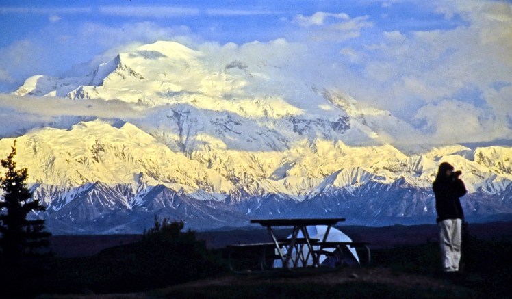
Day 14, July 31, Monday: We left Homer in mid-morning with Denali National Park as today’s destination, stopping to shoot some scenes and wildlife along the way:


")

We stopped at the Denali National Park Visitors Center to buy some groceries, find a campsite, and reserve seats on the next morning’s bus that takes you into the park as far as Wonder Lake, with a view of Denali. Another shopper overheard our dismal conversation with the center’s personnel about the park campgrounds being full and the paucity and expense of nearby commercial campsites. He was a friendly owner of a nearby brewery, and took us aside, telling us where we could camp near the park entrance for free. After getting our bus tickets we followed his advice and found a pull-off next to the Nanana River at sunset, where we broke out the smoked oysters:


Day 15, August 1, Tuesday: We got to the bus stop at the visitors center on time at 6:00 AM, but the attendant at the ticket booth pointed out that our tickets were issued yesterday for yesterday’s bus ride, not today’s. Chris and I were stunned and angry, but we both remembered that the attendant who issued our tickets yesterday was distracted, trying to attend to the couple behind us while trying to answer our questions and issue our tickets from the computer at the same time, which was certainly annoying, but also apparently fatal to our tickets.
The bus driver came to our aid and worked it out with the ticket-taker since the bus did have room today, and we departed at 6:15 as scheduled, but it was a tense 15 minutes, and they told us our ticket issuer would be counseled. After 20 minutes on the road I noticed a moose in the foliage within 30 feet of the road, but we were going too fast and no one else noticed, and I didn’t shout loud enough to stop the bus. Within 30 minutes we saw Denali in the distance, with breaking clouds giving us hope for beautiful views today:

It was a long drive to Wonder Lake, and a longer return, it seemed, and I resolved not to take such a tour again. I didn’t like not being in control of my vehicle and being crowded by other shutterbugs with no room or time for a tripod, which often made for unsharp photos. And most of the bus ride was during the worst light for photography. But we did see some nice stuff, especially Denali, which the bus driver said was clear of clouds for less than a third of the season…


Towards the end of the bus ride, in his excitement to see a large, brown mammal moving in the distance, someone shouted “BEAR!” and the bus stopped and everyone looked far to the left and behind us, but the “bear” turned out to be a bull moose:
")

Despite the number-one desire of all the shutterbugs on the bus to see a grizzly bear, we didn’t see one, nor did we see any bighorn sheep. Nevertheless satisfied that we got our money’s worth, Chris and I went for a dinner in the nearby town and then found the same campsite by the river, thankfully unoccupied.
Day 16, August 2, Wednesday: We drove to Fairbanks, arriving at about noon at the house of my old friends Geoff and Carolyn (Val’s sister). Their previous house in Fairbanks was the destination of our Chevy Malibu trio in 1986, so it was especially nice to land at their house once again. We had a great time with them, especially as they played fiddle and guitar with Chris, and I was the appreciative audience.
Day 17, August 3, Thursday: Chris and I had a halibut lunch in town with Tim, a fellow Four Wheel Camper owner whom I’d met with his wife, Molly, in Glacier back in 2015. He’d flown to Fairbanks to pick up his truck-camper that he’d loaned out, and he was about to drive through Alaska, too, and we compared notes, as always. But Tim was headed north and we south, so we parted ways (Tim later emailed us a shot of himself swimming in the Arctic Ocean.) Chris and I took the truck for an oil change, did grocery shopping, and returned to base to play more guitar with Geoff and Carolyn.
Day 18, August 4, Friday: Since the Denali Highway was praised by all, including our SeaLife Center friend Nathan in Seward, and since it was yet unknown to us, Chris and I decided to take that route for the scenic value, even though it was the longer return route that required us to double-back down to Denali Natl. Park first. We left Fairbanks at 10 AM, drove south to Cantwell and took the turnoff on Denali Highway, which is the 135-mile stretch of gravel road between Cantwell and Paxson. The cloudy weather was discouraging, and we debated the merits of camping earlier or later, to give the weather time to clear before we actually complete this “scenic” highway. We stopped for lunch at a pullout near a pond, where a small mammal watched us as he ate his own lunch…
")


We drove farther for about 30 minutes, to where wild blueberries blanketed the ground as far as the eye could see, and then Chris suddenly pointed out a moose that was feeding in a pond far off to the left, about a thousand feet away, so I pulled over and snapped a shot from the roadside:

Chris didn’t hesitate to hike down the embankment and get very close, keeping himself mostly obscured behind some foliage, and I followed with my tripod and long lens (and getting a lot closer than if a bull moose were our target). I had plenty of time to snap a series of shots before we returned to the truck:


We drove until we found a nice pull-off with a cloudy view of the Alaska Range. We decided to camp and hope for better weather by tomorrow. Here is how the scene looked when we arrived and started setting up camp in late afternoon:

")
Here’s the scene as the clouds lifted over the course of the evening, ending with Chris taking a stroll at 10:40 PM:


And here is the scene just before and after midnight:


Day 19, August 5, Saturday: The morning looked like this:
")
We enjoyed the view on a lazy morning, and it was at least 10 AM before we packed up. As we continued on the Denali Highway we took a 10-mile side trip north in 4×4 mode to an active mine, crossing several streams, which was a fun diversion. The road from Paxson to Gakona turned out to be pretty nice, too, and on the road from Gakona to Tok we had our first bear encounter of the trip, which also turned out to be the closest.
A young grizzly was feeding on berries along the left side of the road, and crossed the road to the right and clambered up the embankment and started feeding off the berries at the edge. I got out of the truck with my long lens and stood at the truck’s right front fender. The bear was less than 20 feet away, but I felt confident that it was high enough on the steep embankment that I would have time enough to jump into the truck if it were to charge me. The bear was in shadow and the berry leaves often obscured its face, so I had trouble getting a clear shot. But I was so close that I could hear it breathing and chomping, and at one point it stopped and looked at me and huffed fiercely, a clear warning. I retreated, but not until I got a shot of its eyes staring at me. A couple of minutes later it disappeared, then crossed the road again to the left and started sharpening its claws on a telephone pole before it shuffled away into the woods.


We ended up about 10 miles north of Chistochina at Indian Creek Rest Stop, which we almost missed since it wasn’t marked. Both of us had caught a glimpse of the inviting spot but didn’t say anything to each other until a minute later, and, in full agreement, we turned around to find a great little campsite for free. More of today’s photos:


")

")
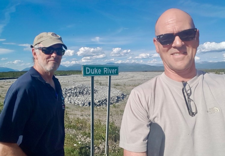
Day 20, August 6, Sunday: The road took us from Chistochina to the border crossing (Buckshot Betty’s on the Yukon side for lunch is not recommended), to Destruction Bay at Kluane Lake. We found a lakeside campsite for free, where we made dinner and enjoyed the view, the weather and the solitude. As Chris strolled the lake shore at midnight, he suddenly shouted “Moon!” and bolted for his camera, rousing me from my hammock to grab my tripod and both cameras and shoot the rising full moon. Today’s shots…

")


Day 21, August 7, Monday: At mid-morning we drove to Chris’s old stomping grounds at an airfield that provides aerial tours of the ice fields of the St. Elias part of the Wrangel-St. Elias international park. (I’d wondered about the origin of that name, but it’s a U.S.-Canada shared area, just as with Waterton-Glacier International Peace Park that crosses the border at Montana.) We had coffee with an old friend of Chris’s, renowned mountain pilot Andy Williams, now retired but with continuing family business interests in the area.
We drove to Haines Junction for lunch and got advice at the visitors center about what to expect in Haines, Alaska. They told us that the salmon are running and the bears are fishing in the Chilkoot River, which sounded great to us. They also gave us the schedule for the ferry between Haines and Skagway, which we intended to take on Wednesday, giving us plenty of time in Haines to shoot bears and eagles.
We drove to Haines, got beer in town, and spent a long time in a wi-fi hotspot while Chris went through the wringer trying to reserve a ferry ticket online using his iPhone. That being finally successful, we drove to a state campground at the Chilkoot Inlet and paid for two nights. We asked a Haines cop where we could find the bears, and he told us to park near a nearby weir and at 9 PM the bears will show up for their salmon dinner.
We parked near the weir an hour ahead of schedule and cooked dinner, and waited for the bears to show up. Shortly after 9 PM, sure enough, a grizzly sow and two cubs came bounding out of the woods and onto our road. They strolled down the road towards us and walked out onto the weir and started fishing. Along with a host of other shutterbugs shooting the same scene, I shot them for about 30 minutes, from the time they arrived until the mother was done eating and led her cubs away, disappearing into the woods on the other side of the river, with the cubs hurrying after her with salmon in their mouths:

")
")


The fishing bears were riveting and it was thrilling to shoot them in this activity. But the light was dim and I had to boost the ISO from my normal 100 to 3200 to get these shots, and even then many of the bears’ movements caused blur. But even more annoying, the weir made it look like a zoo rather than a wildlife shoot. They were almost like circus bears performing for the crowd on cue, and the road was jammed with gawkers. The campground host told us that a third cub was accidentally run over by a car and killed not long ago. We resolved to try for more bear shots in a wilder setting the next afternoon, and avoid this crowded, artificial setting that was the cause of the cub’s demise.
Day 22, August 8, Tuesday: We got up early and drove along the river, scanning for bears, but didn’t see any, so we parked by the lake to make breakfast. We shot some wildlife on the way to Chilkat State park, where we hung out all afternoon, enjoying the scenery and weather:


")


Then we drove back to Chilkoot Inlet in hopes shooting some bears in a wild setting. While I was standing on the bridge over the river, shooting a bald eagle surveying its domain…

… a guy who noticed my long lens drove up and told me that a bear had been spotted at the end of the road on the other side of the inlet, so we drove there and found it:


Chris was in front of me as we fought the underbrush to get a good shot, and I kept losing my footing because I was in flip-flops (!!), so he got a better shot of the bear as it stood up on its hind legs to look over the tall grass. Chris and the bear were face-to-face within 20 feet of each other, but the bear disappeared quickly. Someone in the small crowd that had gathered in the cul-de-sac mentioned that another grizzly was spotted in the tidal basin just behind us, and our binoculars confirmed it. The bear was a long way off, apparently fishing in the inlet.
We decided to approach that bear downwind from it, at an angle in which some boulders in the wet tidal basin at low tide would provide us some cover. I changed into shoes, clipped the bear spray on my belt, slung the tripod and long lens over my shoulder, and we hiked into the tidal basin. We stalked the bear as close as we dared, and hid behind the closest boulder to where it was fishing. At this distance between the truck and the bear, we were keenly aware that if the bear charged us, our only defense would be the boulder, and I envisioned the bear chasing us around the boulder in circles. Even being this close, my long lens didn’t come close to filling the frame with the bear, but I did get a series of magic-hour shots of a grizzly in a wild-looking scene, finally:


")
")


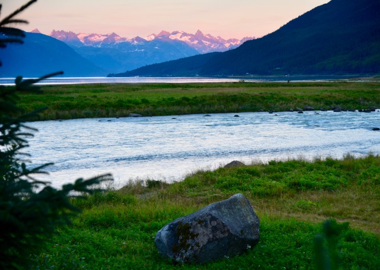
Our protective boulder was a bit bigger than the one in this photo, but here is a sunset view of the same tidal basin and mountains:
Day 23, August 9, Wednesday: The day started badly:
(1) The glass coffee beaker leaked all over the countertop from a crack it had developed on a rough road, dripping into the pantry and onto the rug.
(2) While I manned the camera and long lens at the picnic table, watching the kingfisher from yesterday, the bird flew from its driftwood perch across the lake to a rock perch on our side to check us out, closing a distance of 200 feet to 30 feet. I prayed it would stay put as I composed and focused on it, and clicked the shutter. The image on my screen showed a perfect exposure, focus and composition of the beautiful kingfisher, which had remained frustratingly out of range yesterday for a sharp shot. But then I noticed the “DEMO” sign in the corner of the screen, and I immediately knew I’d missed the shot. The SD card had not seated perfectly in the camera, so the image I saw was not recorded on the card, only temporarily projected by the camera’s internal memory. It easily would have been the best bird photo of the trip, and the failure put me in a mood;
(3) The wi-fi at the Haines library was too weak, so I gave up. It was the town’s only public hotspot.
We drove to the ferry dock two hours ahead of time, as directed, and got squared away with our ticket, and parked in the queue. Then I noticed Chris chatting with a girl outside who had a couple of pets on a leash, waiting for the ferry:


She said she’d adopted the two-year-old cat about a year ago and noticed it got very stressed out when left alone for a day, so she started to take it with her, and now the cat travels in her camper all the time with no signs of stress. Happy campers.
The converted Sprinter cargo van right behind me in the ferry queue turned out to be a couple from Boise who were on their way to do some mountain biking around Carcross, Yukon. They were originally from Ft. Collins, Colorado, and moved to Boise a decade ago when he got a job at Micron Technology, where the owner of a unit in my five-unit condo association also works. Small world.


After we took the ferry to Skagway we crossed the border again (where a Sikh border officer handled our crossing into Canada) and drove about three hours to Chootla Lake just beyond Carcross on Tagish Road. A loon was calling while we ate dinner and I saw a beaver in the water about 40 feet from where Chris was swimming. The beaver swam to the shore about 150 feet away, and in the binoculars it startled me as it looked like a bear when it emerged and briefly busied itself on the shore before disappearing. We had perfect weather with a breeze:


Day 24: August 10, Thursday: We got up at 7 AM, made breakfast and drove to Atlin Provincial Park, arriving at about noon. We had lunch at a local joint and then drove to Warm Bay and got a campsite for free. Chris played guitar while I snoozed and read John Adams in the hammock. We walked up to the “warm spring” and sat in tepid water for about 10 minutes, then walked back. It was a relaxing campsite where the silence was occasionally punctuated with the cry of the loon, of course. It seems that every lake in the Yukon had a pair of loons. And this lake also had a gull that seemed ever hopeful for a handout, hanging around all by itself for hours…


")
")
")

Day 25, August 11, Friday: We got up at 6:30 for the long drive to Stewart. We got as far as 50 miles past Deese Lake, looking for the Hot Springs Provincial Park, which the Garmin GPS identified and directed us to, but the park never showed up. We drove for another two hours, until 9 PM, and finally pulled off to a powerline service road, which actually turned out to be pretty good for camping. It was free, private, above the traffic noise, and had open sky to power my solar panels. The major downside was that it was the worst campsite for mosquitos, so we had to wear the nets outside.
Earlier that day we passed a family of bears on the side of the road, which now seemed commonplace, but I was compelled to snap some photos of them anyway, given they were so obliging, and I got some of the clearest bear shots of the trip:


Day 26, August 12, Saturday: We drove to Stewart and camped at the RV park in Hyder, AK. The wi-fi was very weak to the point of being useless, but it had hot showers and we plugged in to ensure the “house” batteries would be fully charged. It had rained all day and the solar panels weren’t active enough for my liking. Given the weather, we weren’t very keen on hanging out on the U.S. Fish and Wildlife tourist-trap platform again. But Hyder was not far from the route home, so we thought we would try once again to see some bears fishing for salmon in the river tomorrow morning. This afternoon, we explored the mountain road that leads out of Hyder to a copper mine, where we got great views of a glacier:


Day 27, August 13, Sunday: It rained all night and stopped only in time for our return to the bear observation deck at 6:15 AM. We waited for about 15 minutes and saw a bear come out of the woods to the river’s edge, stay less than a minute while sniffing around, and disappear into the woods again. Three weeks after our first visit, we were struck by the smell of the dead salmon, which were more abundant, and the gulls were now thick and fighting each other. No bald eagles appeared, either. We waited another hour with no bear appearing, so after I shot the scene we blew this joint once again…


We drove to Prince George, where navigator Chris determined that the wildfires closed only a few roads and we needed to take only a short detour. We found a rest stop just short of Prince George and cooked dinner there. It was not a campground, but we decided it was a very tolerable campsite with flush toilets and sinks, so we parked as far from the main highway as possible and bedded down in a deserted parking lot.
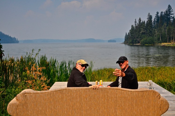
Day 28, August 14, Monday: We got up at 6 AM and discovered that the rest stop was full of campers who had the same idea we did. We cooked breakfast and then drove all day, taking the detour around the wildfires. At lunchtime we found a rest stop with a lake and a jetty that had a couch and a table on it, so we got out the lunch fixings and had our last meal of the trip…

The smoke from the wildfires was really bad on this stretch of road, for about 100 miles. As we approached Kamloops the traffic ground to a halt and crawl for a couple of miles, taking about an hour. We finally saw the reason for it:


It made me realize that during our whole trip, almost 9,000 miles, we never had a mishap, not even a flat tire, or a rock in the windshield or a headlamp, nor did we get stuck in mud. The closest we got to a mishap was running the the gas tank within 15 miles to empty in the middle of nowhere. We arrived at Chris’s house in Vancouver in mid-afternoon, safe and sound with a laptop full of images (literally, my laptop was warning me of the lack of space).
And I must mention that having seen many of the images that Chris snapped on his tiny Samsung phone or point-and-shoot Panasonic camera and posted on Facebook, I was impressed that they rivaled or beat many of mine for composition, depth, light texture and exposure. Maybe some day my heavy 900mm “big gun” can be replaced by a pocket device. The trend seems to be headed that way.
Our Alaska trip ended.
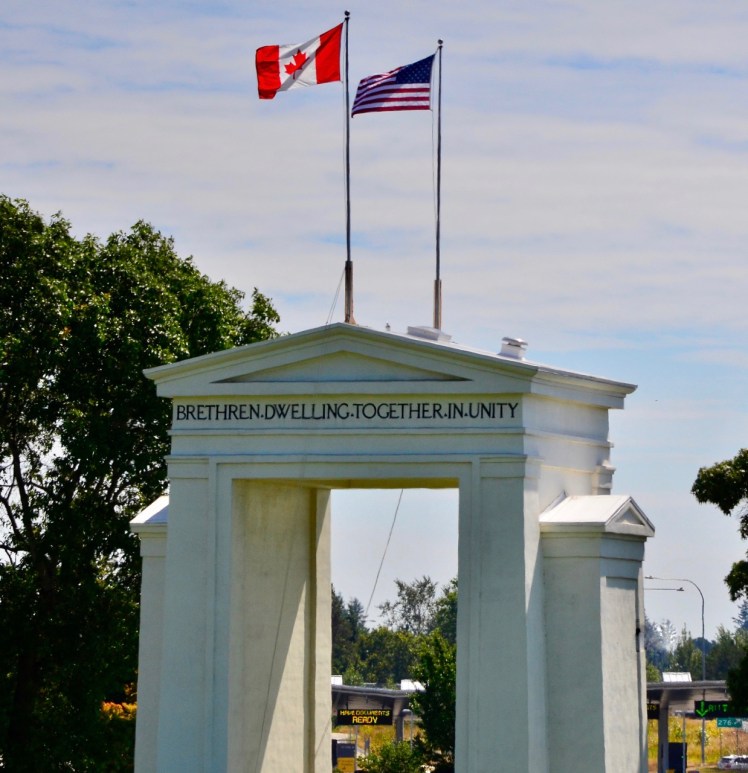
The next day I left Vancouver at around noon and headed back home to Boise. The traffic at the border crossing was much worse going south than north, and it took me almost an hour to get through. But the wait did give me plenty of time to gaze on the Peace Arch monument at the border and reflect on the five weeks that we spent joined at the hip.
The trip was a once-in-a-liftime experience. Chris mentioned that when we were on the Chilkoot Inlet at Haines, stalking that grizzly, the sense of adventure and boldness that we shared in Egypt when we jumped that freight train 50 years ago came washing over him again. It was a moment when we felt really alive, being so close to a danger that could have been life-threatening if the wind had shifted and given that bear a whiff of us. Once again we’d seized the opportunity to live an irreplaceable moment by taking only minimum precautions in exchange for a permanent reward. Actually, even when we first started the trip in Vancouver, I shared that sentiment and mentioned to him, given that we were once again sharing such shenanigans, the camper might as well have had a big sign on the back that read, “HELWAN OR BUST.”
ADDENDUM:
I made it back to Idaho in time to shoot the total eclipse of the sun. John, who is also one of my oldest friends, whom I’ve known since grade school, drove from Colorado to join me in Boise for the drive to the Lost River Range of Idaho. Last year I’d found a very private campsite on a ridge overlooking the Pahsimeroi River Valley, which was in the area where the eclipse would be 100% total, and our plan was to drive there the day before the eclipse in order to beat the crowds. We’d heard that Mt. Borah, the highest mountain in Idaho, which was also in the path of totality, would be crowded as hell, and we saw many campers already staking out a viewing spot along the road between Mt. Borah and the Pahsimeroi Valley. We skipped a lunch stop out of concern that someone might find our campsite before we got there.
We arrived at my “secret” campsite at mid-afternoon on Sunday, August 20, and spent the night. We needn’t have worried, as the campsite required high-clearance 4-wheel-drive to get there. We found ourselves totally alone, with no one in view as far as the eye could see, which wasn’t far given the layer of wildfire smoke. John planned to take a video of the changing light on the landscape under the eclipse, and I planned to directly shoot the eclipse in its totality phase. We were dismayed and worried to see how much smoke was covering the whole area, obscuring the valley and the Lehmi Range on the other side. But the air was tolerable to breathe and the smoke enhanced the sunsets…


… and as it turned out the next day, the smoke didn’t affect the view of the eclipse at all. John’s video turned out to be pretty dramatic visually and accented by our excited exclamations over the 10-minute course of the eclipse (which I hope to upload on YouTube soon). He had brought certified eclipse glasses, which proved essential to getting my shots…

")


This total eclipse, too, was a once-in-a-lifetime experience that was enhanced by sharing it with another of my oldest friends.

Perfect.
LikeLiked by 1 person
Tremendous.
LikeLike