The first and last time I visited Yosemite was in 1978, when my mother and sister and I drove through it during our tour of the West in my mother’s Chevy van, after my mother had settled in Boise a year earlier. We gasped at the stunning Yosemite Valley scenery when we emerged from the tunnel at the southern entrance, on our way from visiting cousins near San Francisco. But we didn’t know the name of “El Capitan” or “Half Dome” and would not have recognized them. Yosemite is among the five most-visited parks in the U.S., but we didn’t even stay a night, we were just passing through.
As I’ve become more aware of the park, especially from Ansel Adams photographs, a book of which my father gave me as a birthday present decades ago, I’ve dreamed of visiting it again with my own camera. That Ansel Adams book has loomed large as the elephant in the room, a silent challenge on my coffee table, gnawing at me for the gaping hole in my portfolio.
Several obstacles had prevented my second visit: The park’s limited access only from the west for half the year due to snow; the increasing crowds that require making reservations months in advance to camp there during the summer season; and the expense of traveling from outside the Western region, not to mention California gas prices. After forty years, finally settling in Boise for retirement gave me easier access, and I finally had the time, funding, and equipment to tackle the beast the way I wanted. I also had more photography experience that I hoped, at least, would not do the park an injustice. Of course, I could never match Maestro Ansel, but if I could grab a few good shots over a few days I’d be happy.
Even from Boise, though, there’s a hell of a lot of Nevada to cross, which is daunting enough in the best of circumstances. And the window of opportunity was narrow: I had to do it before a possible government shutdown on November 22nd, but after the busy season ends on Nov. 3rd, when reservations would end for all but one campground in the park, signaling a drop in crowds, rarely a bad thing in landscape photography.
The online reservation system in Recreation.gov showed it was still very crowded: Of the 240 campsites in the valley none was available for my first night, Monday, Nov. 4th, forcing me to look 20 miles west at Hodgdon Meadow Campground , which was now first-come-first-serve for the winter season. After that I still had to reserve four different campsites for four nights at Upper Pines, that one campground in Yosemite Valley that’s open year-round.
Waiting for any later date in November, the chances of heavy snow increases exponentially, which would be good for photographs but not so much for getting around efficiently. For this trip I did buy new insulated boots and two pairs of snow chains, which California law requires. As it was, in this time of year in Yosemite, with no electric hook-ups and less solar energy available to charge my camper batteries, I expected this road trip to be my biggest test of winter camping to date. The Yosemite National Park website showed the only road with an east entrance, Tioga Pass Road (Rte. 120), was already closed for the season due to snow. It would not open again for six months.
And then there were wildfires to consider. As I was researching this trip wildfires in California were again making headlines. I used an online wildfire status map to determine that fires and air pollution from smoke were not affecting the Yosemite area at the time, but as we all know, that could change quickly. Probably even more than weather or diminished solar energy available, my primary concern was that wildfires would choke me out from the smoke, or ruin photographs from the haze, or prevent movement due to official roadblocks set up to fight the wildfires.
I didn’t have even one photograph of Yosemite in my gallery website, so it was high time I changed that while the gettin’ was good; it was time to bag me some Yosemite trophy images and answer the challenge of that coffee-table book as best I could. I’d be stretching my safari limits after having just racked up over 1,000 miles on a road trip to Yellowstone and the Tetons only a month earlier, but who knows when I’d get another chance for a photo safari to Yosemite with all these stars aligned as they were? I ain’t gettin’ any younger and these road trips ain’t gettin’ any easier. It’s 670 miles from Boise to Yosemite one way, most of it in Nevada.
So, I left Boise on Sunday, Nov. 3rd, at about 9 AM, heading for a campground in National Forest land for the first night, just inside the California border, south of Lake Tahoe. About a half-hour after sunset I arrived at Crystal Springs Campground, which I’d found on Google Maps.
It was closed, actually barricaded. And so was the next one, Kit Carson Campground, about three miles up the road. Fortunately, there was a large, flat, level pull-out in the same area, and I camped there for free. It was quite noisy with the traffic so close, but that’s when earplugs come in handy. It got down to 35 degrees that night, but my thermostat was set at 45, the lowest setting, so I was comfy in my 20-degree sleeping bag and memory-foam mattress.
Monday, Nov. 4: The next morning I hit the road at 6:30 and made it to Jackson, CA, at about 8 AM, for a latte at Starbucks and to refuel. Driving south through the beautiful California countryside, I made it to the Hodgdon Meadows Campground in Yosemite at noon. After paying the $18 for a campsite I headed toward Yosemite Valley to check out the lay of the land where I’d be camping and shooting for the rest of the week.
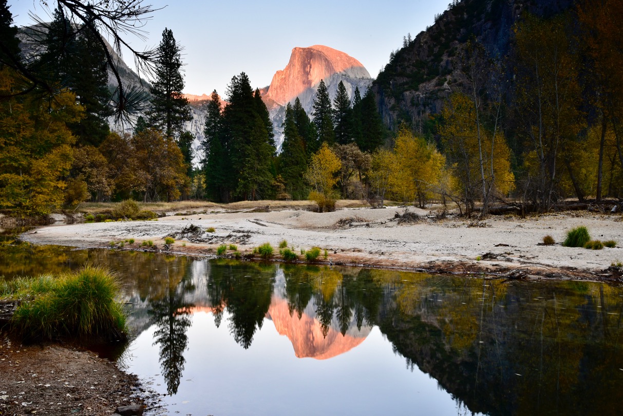
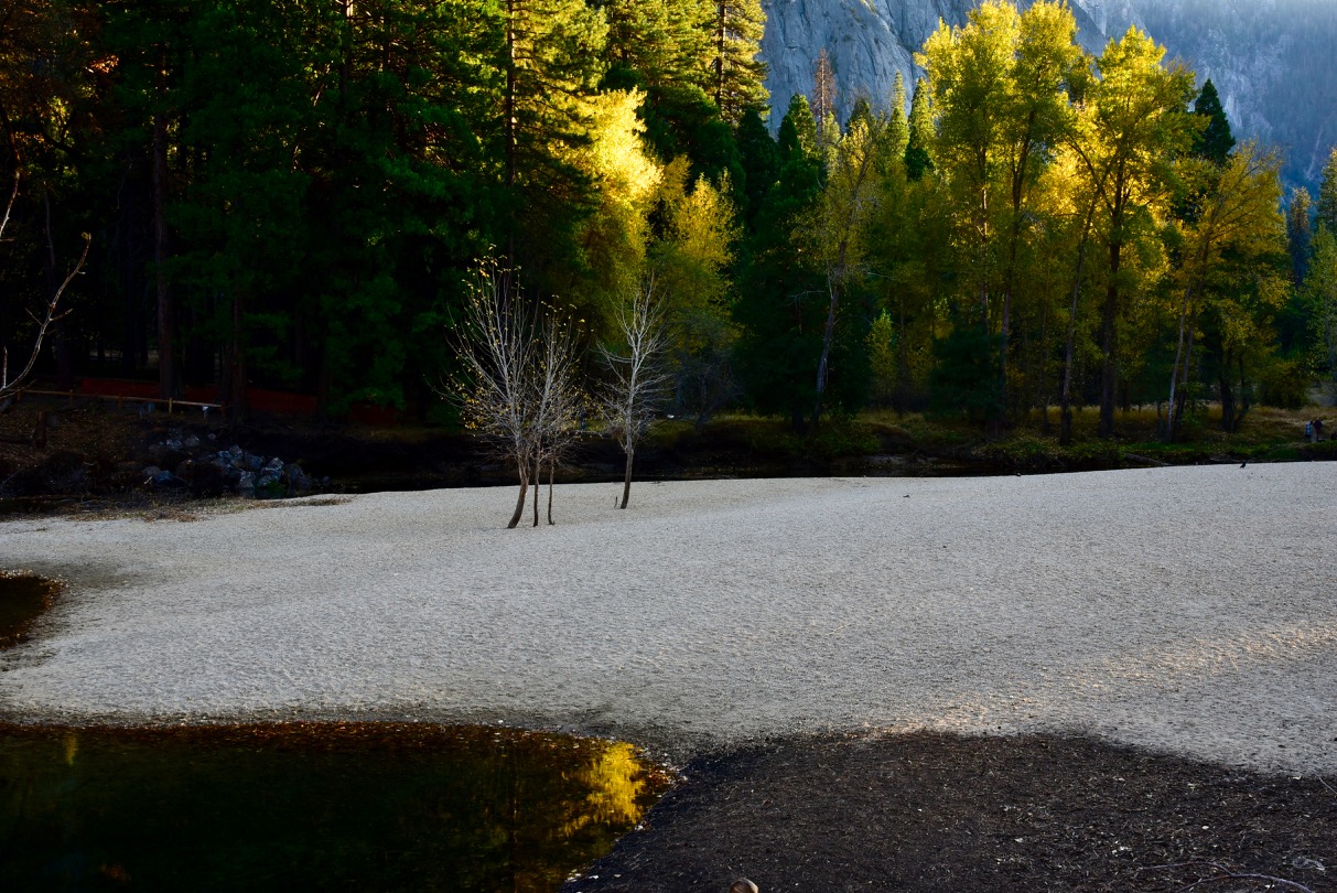
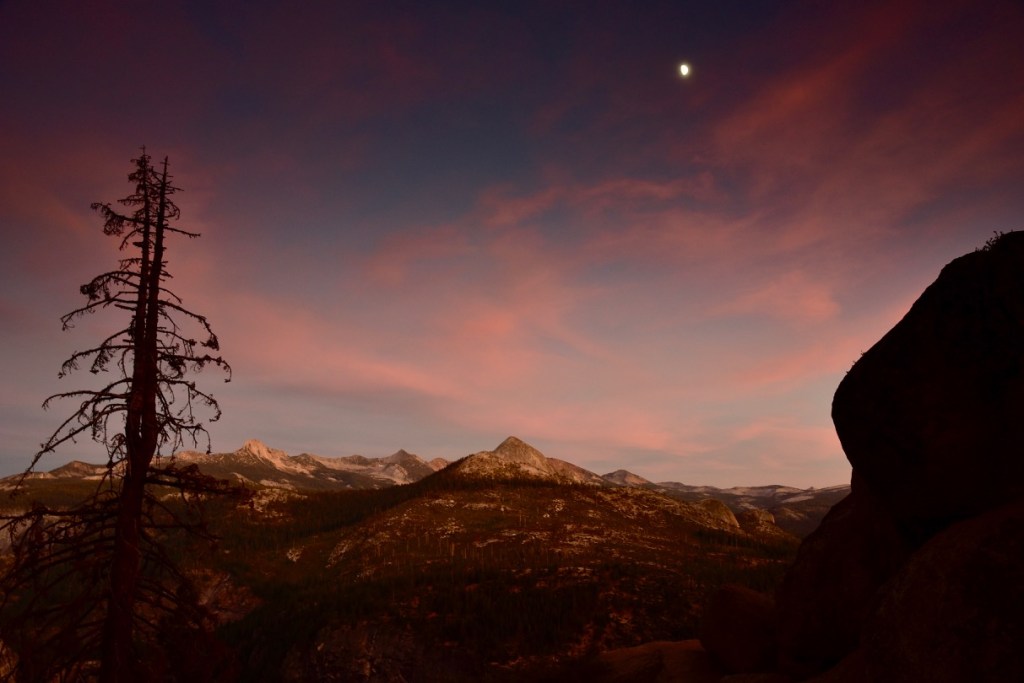
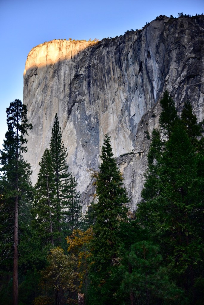
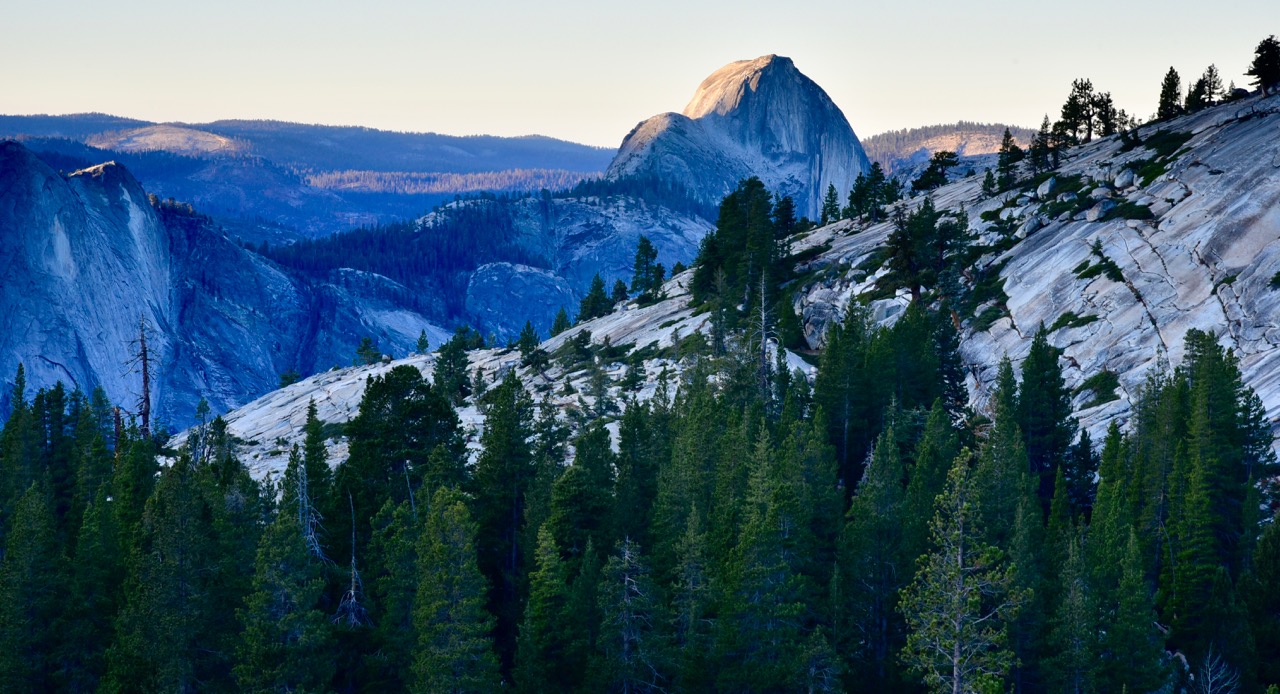
To my surprise, 8 miles down the road, I discovered that Tioga Pass Road was open, contrary to online information that I had obviously misinterpreted. I asked a passing ranger, who told me the campgrounds on that road had closed for the season, but the road was open until the next snowfall closes it, and there was no snow yet. I decided to check out Olmstead Point, about 25 miles down that road, instead of Yosemite Valley, and I’m glad I did. The clear weather allowed for the sunset to color the granite faces that lined the canyon from the overlook all the way to Half-Dome in Yosemite Valley:
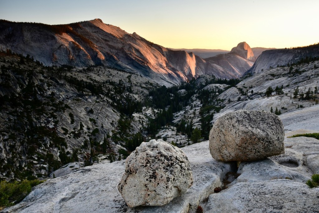
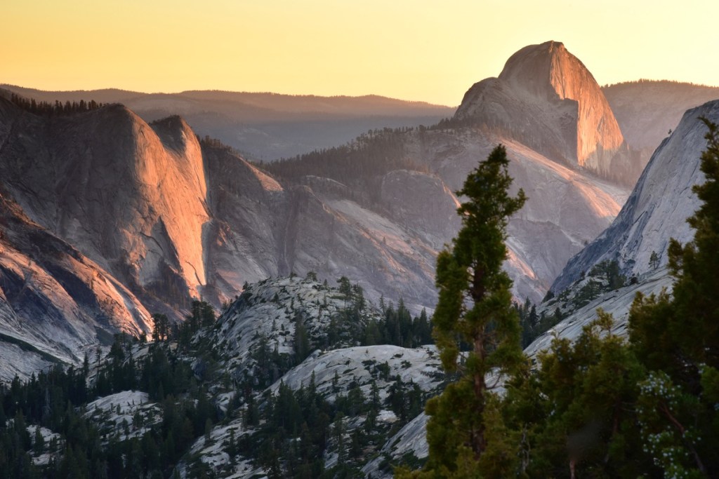
It was starting to dawn on me that the high contrast between Yosemite’s light-colored granite, darker evergreens and deep canyons were complicating my photography. I gained a new appreciation for the expertise of Ansel Adams, and gamely pressed on in answering the coffee table challenge.
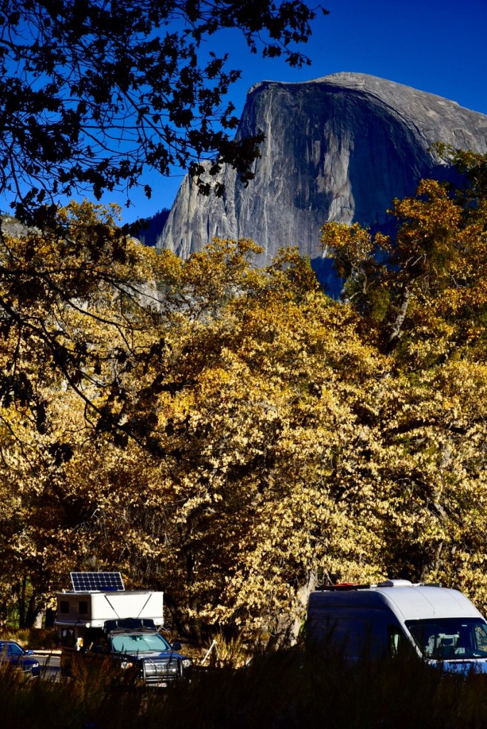
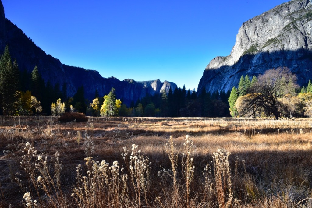
That night at Hodgdon Meadows was quiet and uneventful since the campground was half-empty. The next morning, as soon as I arrived in Yosemite Village in the valley, I found a parking space in front of a completely dry Yosemite Falls on the north side of the valley, one of about a dozen spaces on the side of the road that would fill up by mid-morning. It was the sunniest location in the whole valley for the majority of the day, so I ended up parking here every day to charge my camper batteries, since Upper Pines Campground was too shaded.
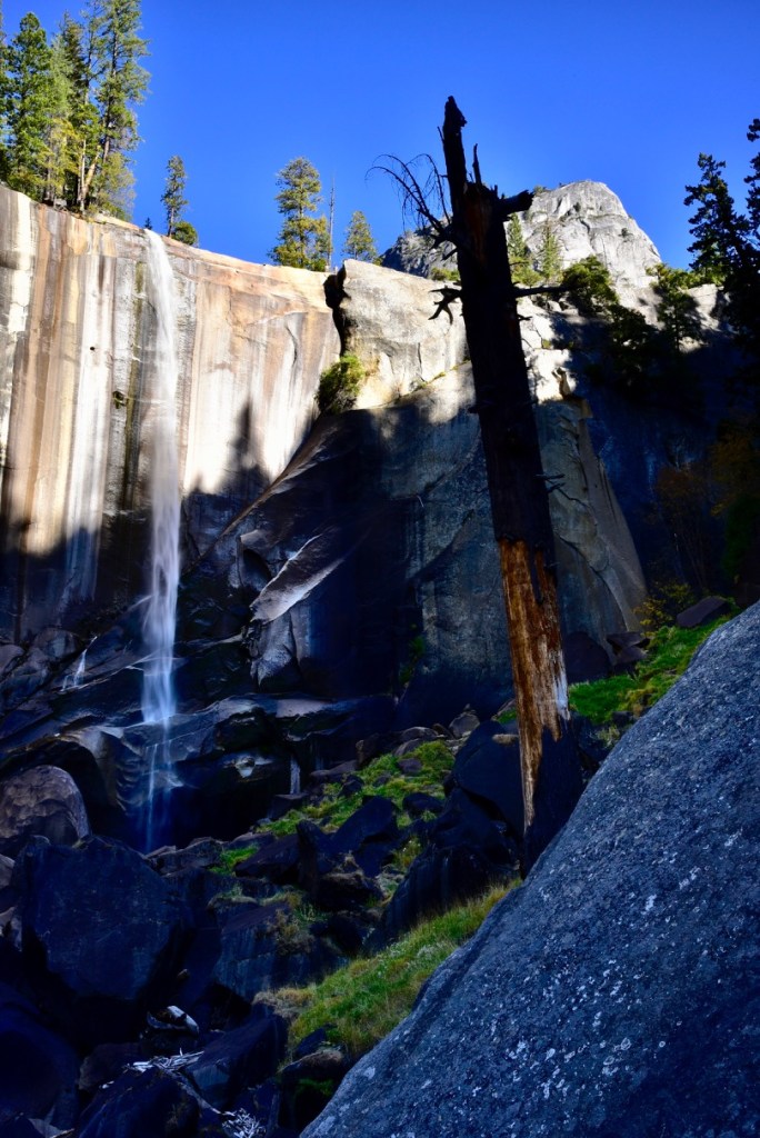
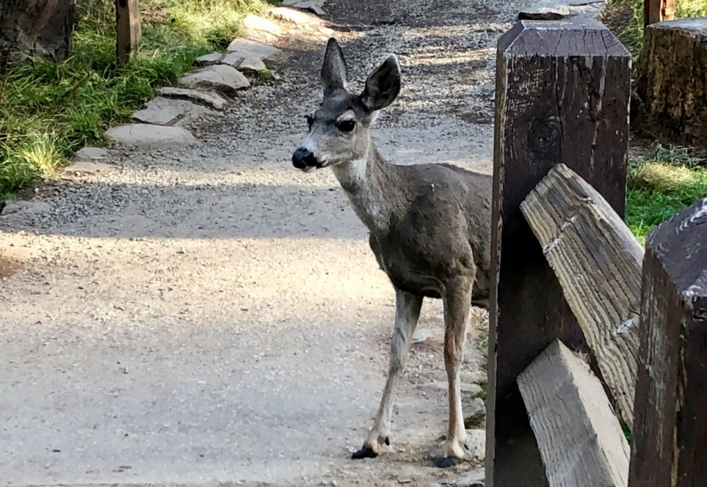
My batteries would fully charge by about 3:30 PM daily. For that convenience, waiting in the camper between photo shoots, I had to endure the noise of a road that was used as often as a city street, as indeed Yosemite Village was a small city. Today, though, after parking here I took the free shuttle to the trailhead to Vernal Falls and hiked a steep 1.5 miles up to the foot of the falls. A ptarmigan was watching the trail of hikers from its perch only about six feet to the side, which delighted a British couple who couldn’t believe the bird was so unafraid. But the falls was disappointing since the water level was very low and the contrast in mid-day lighting was too extreme for decent photographs. I managed to eke out one photo just for documentation purposes:
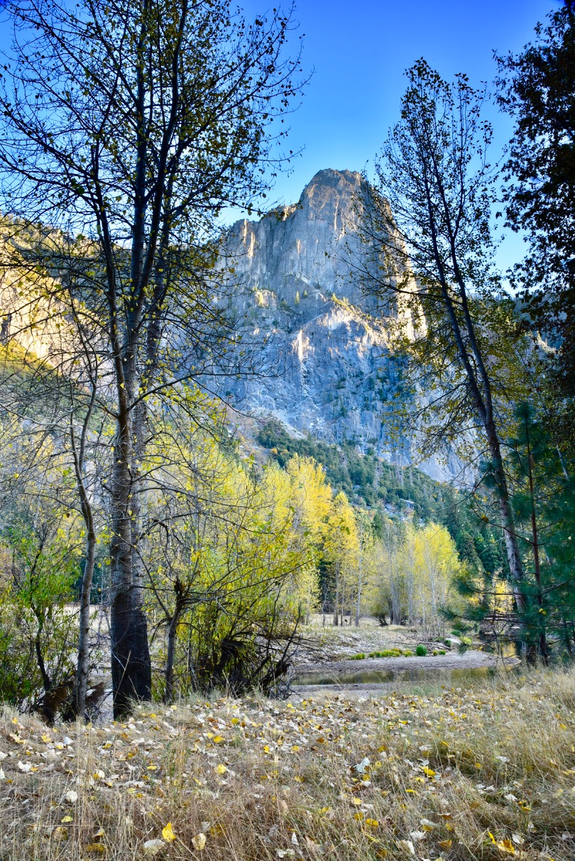
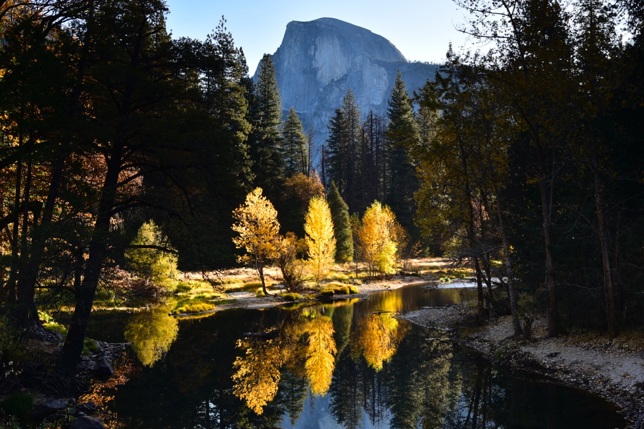
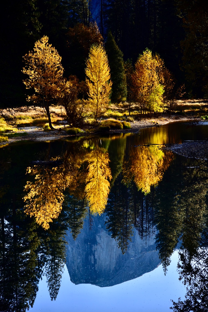
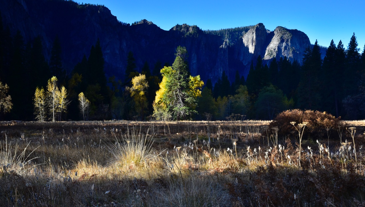
That ptarmigan turned out to be the largest wildlife I saw on the whole trip, and I didn’t even shoot it (just shoot me!). Later that afternoon, after the contour of the valley cliffs blocked the setting sun from illuminating my solar panels, I wandered around the valley floor and did some shooting in the waning sunlight. I was glad that fall colors were peaking here, especially since the colors had been past their peak when I visited Yellowstone and the Tetons the previous month:
My first night in campsite No. 001 in Upper Pines Campground was an eye-opener. It was vast and 100% full, and the smoke from all the campfires forced me inside my camper for the night, where I was glad to confirm that satellite radio reception was loud and clear. My night was filled with music and reading the Benjamin Franklin biography by Walter Isaacson, much better for my mental health than listening to pundits on news shows talking about politics, not that I can avoid watching the train wreck for very long.
The next day, shortly after noon at my sunny spot at Yosemite Falls, the self-described “citified” owner of the Alaskan camper on a Dodge Ram pickup with California plates parked in front of my truck approached me as I returned from my walk to see the Ansel Adams Gallery. He expressed regret for buying his camper instead of a Four Wheel Camper like mine because he had to haul his two 60-pound batteries in and out for every trip in order to charge them at home, whereas I never touch my batteries, I just “plug in” when I pull into my garage; but I had added that DIY plug-in capability myself, it didn’t come factory-installed on my “empty shell” model. He also liked my aerodynamic front end, in contrast to his most un-aerodynamic design. I told him of my Amazon purchase of the black wind-deflector on the cab that increased my gas mileage by one or two miles per gallon and reduces the accumulation of dead bugs on the front of the camper. Maybe he’ll follow suit.
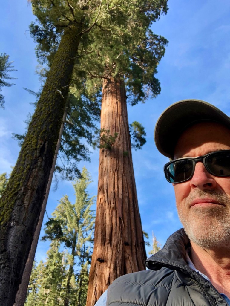
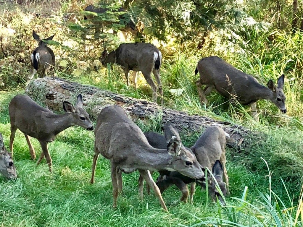
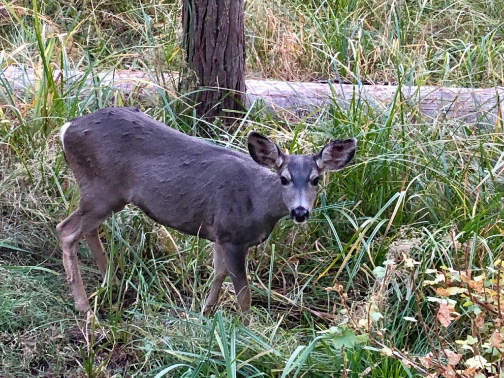
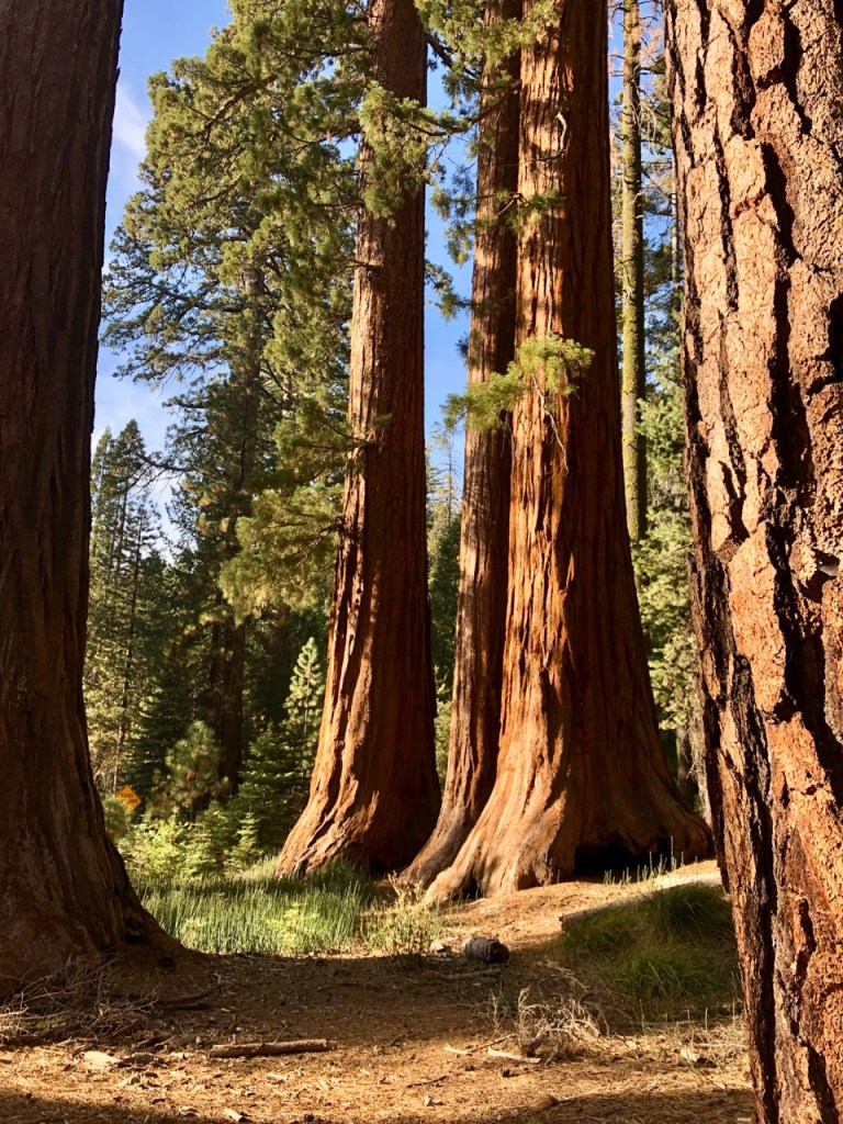
Mr. Citified advised me not to miss the Mariposa Grove of Giant Sequoia trees 35 miles south, which I decided to visit after a ranger confirmed that the Glacier Point road was also still open. I went on a manic drive to the grove and did a manic 2-mile walking tour with only my iPhone camera to see the Grizzly Giant, Fallen Monarch, and California Tunnel Tree. My hazy memory suggested that my mother and sister and I might have stopped at Mariposa Grove in 1978, as Grizzly Giant and the Tunnel Tree seemed familiar. At any rate, a couple of interesting facts I read there: Each sequoia can consume hundreds of gallons of water per day and can live for almost 2,000 years. That’s a lotta water. I love the cinnamon color of the bark. I love these trees, which had a herd of deer that was feeding and unafraid:
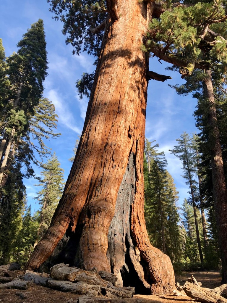
Grizzly Giant 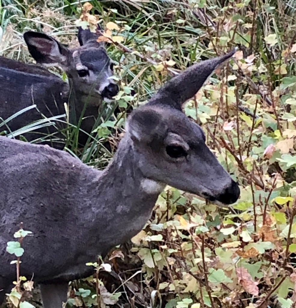
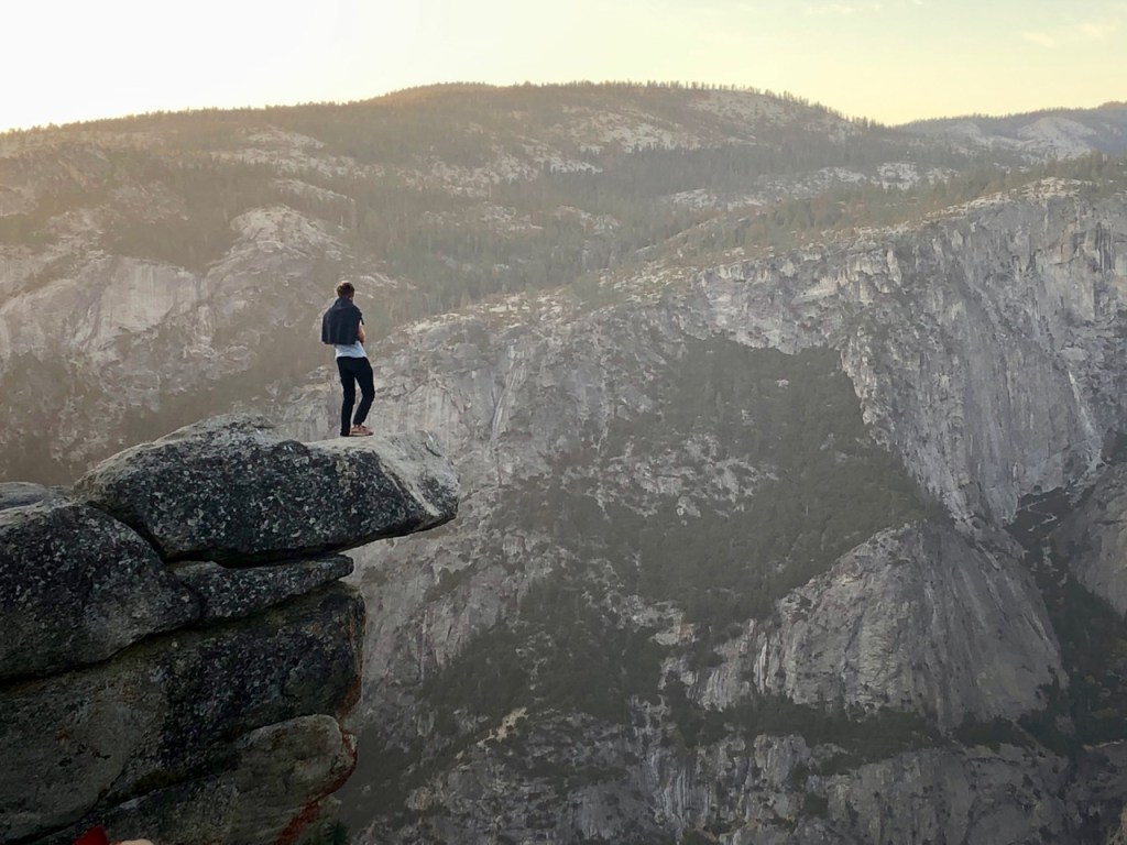
And then I did a manic drive to Glacier Point just in time to catch the view at sunset, including a daring tourist:

I got back to camp in time to take the shuttle to the Ahwahnee Hotel for a decadent dinner that I’d reserved before the trip, a tradition I started last month at Jackson Lake Lodge in the Tetons (no comparison, the Ahwahnee is much better). I met a San Diego couple on the shuttle from the campground who told me it was very unusual not to have snow here by now, that snow made it a magical place, but that April is probably the best month because the waterfalls are so full by then. They told me that Mirror Lake was completely dry, which saved me a disappointing hike.
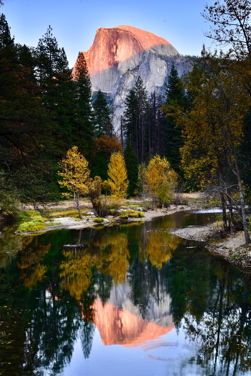
I spent all the next day in the valley, most of it reading in my camper at my sunny spot, and got some morning and afternoon shots from Sentinel Bridge over the Merced River:
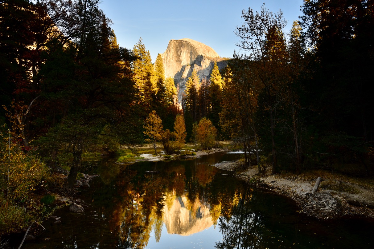
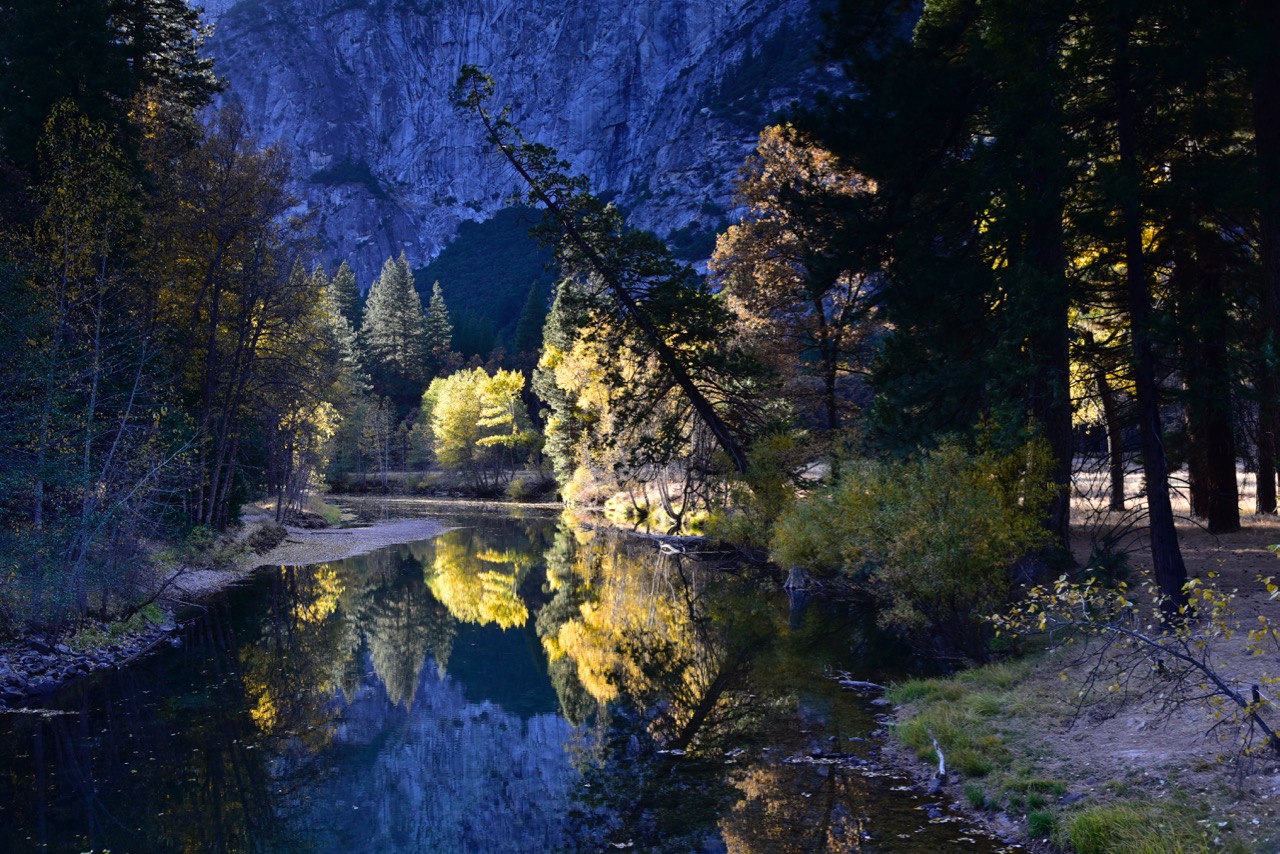
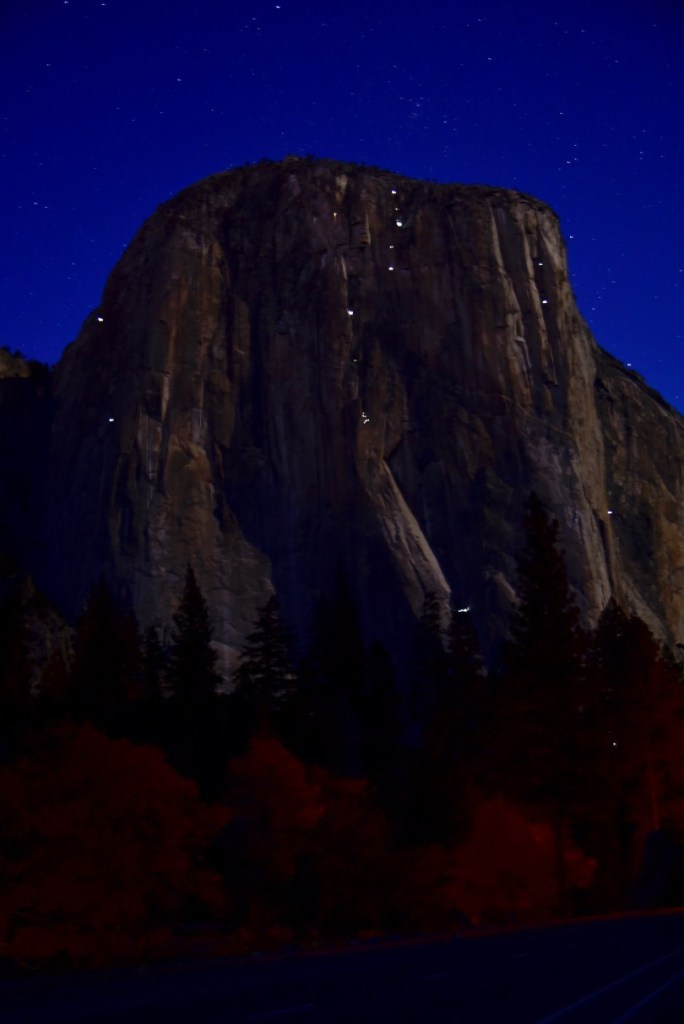
I was envious of another tourist on the bridge who had a video on her iPhone in which she had captured a black bear and cub rambling earlier that afternoon only a few hundred feet from the bridge. That morning I had captured only first light on El Capitan, and that night, the lights of climbers who were camping on the side of El Capitan on their way up, which I thought was pretty fascinating. It helped explain the throng of cars and RVs parked 24-7 on the side of the road near El Capitan:
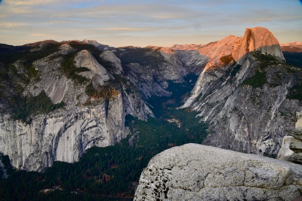
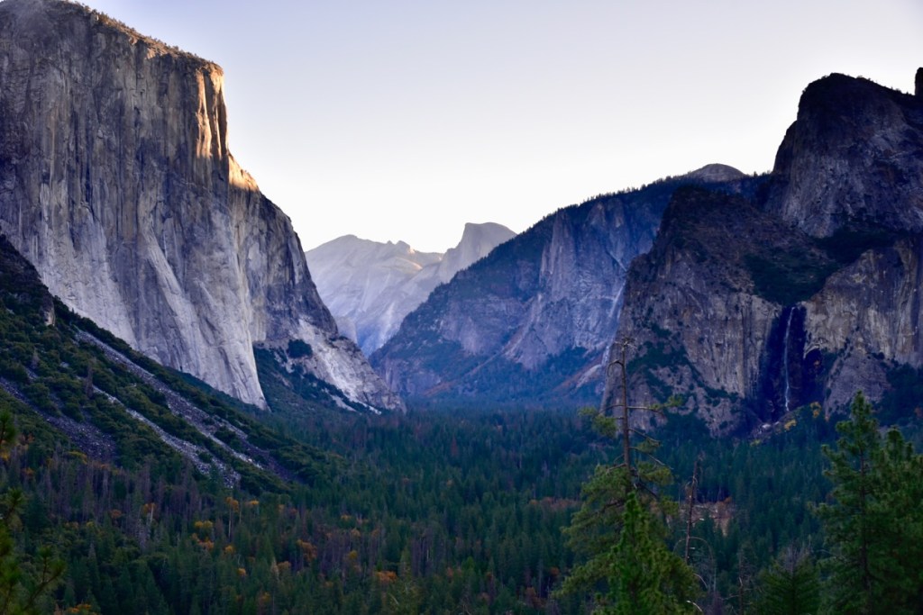
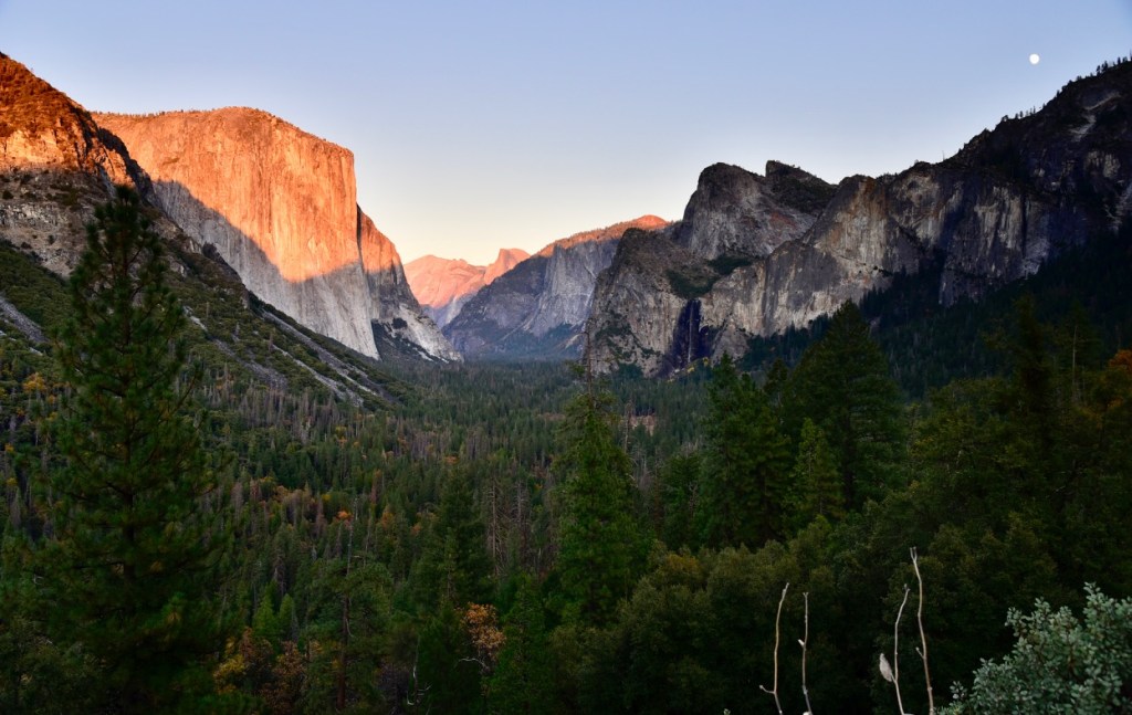
The next day at dawn I stationed myself at the Tunnel View overlook for a shot of the valley as I first saw it 40 years earlier, but showing only a trickle of Bridal Veil Falls:
I then drove back into the valley for another morning shoot and to charge my batteries:
And then drove back up to Tunnel View for a sunset shot on my last night in the valley:
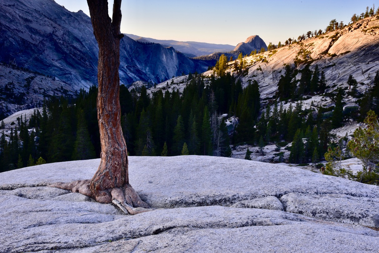
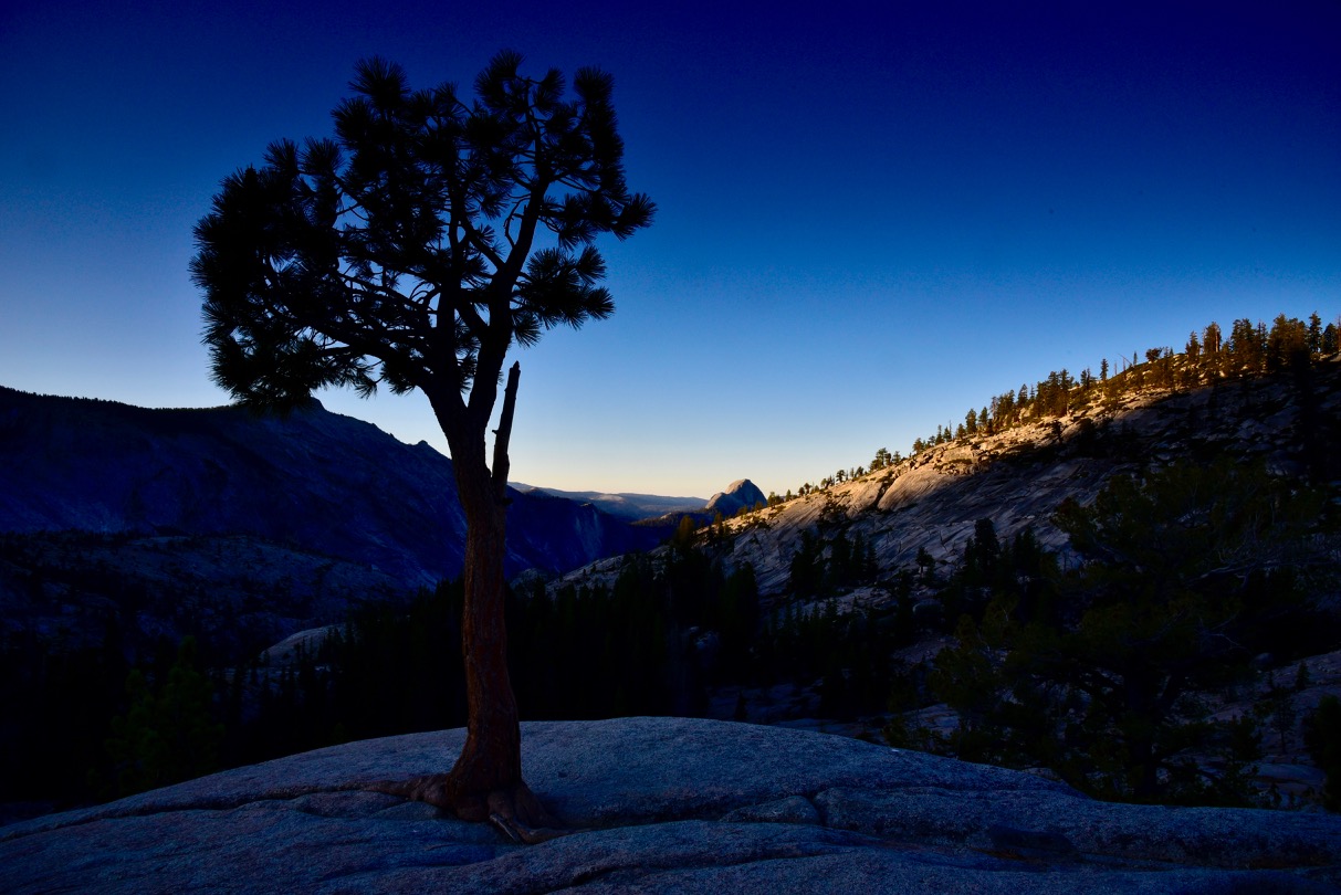
I got to the pullout early to beat the Friday crowds and toted a camp chair to sit and wait at the edge of the parking lot with my camera gear. Of the 40 other people there I was the only one sitting, warm and comfy with one camera mounted on the tripod and the other locked and loaded on the ledge beside it. As I waited I got into a conversation with one older guy with an iPhone who had retired nearby a decade ago and visited the park every couple of months. He showed me a couple of great Aurora Borealis shots he had taken in Iceland the previous winter. He had worked for Albertson’s grocery chain in Boise years earlier. He said this was the warmest November in Yosemite and the first without snow since he moved here, and advised me that to be guaranteed snow it’s probably best to visit in late January. He said it’s a very different park at that time, with no crowds and few campers in Upper Pines. He also advised me to be at Olmstead Point at sunrise for some good photo ops.
So, I got up the next morning at 4:45 AM in order to be at Olmstead Point at sunrise, which was scheduled for 6:30. It was on my way out of the park, after all, so I spent about a half-hour waiting for the sun and another half-hour shooting at sunrise before heading out:
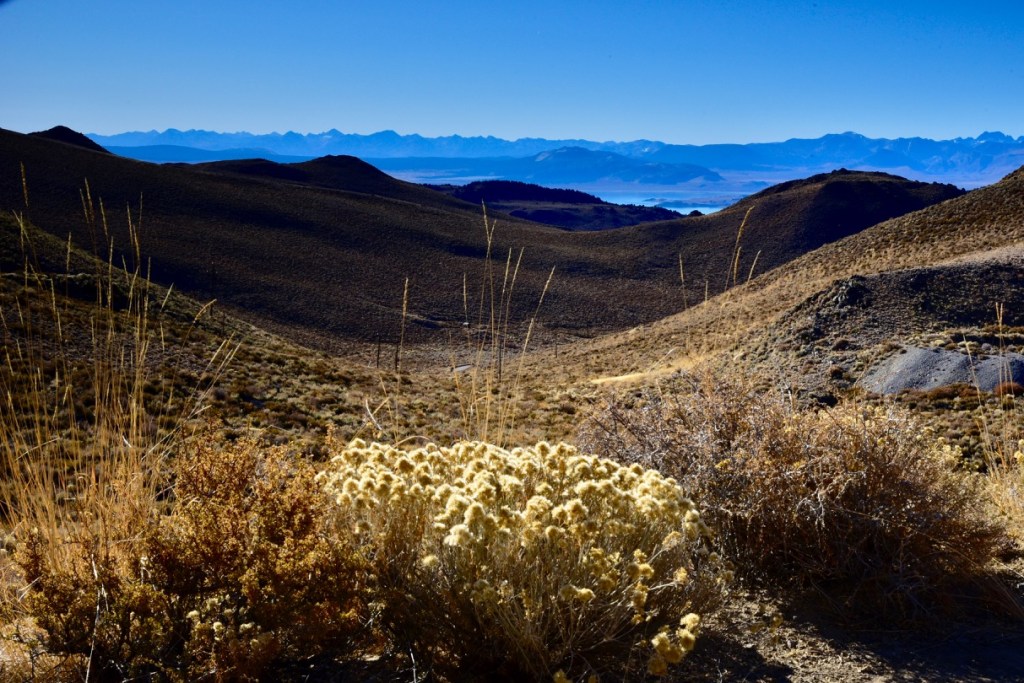
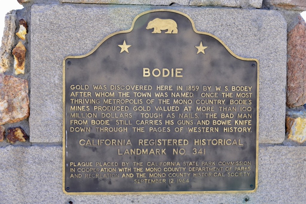
I did a leisurely drive on Rte. 120 to the east entrance and got breakfast and fuel at Lee Vining, on the southwest shore of Mono Lake. In March 2018, Rte. 120 was closed for snow when I passed the entrance to Yosemite, headed north on Rte. 395 from Death Valley. It was the closest I’d been to Yosemite since 1978, but it was just out of reach. Headed back to Boise on that trip I turned east onto Rte. 167 and soon saw a sign for Bodie State Historic Park to the north, a well-preserved ghost town from Gold Rush days that I had hoped to shoot at sunrise or sunset. At that time I went about 6 miles before the dirt road was barricaded, so I was disappointed. This time the road from Rte. 167 was rough but open all the way, so I went for it, finding a nice roadside view along the way, showing a bit of Mono Lake and the Sierra Nevada Mountains in the distance:
Directions on Google Maps doesn’t even allow this road from Rte. 167 to be an option, as it’s much rougher than the longer route from Rte. 395 further north. The historic park’s hours were 9 to 4, and it was well manned with park rangers, so sunrise or sunset shots were not an option, anyway. I arrived at about 9:30, and I was the first tourist there that day. Although the sun was well past the “magic hour” of sunrise I shot much of the town using a filter that I hoped would lend an eerie, other-worldly look to the abandoned structures under the harsh sun.
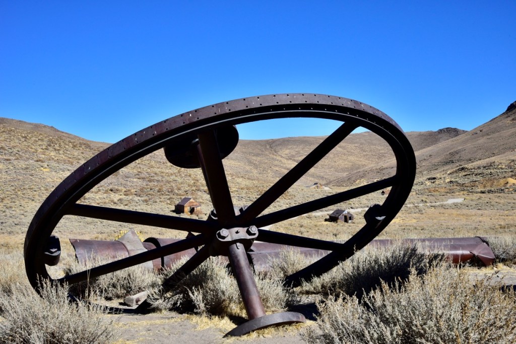


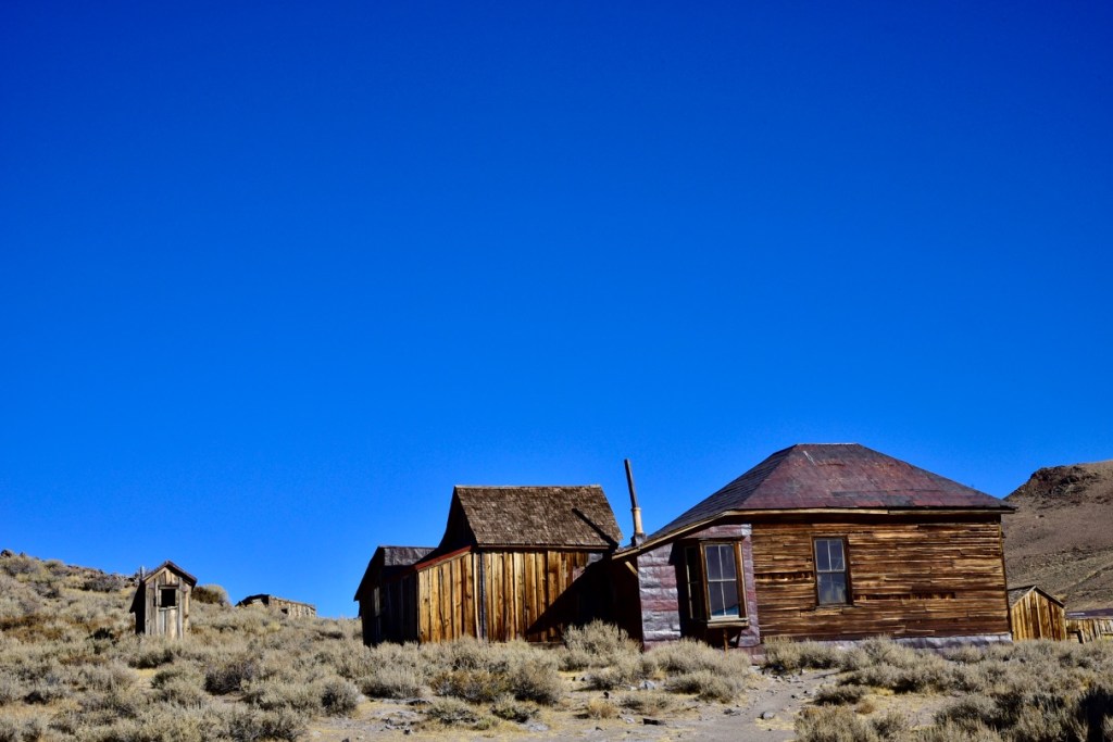

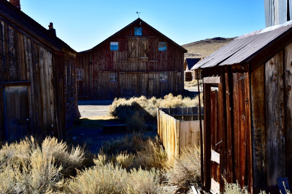


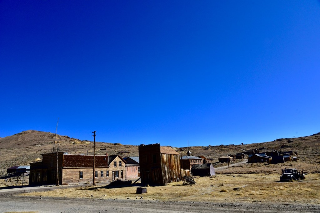

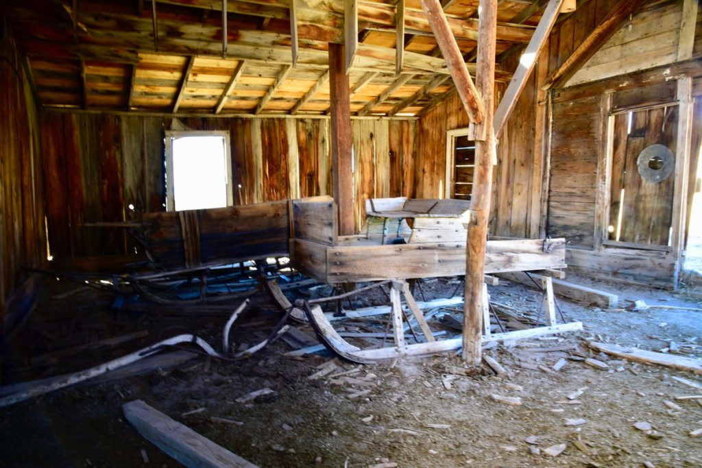
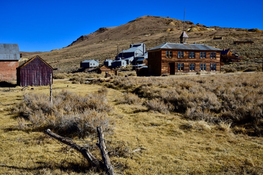
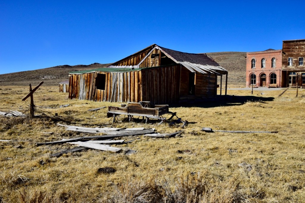
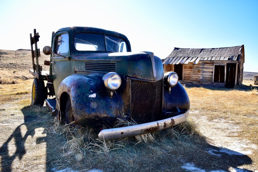

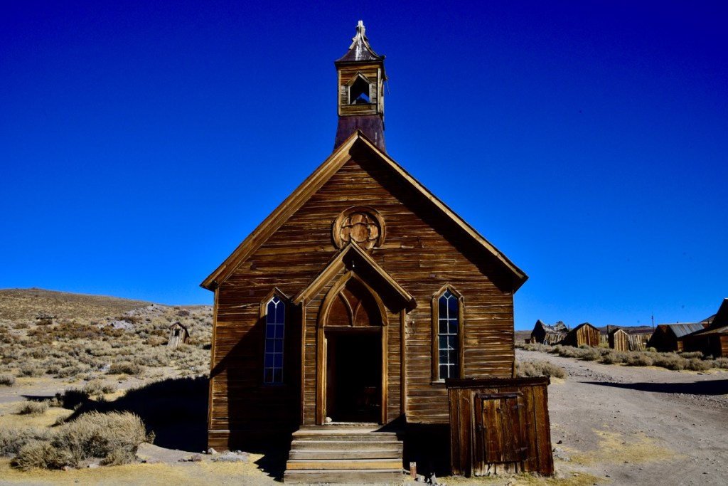
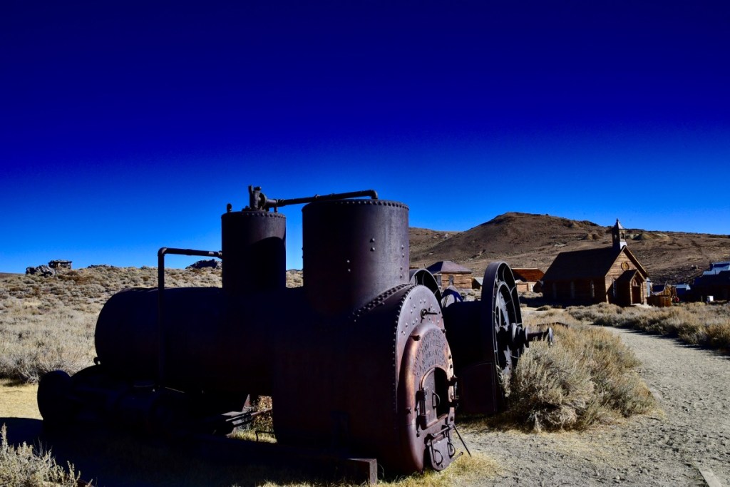

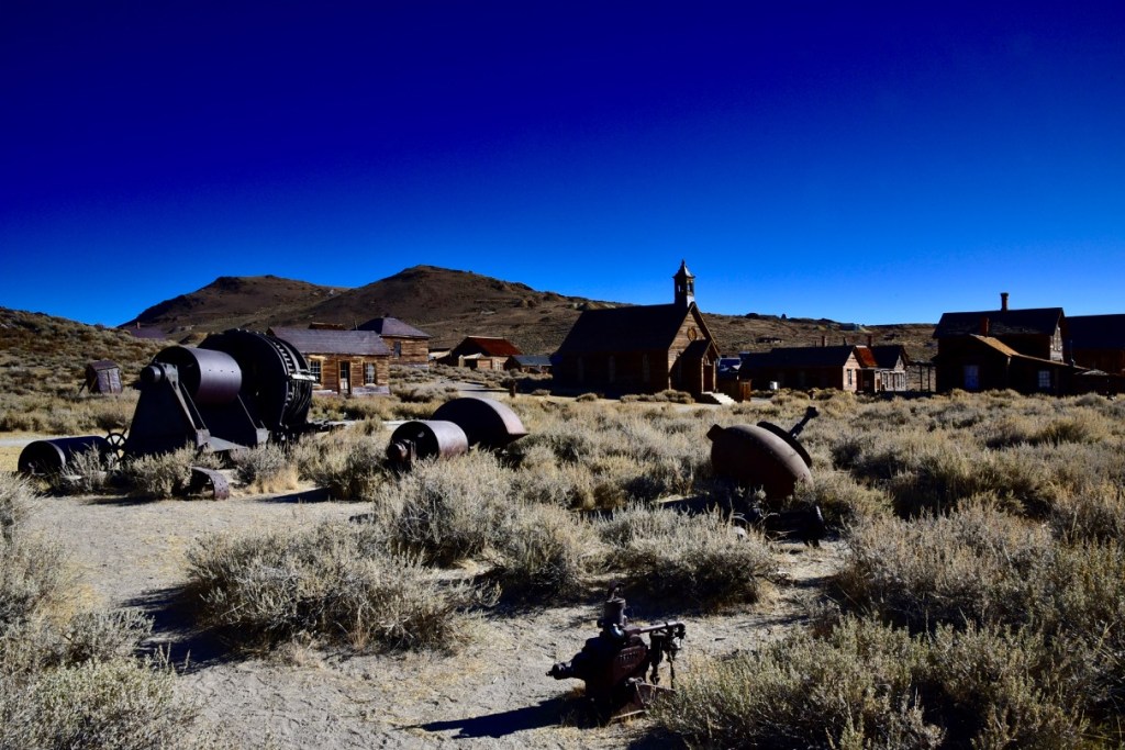
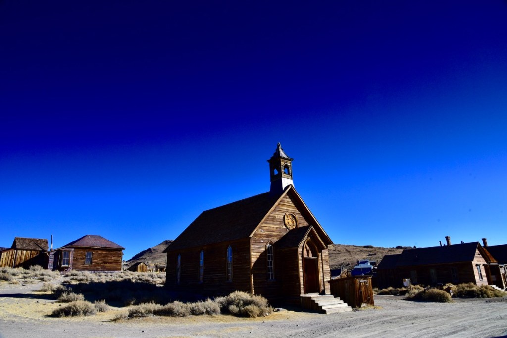
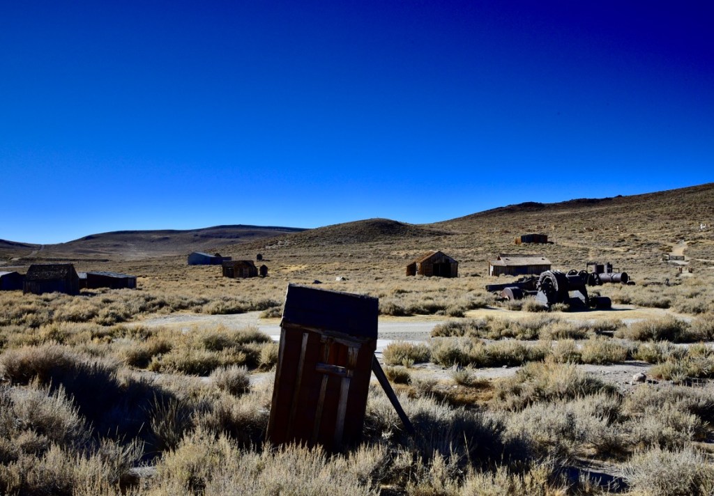
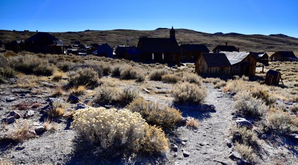
I had the run of the place until tourists began pouring in, and it was getting more difficult to shoot without one of them in the frame. The parking lot was full by the time I left around noon. Anyway, this ghost town was the most extensive I’d ever seen, and one fun fact is that, in its heyday during gold production, the town had 65 saloons. That’s a lotta whiskey.
Although the skies over Yosemite Valley and Bodie could have been enhanced by a few clouds at the right time for photography, I think I got some decent shots toward slaying that elephant on the coffee table. I consider myself lucky to have had a week there with no wind or rain, and no haze from the wildfires that were not so far away. As it turned out, when I got back home, Boise was under high alert for air pollution, mostly due to an inversion layer of automobile emissions and wildfire smoke, and the wildfire status map showed that Yosemite Valley was also inundated by air pollution from the California wildfires only a couple of days after I had departed the park. And a pit stop in Nampa, only 20 miles west of Boise, made me gag from the noxious air that apparently is a regular occurrence from food processing plants there, adding to the pollution from wildfires.
At the time of this writing, Venice is under water, Australia and California are burning, arctic weather in most of the eastern U.S. is setting records, and Boise’s air pollution and high temperatures are setting records. Which brings me to the other elephant in the room: Climate change, and our governments’ inability or lack of will to address it, is destroying our environment as we all go about our business and our road trips.
During 2011-2013, short-term fine particulate pollution levels [from wildfires] in Ada County (which includes Boise) substantially exceeded EPA’s health-based standards and were the seventh highest in the nation. Now Idaho is ranked as the second worse state for air pollution from airborne particulate matter, after California. A couple of years ago the smoke was so bad that it made me go on a road trip to Utah.
It does make me wonder how this bigger elephant in the room is going to affect my life in Boise, and whether moving to another place is any solution. Probably I’ll stay in Boise. After all, where in the U.S. could anyone go to escape the effects of climate change? Besides, I’m really settled here now, more so than in most of my previous residences, and here are a couple of examples of how living our lives in quiet desperation apparently trumps any substantial effort toward solving the elephant problem:
The way things are going, I can easily imagine that in 100 years, Boise will look like Bodie, and there will be no more elephants anywhere.

Superb, Michael! I’m very glad to be on your list.
>
LikeLike
Thanks, so glad you like it!
LikeLike